Skip to content

Or try searching by Category and/or Location

Communities

About 10,900 people live in Austurland, which is 22,721 km² and geographically diverse. Communities are scattered, and the towns are different even though most of them developed around the fishing industry. Today, tourism and industry are also prominent in Austurland and each community has its own characteristics. You are welcome to visit!

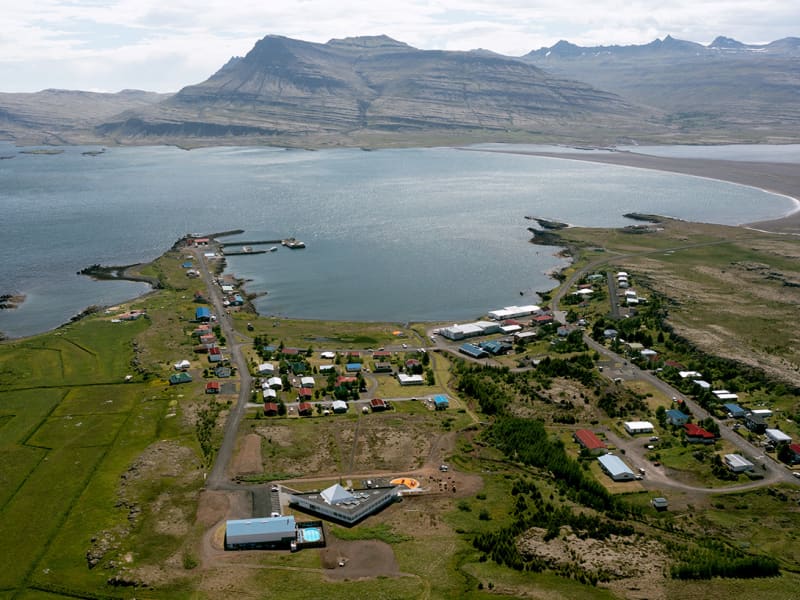
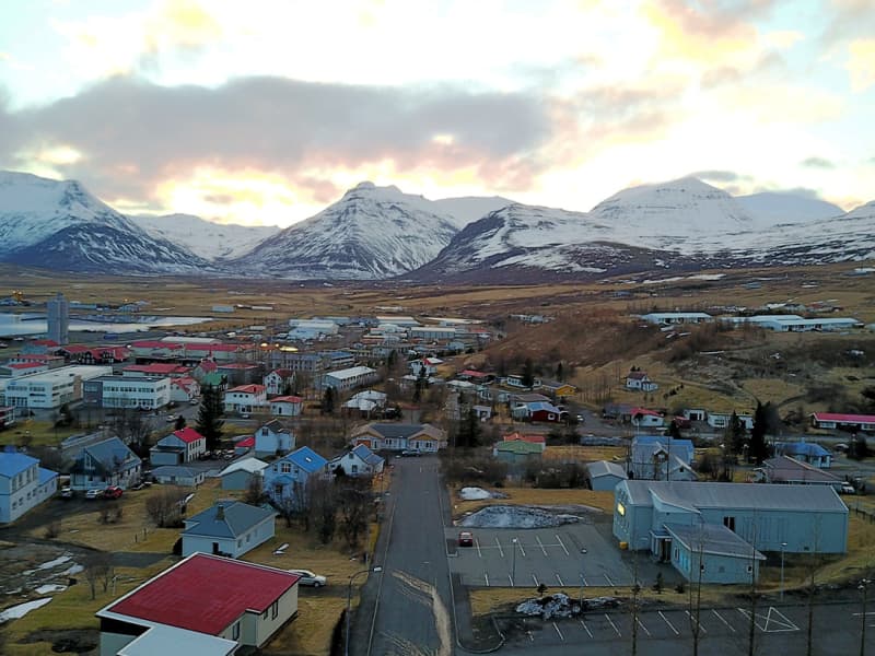
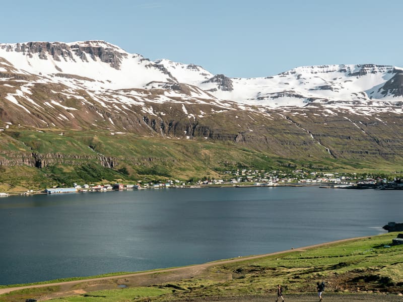
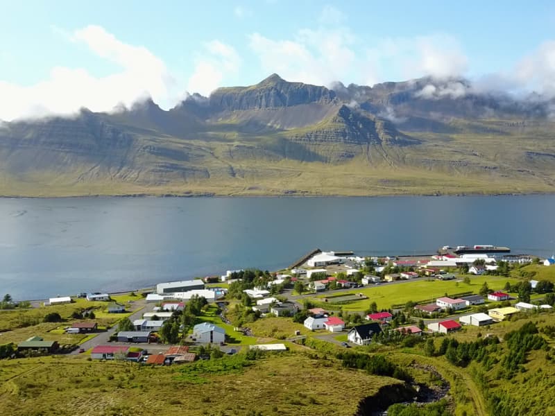
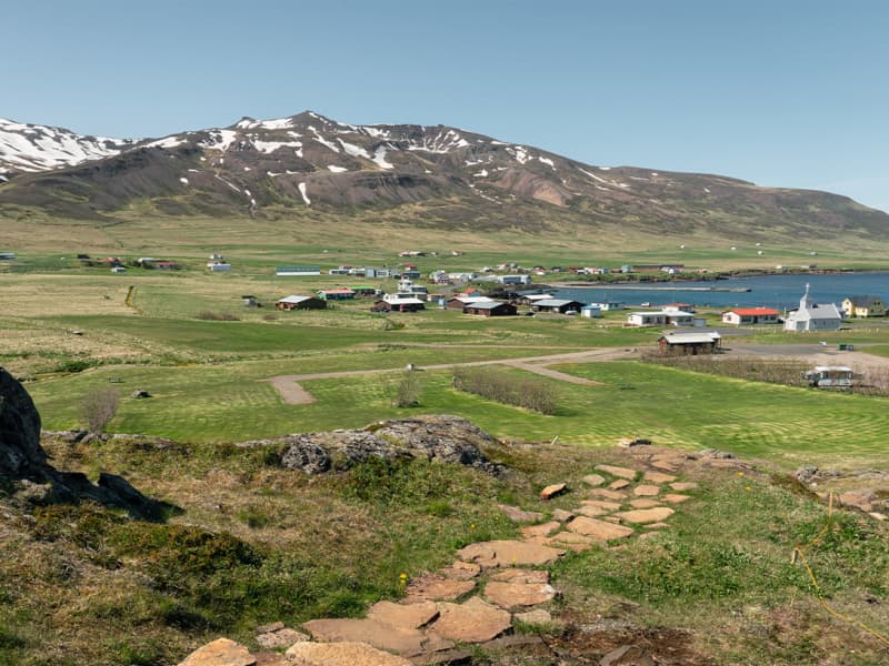
Borgarfjörður eystri
You’re in good company in this beautiful region: around 100 friendly locals populate the village, tourists pass through to enjoy the surrounds (including first-rate hiking trails), Icelanders make an annual pilgrimage for a great summer music festival, birdlife pays a visit for a few months each year, and even royal elves call the area home. True! You can visit the central hill known as Álfaborg – the name translates as the ‘Elves’ Castle’, and the queen of the Icelandic elves allegedly resides here with her court.  
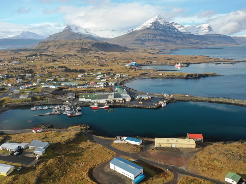
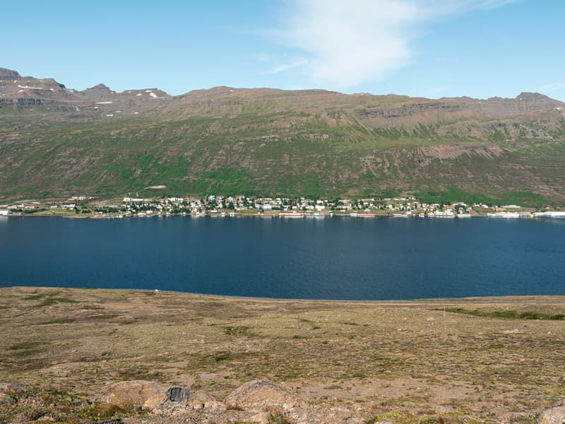
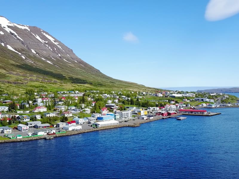
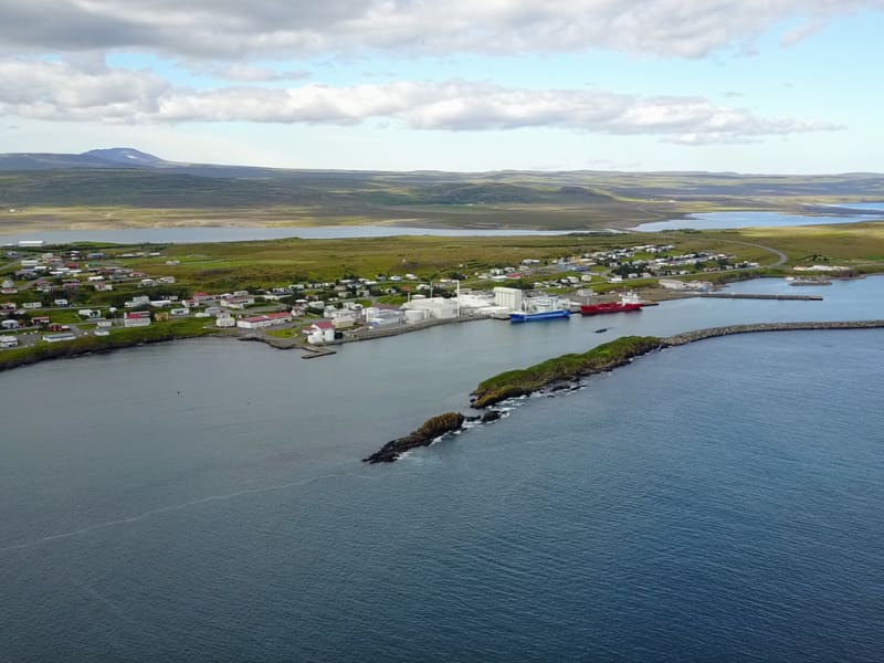
The 70km drive from Egilsstaðir to Borgarfjörður winds through some exceptional viewing points, over and around the mountains, until it reaches the small bubble of civilization. Follow the road through town and after about 5km you’ll reach a small fishing harbor. Here, at Hafnarhólmi, is some of the best bird-watching in the country, including easy close-up viewing of puffins and kittiwakes.  
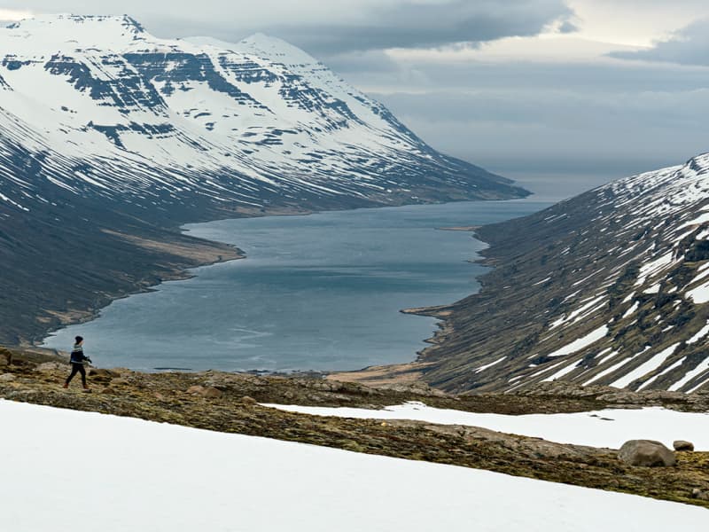
Yes, the birds are a big drawcard, but Borgarfjörður has also become renowned for its excellent hiking trails known as ‘Víknaslóðir’, which traverse colorful rhyolite mountains and lead to deserted fjords and coves on the way to Seyðisfjörður. Other trails take hikers into the dramatic Dyrfjöll mountain range. Locals have marked numerous trails that cater to most skill levels and range from an hour to a full day, and compiled a detailed map. They’re ready to help you explore.      Highlights:  Walk: to the giant boulders and grassy meadows of Stórurð. But you’ll find near-endless options here for walking and hiking.  Taste: local fish in one of the town cafes. Fish soup is a Borgarfjörður favorite!  Soak: at the local spa, where outdoor hot tubs have the added appeal of fine mountain views.   Road-trip: around the bay to reach Hafnarhólmi and its bountiful birdlife.   
Breiðdalsvík
Tiny Breiðdalsvík is a relatively young fishing village with some surprises and plenty of small-town hospitality. It lies on the coast with great seascapes and black sand beaches, making fishing and boat tours popular from its old harbor.   Some of the loveliest scenery lies inland from the town, in the spectacular valley of Breiðdalur. This is the longest and widest of the valleys in East Iceland, and it’s surrounded by majestic mountains rising to over 1000 meters on both sides. The impressive Breiðdalsá river, well known for salmon fishing, winds its way scenically across the valley basin to the sea. Breiðdalur makes a wonderful place for exploration and activity, from hiking to horse-riding. There are waterfalls and small forests to discover, and colorful rhyolite peaks to admire. Local guides can help you explore hard-to-reach places and let you in on local secrets.   Back in Breiðdalsvík, take a step back in time inside the old general store, preserved with some quirky 1950s features, then head next door to the craft brewery (yes, even a town of around 140 people needs a brewery!). Be sure to check out the local heritage inside the old fish factory on the main street, which displays a fascinating old relief map of Iceland.     Highlights:  Walk: south of town is the Streitishvarf area, a peninsula, and cliffside location with marked trails, a lighthouse, and delightful views.   Taste: there’s great locally caught fish, and it pairs well with beer from the town’s craft brewery Beljandi, named after a beautiful local waterfall found in Breiðdalur.  Road-trip: as an alternative to Route 1 (the Ring Road), you can take Route 95 through Breiðdalur then continue as it climbs over Breiðdalsheiði, an ancient, eroded volcano. The views over the valley and coast are unforgettable. Route 95 ends in Egilsstaðir.  
Djúpivogur
In the southern pocket of East Iceland, life moves at an unhurried pace. The scenic town of Djúpivogur is part of Cittaslow, ‘an international network of cities where living is good’. Towns that subscribe to the Cittaslow movement focus on the authenticity of products, good food based on the slow food philosophy, rich and fascinating local craft traditions, and the protection of the environment together with the joy of slow and quiet living on a daily basis.  A tranquil pace allows time for locals and visitors to stroll, explore, and breathe deeply. Come see the benefits, and check out the unexpected history and creativity on display. There’s a long history of trading since 1589, and the oldest house in Djúpivogur (called Langabúð, built in 1790) now serves as a cultural center. Local craftspeople have studios and quirky outdoor galleries, and don't miss the outdoor sculpture called Eggin í Gleðivík, by artist Sigurður Guðmundsson. The sculpture is of 34 oversized eggs arranged along the waterfront, and it celebrates another drawcard of the area: the rich birdlife. Shallow lagoons, coastal lakes and mudflats in the area are magnets for feathered friends, and the Búlandsnes sanctuary is renowned among bird-lovers. Offshore from Djúpivogur is the small, uninhabited island of Papey, a favorite for puffin-watching.   Dominating the landscape is the pyramid-shaped peak named Búlandstindur, reaching 1069 meters. According to legend, it can make wishes come true during the summer solstice; others believe it has supernatural powers. All year round, it fulfills the wishes of hikers looking for interesting trails.     Highlights:  Walk: among birdlife at Búlandsnes sanctuary, or with some care to the peak of mystical Búlandstindur.  Taste: homemade cakes at Langabúð, the oldest house in town. It’s now home to sculptures, a heritage museum, and a sweet coffeeshop.  Soak: with locals at the modern swimming pool.  Road-trip: follow the winding Ring Road in and out of town for some scenic natural highlights. Head north for Teigarhorn nature reserve and beautiful Berufjörður, or south to the black sands of rugged Stapavík beach.
Egilsstaðir
The hub of the east, Egilsstaðir is the largest town in the region and it’s home to all the services a traveler might need. Across the bridge is the sister town of Fellabær, and together the population for the twin towns nudges 3000 inhabitants.   Transport connections are easy: Egilsstaðir airport has daily flights to and from Reykjavík, and buses connect to larger regional towns. Egilsstaðir makes a great hub for exploration – on its doorstep is Lagarfljót, a lake that may or may not be home to a monster, plus scenic hiking trails and roads to deliver you to neighboring fjords, forests, highland farms, waterfalls and wide open spaces. Just outside Fellabær is the newest addition to Iceland’s stellar collection of designer bathing spots, Vök Baths.   Egilsstaðir’s food scene is full of local flavor – you can sample farm-fresh produce and locally produced beer, and satisfy all budgets in restaurants that range from quick, easy pit-stops for road-trippers to upmarket dining rooms showcasing unique ingredients that haven’t traveled far to reach your plate.   There are places to tap into local culture, too, including the local museum with its focus on history and the introduction of reindeer to the region. Annual festivals celebrate an eclectic array of themes, including jazz music, winter darkness,and lake-dwelling beasts.    Highlights:  Walk: to Fardagafoss, a waterfall at the foot of Fjarðaheiði heath.   Taste: local reindeer, served in one of the fine restaurants. Vegetarians should look out for barley grown in the area.  Soak: with local kids at the town’s outdoor swimming pool, or in pools floating atop a lake at Vök Baths.  Road-trip: around the shores of Lagarfljót, to check out splendid Hengifoss waterfall, Skriðuklaustur monastery andSnæfellsstofa, a visitor center for the eastern area of Vatnajökull National Park.  
Eskifjörður
Eskifjörður and its surrounds are a fabulous microcosm of the east, with attractions that neatly sum up the region’s appeal. History and nature work their magic here, and you can investigate towering mountains, nature reserves, deserted black beaches, time-stands-still history, and surprising geology.   As you approach Eskifjörður along Route 92, the road skirts around the base of the majestic mountain Hólmatindur, the pride and joy of the locals. It stands at 985 meters and in its shadow is the Hólmanes nature reserve, home to walking trails that weave between rock formations. East of town is another special reserve, Helgustaðanáma, named for the important quarry where Icelandic spar crystals were once mined.  In town, it’s easy to find evidence of the fishing and trading history of the area. Eskifjörður became an official trading post in 1789 and has been a commercial center ever since. A visit to the Maritime Museum creates context, then a visit to Randulfssjóhús adds personal insight into the era. This is an old seafarers lodge where you can see fishermen quarters unchanged since 1890; today the building cleverly blends maritime exhibitions with local seafood flavors in itsrestaurant. If the weather is good, here you can rent a boat and fishing rods and take to the fjord waters for your own angling experience.    Highlights:  Walk: among the rock formations at Hólmanes, with birds for company and possible sightings of whales offshore.  Taste: be brave and try fermented shark and dried fish at Randulfssjóhús.  Soak: with the locals at the modern swimming pool, with water slides and hot pots to enjoy. Road-trip: if you have a 4-wheel-drive, take the rough Road 954 east to Vöðlavík, a deserted cove with a black sandy beach wedged between mountains.  
Fáskrúðsfjörður
Fáskrúðsfjörður dishes up a Gallic surprise in the middle of the Eastfjords: a strong historical connection to France that today is showcased and celebrated. The village road signs are even in French!  The fjord’s town is called Búðir, but everyone calls it Fáskrúðsfjörður. It became a trading post in 1880, and from the latter part of the 19th century until 1935 it was the main hub for French fishermen working off Iceland’s east coast. The town is well known for its French heritage and has a strong connection to its counterpart in northern France, Gravelines (where most of the seafarers sailed from).  Just outside the town is a graveyard, the burial place of French (and Belgian) sailors. The town’s hub is the former French hospital, built in 1903. Today it is a beautifully restored hotel and restaurant, with an award-winning museum on-site that details the French seafaring life in East Iceland.   A tunnel connects Fáskrúðsfjörður and Reyðarfjörður, but the longer coastal route, along Road 955, delivers scenic views – look out for the legend-filled island of Skrúður, home to thousands of puffins and gannets in summer. The island is surrounded by high cliffs accessible only to the bold and the brave; it’s home to a sizeable cave that was occasionally used by sailors seeking shelter.    Highlights:  Walk: Feeling energetic? Climb Sandfell, a 743-meter rhyolite mountain on the southern side the fjord. With less ambition, it’s fun to stroll around town to see French connections in buildings, street names and monuments.   Taste: look for French influences in the menu of the Fosshotel restaurant, and dine with grand views over the fjord.  Road-trip: opt for the longer scenic route instead of the convenient Route 1 tunnel. Take Road 955 for sweeping views.  
Mjóifjörður
In a country that specializes in unspoiled and out-of-the-way places, Mjóifjörður might just take the title of ‘most remote’.   Its name translates as ‘Narrow Fjord’, and it’s an 18km-long inlet that is home to just one tiny village, Brekkuþorp. Today, only about 14 people live in Brekkuþorp year-round, and they are clearly people who relish some nature-induced solitude: the road into Mjóifjörður is breathtaking, but it’s open for only about four months of the year (depending on the weather). The rest of the year, Mjóifjörður is only accessible by scheduled boat from Norðfjörður.  The rugged road off Route 1 descends into the fjord and along the northern coast, giving you a road-trip through Mjóifjörður highlights, a collection of natural and historic sites that together tell quite a story. One of the best-known spots is the beautiful multi-tiered waterfall Klifbrekkufossar, which cascades down the mountainside. The ravine Prestagil (the Priest's Ravine) takes its name from a local folktale that tells of a huge troll woman who tried to seduce a priest into the ravine. The small inlet of Smjörvogur was once used as a prison as there was no way in or out of it without assistance. At Asknes you’ll see the remains of an old whaling station, the largest in the world at the time it was built by the Norwegians around 1900, with over 200 hundred workers. Keep driving as far east as you can go and you’ll reach Dalatangi lighthouses (an old one from 1895, and a ‘new’ from 1908), with magnificent panoramas in all directions.   In summer, when the road is open, there are simple services for travelers seeking tranquility, natural wonder, and endless hiking opportunities. Come prepared!  Highlights  Walk: to find the best angle for a photo of Klifbrekkufossar. If you’re feeling energetic, take a day-long hike over the mountains to a neighboring fjord.  Taste: coffee and cake in the small guesthouse that opens in the summer in Brekkuþorp.  Road-trip: around the north shore of the fjord, as far as you can, to take in all the sights and end at Dalatangi. 
Neskaupstaður
Neskaupstaður is about as far east as you can go in Iceland, and soaring mountains provide a scenic backdrop to the town (which is sometimes called Norðfjörður, after the fjord it sits on). The fjord and those surrounding mountains provide plentiful recreational opportunities, from hiking to horse-riding trails.   Today the area is accessed via a new, 8km-long road tunnel, but until 50 years ago it was only accessible by sea, a fact that had a stimulating effect on the local culture. Neskaupstaður is known for an impressive music scene and it hosts one of Iceland’s eclectic summertime festivals: Eistnaflug, dedicated to metal and punk music. Other forms of cultural life are on display at Safnahúsið, a three-in-one harborfront museum that houses a natural history collection, a maritime exhibit, and the modernist artworks of local painter Tryggvi Ólafsson.   Just outside, on the waterfront, is where Neskaupstaður shines – take a boat trip to see if you can spot whales, and revel in the landscapes that include the rosy glow of Rauðubjörg (the Red Cliffs) across the fjord. Back on land, follow the road as far east as you can to reach a nature reserve full of walking trails and birdlife under the sheer cliff Nípa, plus a legend-filled cave, Páskahellir (Easter Cave), down by the shoreline.   This is one of the largest towns in East Iceland and it’s home to the region’s main hospital. Services are good, and include quality restaurants and hotels.   Highlights:  Walk: along the paths that begin at the avalanche defence structure close to the camping ground, to enjoy spectacular views over the town and fjord.  Taste: farm-to-plate lamb and fresh seafood at a number of places around town, or create a picnic to enjoy at the botanic park.  Soak: in the beloved local pool (with water slides, and views) called Stefánslaug.  Road-trip: follow the road all the way through town to arrive at the parking lot for the nature reserve, then head out on foot to explore.
Reyðarfjörður
At over 30km long, Reyðarfjörður is the longest and widest of Iceland's Eastfjords. Norwegians once operated whaling stations along the fjord, and fishing was naturally a part of the area’s history. These days the Alcoa aluminum smelter is the main employer, making this the most industrial pocket of the east. But industry doesn’t mean a lack of beauty – in fact, you may recognize some of Reyðarfjörður’s dramatic natural features if you’ve seen the British TV series Fortitude, which was largely filmed here.   Another UK connection: During World War II, the Allied forces had a base at Reyðarfjörður. The remains of the base are visible, ranging from old barracks to small gun shelters. The Icelandic Wartime Museum does an excellent job explaining the period; it’s an interesting museum in a country that has never been at war.  The town has outdoor activities that appeal to locals and visitors. A walk to the waterfall in Búðará is recommended, as is the walk towards the town centre, along the 'Love Lane'. Fishing at the local pond (called Andapollur) is a relaxing pastime, and a hike to the sheltered area beneath the shrub-covered slopes of Grænafell peak is a must. An easy, marked hiking path leads onto the mountain from Fagradalur valley, and there is also a hiking path along the beautiful Geithúsaá river ravine. Large boulders in the shrubbery could be mistaken for elf dwellings but are in fact depositsleft by avalanches and landslides from the mountain.     Highlights:  Walk: Grænafell has served as the prime location for local outdoor activities for years. At the mountaintop there’s a lake, and a spectacular gorge carves the landscape beside the peak.   Taste: treats from the town’s popular bakery, or drop by Tærgesen for a meal inside a charming old building that served as a set location in Fortitude.   Road-trip: heading south and with a little extra time, you can opt for the longer scenic route (Route 955) instead of the convenient Route 1 tunnel towards Fáskrúðsfjörður.   
Seyðisfjörður
Color and creativity abound in Seyðisfjörður, a village filled with bright cottages and artist studios. Recently it has become famous for its photogenic Rainbow Street, which ends out front of the pretty blue town church. It’s not hard to see reasons behind the town’s popularity with tourists, as nature combines with local life to make visitors reach for their hiking boots and camera.  The town’s colorful, Norwegian-style wooden houses date from the early years of the 20th century. In fact, the fjord has been an important trading center from the 19th century until modern times, due to its natural harbor and proximity to the European continent. The latter feature is on display as the weekly ferry pulls into port – this is Iceland’s sea link to Denmark and the Faroe Islands, and in summer the Norröna ferry transports plenty of campervans and 4-wheel-drives with their owners ready for Iceland exploration. The town community numbers only around 700 but it impressively manages a thriving arts scene that includes summer and winter art-themed festivals, artist residencies, and even art installations high in the hills. Walking trails can take you to Tvísöngur (a mountainside sound sculpture), alongside the Fjarðará river or the edge of the fjord, or high into the surrounding hills and valleys to encounter wild waterfalls and impressive panoramas.   Services in Seyðisfjörður are excellent, with an abundance of high-quality places to stay and eat.   Highlights: Walk: among the waterfalls of Vestdalur Nature Reserve, up to the Vestdalur lake and the cave of ‘The Mountain Maid’.  Taste: everything from super-fresh sushi to creative pizzas and burgers, plus a local beer named after a wartime fjord shipwreck, El Grillo.  Get active: get out on the water in a kayak or on a local fishing boat for sea-angling and sightseeing.  Road-trip: follow the road from Egilsstaðir up and over Fjarðarheiði mountain pass, then zig-zag down to the town and enjoy the views as you descend.   
Stöðvarfjörður
Stöðvarfjördur is the only Eastfjords town that the Ring Road travels directly through, and there are plenty of opportunities to stop and enjoy the unsung treasures of the location. The locals here sustain themselves with fishing, tourism and art, and as with many villages in the Icelandic countryside, there is a creativity that bubbles away – likely fueled, in part, by the spectacular surrounding nature.  As with most of the Eastfjords, mountains loom over the coastline. On the north side of Stöðvarfjördur is the towering peak Steðji and nearby Hellufjall. To the fjord’s south is the majestic mountain Súlur. The area’s geology is rich, and the best way to witness the astounding variety of stones and minerals found in East Iceland is to visit the dazzling stone collection amassed by local woman Petra Sveinsdóttir over her lifetime. Petra’s home and garden is now the setting for all sorts of wondrous treasures that will leave a lasting impression.  Natural forces in the area include waterfalls, rock formations, and Saxa, a unique sea geyser. Creative forces can be seen in the small art galleries and the souvenir-perfect arts and crafts created by locals, offered for sale in the summer market known as Salthússmarkaðurinn. The town’s old fish freezing factory has been reborn as a center for creativity, home to artist studios and residencies, workshops, and much more - even a recording studio. Come and be inspired.   Highlights:  Walk: Jafnadalur is a valley at the head of the fjord, and trails here to lead to a beautiful rock arch on the slope of Álftafell. On the way you’ll pass Einbúinn (The Hermit), a huge solitary rock in otherwise flat surroundings.  Taste: homemade cakes and soup from the café kiosk out front of Petra’s Stone Collection.  Soak: It may be small, but the town has a swimming pool (of course!).   Road-trip: As you head north out of town, stop to admire the coastal rock formation called Saxa (The Grinder). This is an impressive perforated cliff where the sea erupts into the air.
Vopnafjörður
There’s good reason to turn off the Ring Road (Hwy 1) at Route 85: the secluded town of Vopnafjörður sits pretty on a scenic stretch of coastline, surrounded by mountains, valleys, sea cliffs and rock formations. The natural wonders are in evidence, but there are great tributes to history here, too: Kaupvangur in the heart of town houses a museum in remembrance of the thousands of emigrants who left the region for Canada and the USA in the wake of the Askja volcanic eruption in 1875. Outside Vopnafjörður, the 250-year-old turf-roofed farm Bustarfell is a folk museum where history comes alive through summertime storytelling and workshops. The surrounds of Vopnafjörður hold plenty of natural beauty as well as farm guesthouses and cottages ready to welcome visitors keen for a taste of local life. World-renowned salmon-fishing rivers have hosted illustrious guests including the Prince of Wales and George Bush sr. The local birdlife is a magnet for birdwatchers, while coastal walking trails and mountain hikes add more opportunities for active sightseeing. To end the day, seek out the remote riverside swimming pool Selárlaug for a true local experience. Highlights Walk: Fuglabjarganes is a scenic stretch of coast where birdlife fills the bluffs and rock pillars stand to attention. Taste: homemade cakes in café Hjáleigan at Bustarfell, or Asian specialities at Kaupvangur, the restored customs house in the centre. Soak: at Selárlaug, a geothermal swimming pool on the banks on the river Selá. Road-trip: as an alternative to Route 85, take Route 917 as it travels scenically over the 655-meter pass of Hellisheiði eystri, providing specta cular views. The road is steep and winding but passable for all vehicles in summer.
Fljótsdalur
Fljótsdalur is a valley in Austurland, named after Lagarfljót lake, which flows through it. The valley is deep and wide, has calm weather and beautiful nature. Agriculture is practiced in the area, forestry and tourism. It is lush and beautiful in Fljótsdalur and there are many natural gems to be found, majestic waterfalls, green forests and more. Vatnajökull National Park is one of the largest national parks in Europe and there is much to see. It is unique in the world due to its diverse landscape forms due to the interplay of volcanic activity and glaciers.  Ranaskógur, Hengifoss and Strútsfoss are examples of other places worth visiting. It is also informative and fun to go to the cultural and educational center Skriðuklaustur, the visitor center Snæfellsstofa and Wilderness Center.