
The Hiking Treasures of the Egilsstaðir Region collection, found here below, features 30 wonderful hiking trails waiting to be explored. The destinations take you through a diverse Icelandic landscape, with mountain paths and peaks, waterfalls, lakes, streams, canyons, small caves, and secluded inlets along the coast. The Local Touring Club in Fljótsdalshérað has contributed much of the work and local knowledge behind this selection of hiking trails.
Collecting Stamps
At each destination, you’ll find a cylinder containing information about the site, a visitors’ logbook, and a unique stamp. Pick up a Hiking Treasures card at the Information Centre in Egilsstaðir at Egilsstaðir Camp or the Local Touring Club office at Tjarnarás 8. Collect stamps as you explore, and collect 10 stamps to receive a certificate from the Local Touring Club. Unless otherwise stated, GPS coordinates mark the location of the cylinder, and trail distances are given as round-trip kilometres.
Respect Nature
Please help protect these beautiful and delicate areas:
- Stay on marked trails and respect landowners and farmers.
- Close gates and take care around fences and livestock.
- Leave nature as you found it.
- Tell someone your hiking plans, including your expected return time and a Plan B.
- Let someone know if your plans change.
Landsendi
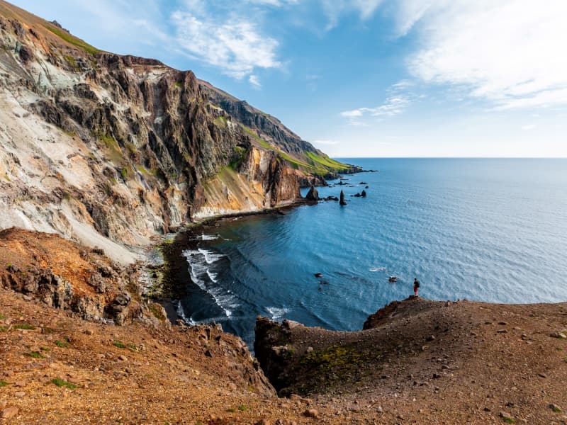
Walk from the sign by the road no 917 towards Ker (before crossing the mountain road Hellisheiði) (N65°42.52- W14°24.41), and from there to Landsendahorn cliff. There one can enjoy a magnificent view of Móvíkur. Above them are 200–300 meters high cliffs and hanging rocky slopes called Móvíkurflug. The rock consists mostly of rhyolite of many colors but mostly yellowish, light brown or greenish grey. The cylinder with the visitors’ log and a stamp is on the banks above Ker.
Part of Hiking Treasures in Egilsstaðir Region
GPS : N65° 43.352-W14°23.300
Powered by Wikiloc
View
Hengifoss Waterfall
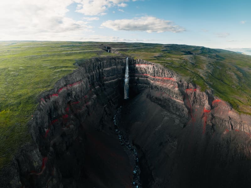
Hengifoss Waterfall is one of the most popular destinations in East Iceland, known for being one of the tallest waterfalls in Iceland at 128 meters high. It is particularly picturesque. A good hiking trail leads you to the waterfall from a service center by the parking lot. Excellent accommodations, restaurants, and activities can be found in the surrounding area.The Hengifoss waterfall plunges from the plateau into a magnificent gorge. The layers between the numerous Tertiary lava strata yield a reddish color, particularly striking in the cliffs around Hengifoss. On the way to Hengifoss, you can also see Litlanesfoss, which features impressive basalt columns on both sides of the gorge.How to Get ThereFrom Egilsstaðir, the major town of East Iceland located by Highway 1, there are two routes to Hengifoss. You can drive on either the west side or the east side of Lake Lagarfljót. The distance is the same, around 35 km.West Side: You will find the junction with Highway 1 on the hill by the timber bridge close to Egilsstaðir airport. It is marked as Route 931 with signs pointing to Fljótsdalur and Skriðuklaustur.East Side: Follow Route 95 first and then Route 931 towards Hallormsstaður, continuing until you reach the end of Lake Lagarfljót. There you should see the waterfall and the parking lot by the main road.From the parking lot, it takes 40-60 minutes to walk to the waterfall on either side of the river. Start by going through a gate by the service center and climbing up a flight of stairs. Then follow a good gravel trail for the next 2 km, which is moderately steep but not very difficult. About halfway up, around 1.2 km from the parking lot, you will see Litlanesfoss with its beautiful basalt columns. There are trails down into the canyon below the waterfall, but they are steep and covered in loose gravel, so be cautious if you decide to enter the canyon. Keep in mind that getting very close to the canyon edge is risky due to the danger of falling. This is especially important if you are accompanied by children.There are two bridges for hikers to connect the trails on each side of the river: one at the upper end just before you enter the great gorge, and the other by the parking lot.By the parking lot is a new service center where you can get information from rangers about the area and the surroundings. We recommend taking your time to visit Hengifoss as there is much more to explore in the area than just the waterfall. You can learn more on this website and use it to help plan your trip.Hiking in SummerDuring the high season (July), Hengifoss can be crowded, mainly with cars at the parking lot. If you can't find a parking space, continue further into the valley and check the visitor's center for Vatnajökull National Park at Skriðuklaustur (5 km away), then return to see if a space has opened up.The waterfall and the gorge face southeast, so for the best lighting, visit in the morning. In June and July, there is usually plenty of water in the river, making Hengifoss magnificent. However, in August, if the summer is really dry, the falls may not be as broad, but they are still enormously high.Late May and early June can be risky due to melting snow in the highlands, causing high water levels in creeks and rivers. Expect muddy trails and slippery paths on your way to the waterfall, and the need to wade through some small streams. By autumn, rain can make the trails muddy as well, but you usually won’t have to wade through any streams unless you want to enter the gorge and get close to the base of the great waterfall.Hiking in WinterMore people are visiting Hengifoss in winter, but caution is necessary. The trails and paths can become icy and very slippery, so stay away from the edge of the canyon and be aware of the dangers. It is not safe to enter the gorge by the big falls in winter due to the risk of falling ice from the cliffs.
Powered by Wikiloc
View
Stuðlagil
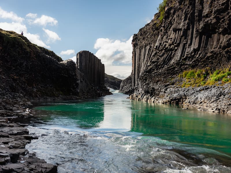
Stuðlagil is a unique basalt canyon located in Efri-Jökuldalur in Fljótsdalshérað, which in recent years has established itself as one of the most exciting destinations in East Iceland.
For the longest time, Stuðlagil canyon was mostly hidden by a powerful glacial river called Jökulsá á Dal (referred to as Jökla by locals). It wasn’t properly discovered until after the Káranhjúkar hydro-dam was put in use and the Hálslón reservoir started to fill, making Jökla’s water levels drop and revealing the stunning basalt columns of Stuðlagil canyon. Jökla is one of the longest glacial rivers in Iceland, spanning a total of 150 kms from Vatnajökull glacier to Héraðssandar beach. Entering Jökla, or other glacial rivers, is extremely dangerous and forbidden as they are very powerful, and their currents are not always visible on the surface.
Stuðlagil canyon boasts one of the country’s largest and most beautiful basalt formations and is exceptionally graphic, especially when Jökla’s glacial water is clear. The bluish-green colour of the water, which contrasts beautifully with the colourful basalt columns, really is a sight to behold. As is with glacial rivers, its colour and water flow change depending on the season. Come spring and snow start to thaw, and the Hálslón reservoir is overflowing, the river takes on a grey-brown colour. Overflow is most common from the beginning of August until October – but can occur at other times too. You can monitor the water level of the reservoir at any time. Stuðlagil canyon is a fantastic destination no matter the season, and no one should leave Austurland without visiting, even if only for a short time!
Stuðlagil canyon is located roughly 52 kilometres (about an hour’s drive) from Egilsstaðir. If you’re visiting from the North, it will take around an hour and a half to drive from lake Mývatn. When leaving Route one (the Ringroad) towards Stuðlagil canyon, you’ll be driving on a gravel road (923). Although gravel, the road is accessible to all cars and is open all year round. Keep in mind if visiting during wintertime that, weather and road conditions can change in a matter of minutes. You can access Stuðlagil canyon via two routes:
Stuðlagil observation platforms
Driving north on Highway 1 from Egilsstaðir, leading you through Jökuldalur, take the exit down route 923, just beyond Skjöldólfsstaðir. From there, it is about a 19 km drive on a gravel road to the farm Grund which stands on the northern side of Stuðlagil canyon.
Upon arrival, you'll find convenient parking and restroom facilities. From there, you’ll have safe and well-marked access to a series of observation platforms thoughtfully positioned throughout the area. These platforms offer breathtaking views from the canyon rim as well as from various points along the trails that wind down to the canyon floor. Whether you choose to take in the sweeping panoramas from above or explore the scenic paths that descend through the rock formations, you'll be treated to a variety of unique perspectives that highlight the natural beauty and dramatic scale of the canyon. With safety rails and maintained trails, it's an experience designed to be both awe-inspiring and accessible, just a short walk from the parking lot.
Stuðlagil hike
Driving north on Highway 1 from Egilsstaðir, leading you through Jökuldalur, take the exit down route 923, just beyond Skjöldólfsstaðir. Turn towards the Klaustursel farm after driving roughly 15 kms. By Klaustursel, you’ll find two parking lots, one by the bridge over Jökla (around 10 km hike to Stuðlagil canyon back and forth) and the other by Stuðlafoss waterfall (about 5 km hike to and from Stuðlagil canyon).
Stuðlafoss is a majestic waterfall surrounded by towering basalt columns. It truly is a sight, and you won’t find many like it in the world. Standing at the bottom of Stuðlagil canyon is another unique experience to check off your bucket list. Keep in mind when entering the canyon that the rocks might be wet and very slippery.
The nature surrounding Stuðlagil canyon is stunning but delicate. Visitors are encouraged to show respect for the area, wildlife and nature and leave it as they found it. From May 1st to June 10th, numerous pink-footed geese nest in the area and, therefore, crucial that guests stay within the marked trails so as not to upset the birds. The area surrounding Stuðlagil canyon is agricultural, so it’s common to see farmers bringing their sheep down from the highlands right before winter hits, which can be an enjoyable experience.
In summertime, you can continue your drive through route 923 into the East Iceland Highlands (F-roads are generally only open from around mid-June for a few months, see more here). T here you can get on to The Highland Circle travel route, which will lead you to exciting places such as Kárahnjúkar dam, Laugarfell and down into Fljótsdalur. Note that parts of the way are only accessible for well-prepared 4x4 vehicles.
For further information, visit the official Stuðlagil website.
View
Stórurð
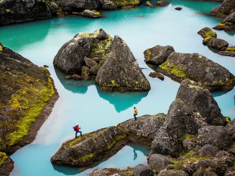
Stórurð boulders is one of Icelands most spectacular sights and has gained more popularity amongst hikers in recent years. The expansive surroundings offer plenty to see and experience; blue-green ponds contrast with flat, vegetated meadows surrounded by sheer-sloped and jagged tuff Dyrfjöll mountain peaks. As the name suggests, the area is strewn with many enormous boulders, likely abandoned by retreating glaciers.
Five marked trails lead to and from Stórurð. Two from Vatnsskarð pass, one from Njarðvík and two from Borgarfjörður Eystri. Since Stórurð is located over 400 m above sea level, snow often lingers far into summer so best time for exploring this magnificent area is from mid-July to first appreciable snows of autumn. The hike back and forth takes about 4-5 hours so consider this a day tour.
View
Þerribjörg
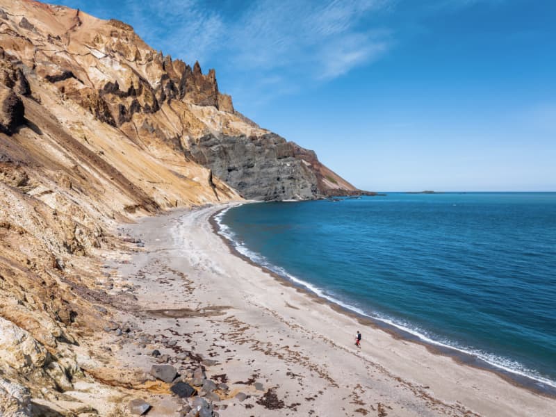
Drive the main road up Hellisheiði mountain and when you’ve reached where you are about the highest part, take an off-road trail to the right from there until you’ve reached Kattárdalsdrög. The trail leads to Kattárdal valley. There is a sign where you can park your car and start walking. The trail is staked to the edge of the cliffs above Múlahöfn harbor. From there (65°45.144 - W14°21.964) lies a trail below the edge, down a rocky slope down to Múlahöfn, one of the natures’ masterpieces surrounded by cliffs and huge pillars of rock on two sides.
This harbor was declared an official trading harbor in 1890 but was only used once as such because of the complications when bringing the shipment further on land. From the harbor, walk north to the outer point. From there one can see Þerribjarg cliffs and Langisandur shore. The cylinder with the visitors’ log and a stamp is by the trail leading down to the beach. Hikers are encouraged to go down and walk along the sand under Þerribjarg before turning back.
Part of Hiking Treasures in Egilsstaðir Region
Powered by Wikiloc
View

Stapavík by Héraðsflói
Stapavík is an inlet that lies in a magnificent setting of steep cliffs and the open sea. From 1930-1945 Stapavík was a used as an unloading port for ships and is closely related to the commercial history of Borgarfjörður Eystri and Hérað. Remains of the facilities are very picturesque and the view from the inlet is beautiful on a sunny day.
A marked trail leads from the farmstead Unaós, following Selfljót river downstream to the rivermouth. Héraðssandur black sand beach opens to the North of the river with a view over Hellisheiði Eystri rhyolite mountain ridge. This is a about a two hour long (back and forth) family friendly hike. Travellers could also challenge themselves to a longer hike by crossing Gönguskarð mountain pass over to Njarðvík which adds a about two hours to the hike.
Powered by Wikiloc
View
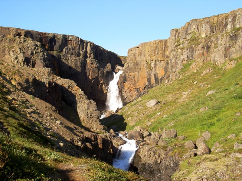
Fardagafoss Hiking Trail
Fardagafoss waterfall is located near Egilsstaðir, at the base of Fjarðarheiði. It is one of three waterfalls on the Miðhúsaá; the others are called Gufufoss and Folaldafoss.
A marked hiking trail leads to the waterfall. The walk is generally easy, except for the final section, which can be a bit challenging to cross. The trail begins at a parking area along Road 93, near the rock known as Áningarsteinn.
Behind the waterfall there is a cave. According to local legend, a fearsome giantess once lived there. It is said that a tunnel runs beneath Fjarðarheiði to Gufufoss in the Fjarðará in Seyðisfjörður.
The giantess of Fardagafoss was said to possess a cauldron filled with gold. When she grew so old that she knew her death was near, she slid the cauldron down into a deep pothole in the middle of Gufufoss, further downstream along the Miðhúsaá River. Legend says that when the water level in the river is low, the handle of the cauldron can sometimes still be seen.
Powered by Wikiloc
View
Strútsfoss
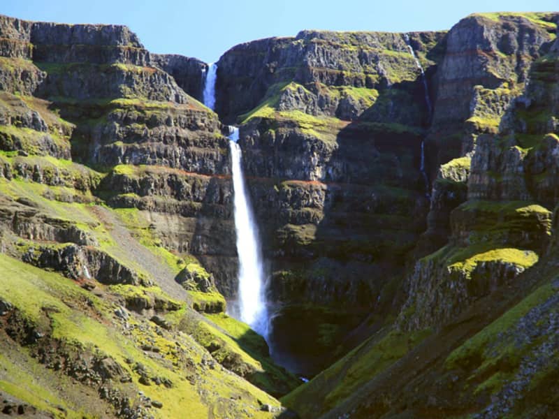
Start at the sign near Sturluflöt, the innermost farm in Suðurdalur, located east of the Kelduá. From there, walk along the banks of the Fellsá on the eastern side of Villingadalur.
The waterfall cannot be seen until you are quite far into the valley. Once there, you can continue along Strútsgil. Near the creek you will find a cylinder containing a visitors’ logbook and a stamp.
Reaching the waterfall itself requires walking into the creek and crossing the river several times, which can be difficult and potentially dangerous.
Strútsfoss is listed as a protected natural site.
This location is part of Hiking Treasures in the Egilsstaðir Region.
GPS : N64°54.194-W15°02.314
GPX file of the track
View
Rjúkandi
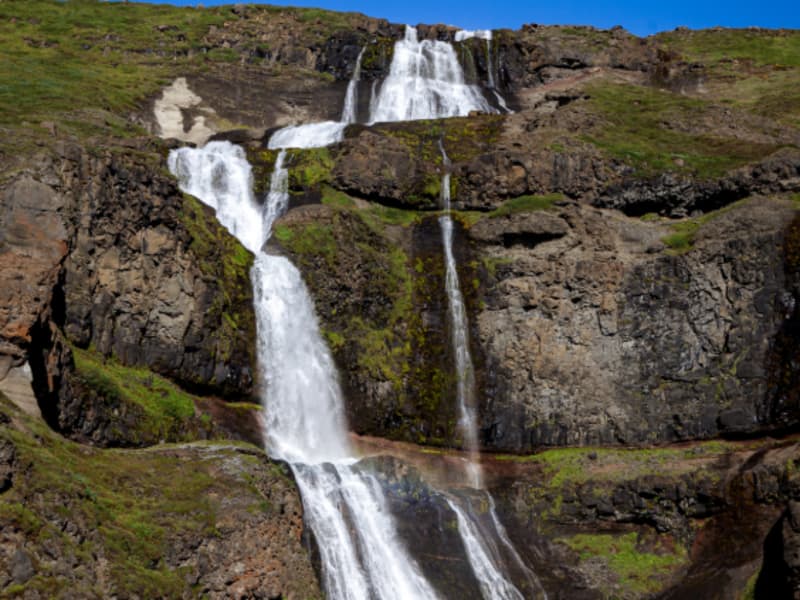
Rjúkandi waterfall is a beautiful waterfall that gracefully descends a few cliffs, from the mountains and almost down to highway 1. Access to the waterfall is very good; it is only a short walk from the car park by the main road.
View
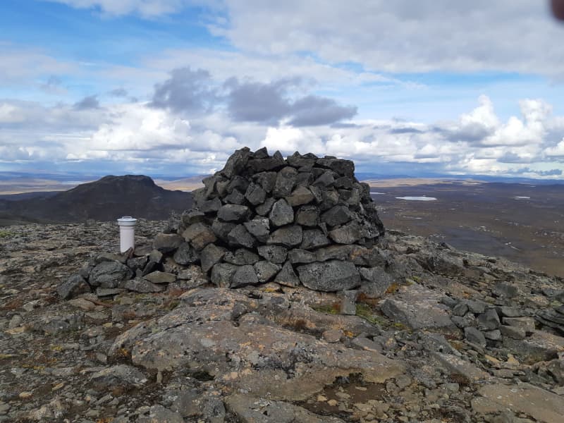
Eiríksstaðahneflar - hike
Hike starts by að sign on the bank of river Þverá south of Eiríksstaðir farm and continues on to Fremri Hnefill – mountain top (947 m). From there one can cross over to the top of Ytri Hnefill (922m) and down to Eiríksstaðir farm again. Travellers could challenge themselves to a longer hike by walking over to the ruins of the abandoned Hneflasel farm and then traverse back between the two mountains to Jökuldalur valley.
Part of Hiking Treasures in Egilsstaðir Region
GPS : N65°08.617-W15°28.195
View
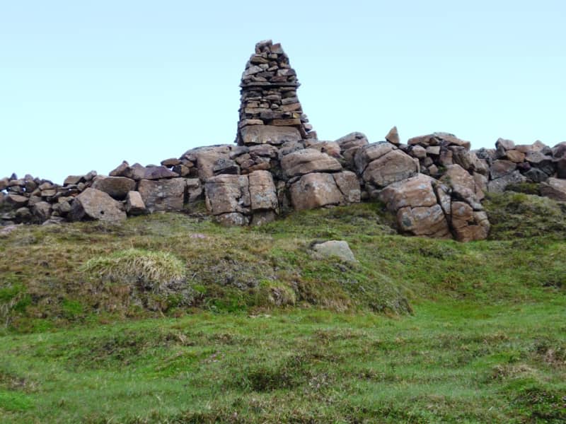
Grjotgardur við Hjardarhaga
A walk of about two and a half hours, fairly short but quite steep. Park your cars at the crossroads to Hnefilsdalur. Walk from the sign, located by the main road (no 1), a marked path up along the river Sauðá up to the edge of the slope to the stone wall or fence. Follow the fence until you’ve reached the cylinder with the visitors’ log and stamp. Keep on towards Teigará to the cairn and then walk back for a bit down a staked horse riding trail through Hestagil creek. The purpose of the stone wall is unknown but thought to have been a fence for farm animals.
Part of Hiking Treasures in Egilsstaðir Region
GPS : N65°21.391-W15°00.061
Powered by Wikiloc
View

Hnjúksvatn
Hnjúksvatn is a lake on the heath across from Merki farm. Walk from the sign by road no. 923 along Hnjúksá river to Binnubúð hut by Hnjúksvatn. By the hut, you will find the cylinder with the visitors’ log and stamp. An old lady and midwife, Brynhildur Stefánsdóttir built this hut for those who wished to visit and enjoy the highlands.
Part of Hiking Treasures in Egilsstaðir Region
GPS : N65°14.333-W15°15.887
Powered by Wikiloc
View

Magnahellir
Drive north of Kárahnjúkastífla reservoir along a road (fit for SUV) on Lambafell to crossroads by Laugavellir. Drive down to a parking area by Dimmugljúfur canyons. There you will find a sign containing information and the trail running through Hafrahvammar canyon and Magnahellir cave where you will find the cylinder with the visitors’ log and stamp. The farmers in Eiríksstaðir used to keep their sheep in the slopes by Jökulsá river close to the cave called Magna cave which derives its name from the farmer named Magni who was the first one to keep his sheep there in winter.
Part of Hiking Treasures in Egilsstaðir Region
GPS : N64°99.252-W15°71.683
Powered by Wikiloc
View
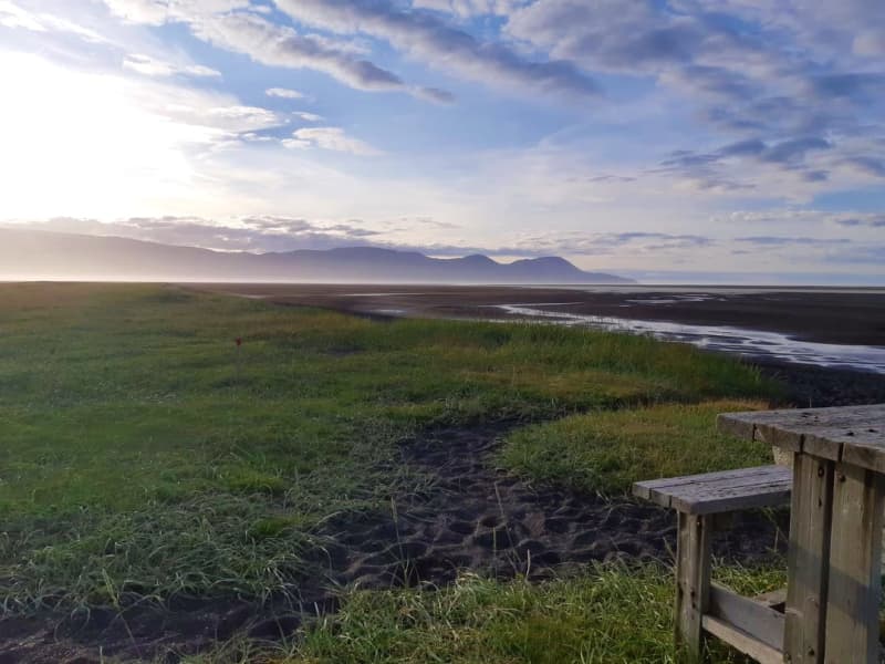
Húsey
Húsey farm is renowned for its picturesque nature, abundant wildlife and hiking opportunities. A marked hiking route will take you towards river Jökulsá where seals and seal pups hang out in the river mouth and out to Héraðssandur black sand beach. Húsey is a bird watchers' paradise and with nesting grounds of red-throated divers, parasitic jaegers and great skuas, to name a few.
The walk takes you across the open plains around Húsey farm, on the coast of Héraðsflói Bay. You can choose between a 6 km route (approx. 2 hours) or a longer 14 km circular route. The area is rich in birdlife, and seals can often be seen in the rivers and along the shore.
The walk starts at the information sign just inside the gate at Húsey. Follow the trail towards the Jökulsá River and then along the riverbanks until you reach a small box containing a guestbook and stamp. The box is located by a table near the sea, approximately 3 km from the farm. Continue towards Húsey farm and follow the road back to complete the circle.
Distance: 6 km
GPS coordinates: N65°38.775 – W14°14.670
Húsey is the easternmost farm in Hróarstunga, situated on a 30 km² island between the Jökulsá á Dal (Jökla) and Lagarfljót rivers. The highest point is Sandhóll, at 13 m above sea level.
The landscape has been shaped by the two rivers and the powerful waves of Héraðsflói Bay. The area consists of sandy shores, dunes, heathland and wetlands. Strong northerly winds can carry sand inland, making it difficult for vegetation to establish. Land reclamation efforts include planting marram grass and strengthening the vegetation cover.
Húsey is a remarkable natural area and is listed as a protected site. Around 30 species of birds breed in the area, and reindeer, arctic foxes and mink can occasionally be spotted. Seals are particularly common, often gathering in large numbers in the rivers or resting on the sandbanks. Trout and salmon are also caught in the rivers.
Húsey is well known for its unusual and abundant wildlife. The farmer, Örn Þorleifsson, has become something of a local legend for raising orphaned seal pups in a pond near the farm. He has also attracted greylag geese, which roam freely around the farm.
For further information, please contact the Húsey hostel.
GPS : N65°38.775-W14°14.670
Powered by Wikiloc
View
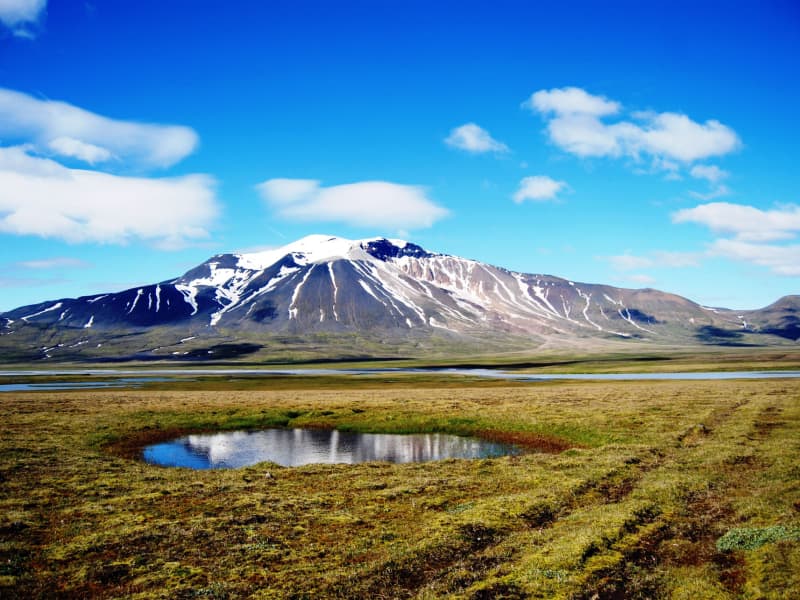
Snæfell
Mt Snæfell towering to 1,833 m, is the highest mountain in Iceland, outside the glacier regions. Even so, and despite the omnipresent snow, (Snæfell = "The Snow Mountain), it is fairly accessible from Snæfellsskáli hut. While Snæfell boasts a splendor of its own, it offers a fabulous view, partly overlooking the oasis of Eyjabakkar. Eyjabakkar is the choice habitat for geese. Reindeer can frequently be spotted west of Snæfell, towards Hálsalón reservoir, in addition to other territories in the East Iceland highlands.
GPX file of the hike is accessible here
View
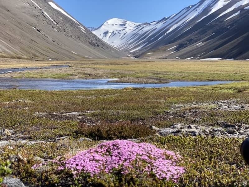
Valtyshellir
Walk from the sign by road no 1 road east of Gilsá river (N65°08,172-W14°31.133), pass the ruins of Hátún which used to be a large farm in the early ages. It is said to have had 18 doors on iron hinges and latches. Remains of old rock fences are visible.
In the 19th century, an ancient sword was discovered there but it was promptly melted down and the metal cast for horseshoes and other necessities. Walk on further and along a flat grassy pasture named Kálfavellir. Valtýshellir is a small cavity further on behind some rubble north of Hjálpleysuvatn lake. The walk is about 8,4 km. The visitors’ log and a stamp are by the cave.
GPS : N65°06.410-W14°28.517
Powered by Wikiloc
View
Bjargselsbotnar
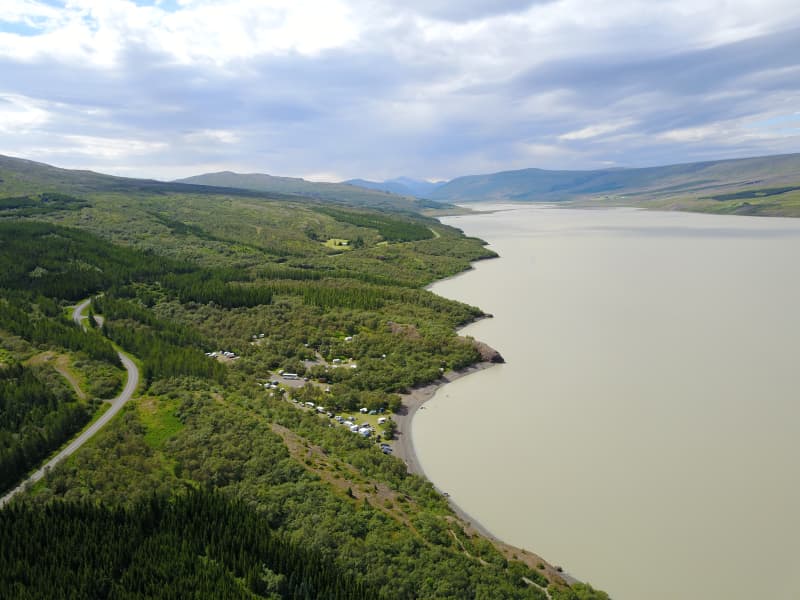
Hiking trail starts by a sign near Hallormsstaðarskóli schoolhouse in Hallormsstaður woodland following a light green marked trail that passes through an area where half the mountain slid forward some 10.000 years ago. You’ll ascend up to Bjargselsbotnar, onwards to Bjarg and Þverbjarg to Illaskriða landslide. From there you follow the trail to the Leirtjarnarhryggur ridge.
Part of Hiking Treasures in Egilsstaðir Region
GPS : N65°05.465-W14°43.031
GPX file of the track
Powered by Wikiloc
View
Vestdalsvatn
A great trail for hiking which involves crossing Vestdalsheiði mountain range, from Hérað to Seyðisfjörður. Vestdalsheiði heath used to be a frequently traveled road. People walked along Gilsá river, across the heath, and into Vestdalur valley. Walk from the sign in Fjarðarheiði (N65°15.577-W14°13.524) and head towards the western part of the mountain Bjólfur. You will see the Lake when you get near the mountain.
This is a nice walk in rolling hills. When you get to Vesdalsvatn you can choose between three routes if you don´t want to take the same route back. Down Vestdalur by a staked trail to Seyðisfjörður; down Gilsárdalur valley down towards Gilsárteigur farm (east of Eiðar in Fljótsdalshérað) or go west of Bjólfur mountain down to Stafdalur valley. The cylinder with the visitors’ logbook and a stamp is where Gilsá river runs out from the lake. You will need to cross the river if you choose to walk from Fjarðarheiði.
Part of Hiking Treasures in Egilsstaðir Region
GPS : N65°17.102-W14°17.887
Powered by Wikiloc
View
Hrafnafell
Drive the gravel road up to Fjallssel farm and to the highest spot south-west of Hafrafell. Walk from the sign by the road towards the antennas on Hrafnafell where you can find the cylinder with the visitors’ log and stamp. Do walk on to Hafrafellsrétt livestock pen (N65°18.02-W14°29.23) which is man-made of rocks and stones, between cliffs slightly to the east of the trail.
It is also very nice to descend east of Hrafnafell and see Kvíahellir cave (N65°18,359-W14°29,063). If you take the circle the walk is 5.8 km long and a red trail.
Part of Hiking Treasures in Egilsstaðir Region
GPS : N65°18,304-W14°29,098
Powered by Wikiloc
View
Mulakollur
Þingmúli divides Skriðdalur into Norðurdalur and Suðurdalur. The Round Road nr.1 lies through Suðurdalur to Breiðdalur. The homestead at Þingmúli was a place of gathering for the Thing in Eastern Iceland for centuries.
The northernmost part of the mountain is called Múlakollur. Walk the ridge from the sign straight up to 400 m. When you reach Múlakollur’s top it is pleasant to walk onwards and along the top and descend on the east side a bit south of Múlastekkur. One can also ascend by walking up from Múlastekkur.
Part of Hiking Treasures in Egilsstaðir Region
GPS : N65°01.624-W14°38.049
Powered by Wikiloc
View
Heidarendi
Take the driveway up to and above Heiðarsel farm and turn to the left before you come to the farm Nátthagi. Walk from a sign by the old road above Nátthagi. Walk up to the top and further on to the right where you get to the cylinder with the visitors’ log and stamp. It is pleasant to walk on from Heiðarendi descend and walk back by the old gravel road.
Part of Hiking Treasures in Egilsstaðir Region
GPS : N65°23.085-W14°33.819
View
Hvannargil
Walk from the sign by road F905. A circular trail from Kjólsstaðaskora then Vatnsstæði, inside the lowest Hvannárgil creek through all three creeks to the end of the highest. The highest creek is spectacular and ends in a waterfall. The cylinder with the visitors´log and the stamp is in the highest creek. Walk back down Slórdalur.
GPS: N65°16.868-W15°47.418
Powered by Wikiloc
View
Hottur
Höttur (Hátúnahöttur) is a beautiful mountain which lies in the mountain range between Vellir and Fagridalur and is favored by many who live in Egilsstaðir.
Walk from the sign by road nr 1 east of Gilsá river (N65°08,172-W14°31.133), towards Grjótá river by Víðihjalli and up along the river. Onwards and up to Hattarhólar, turn inland and ascend to the top of Höttur (1106 m).
Part of Hiking Treasures in Egilsstaðir Region.
GPS : N65°07.63-W14°27.25
Powered by Wikiloc
View
Kóreksstaðavígi
Kóreksstaðavígi is a beautiful rock of basalt columns. There the Viking Kórekur is said to have fought his enemies to the death and been buried at the site. One drives past Hjaltalundur and takes the road towards the farm Kóreksstaðir. Park your car in an area close to the sign by the gate leading to the farm. Walk on towards the Kóreksstaðavígi where you will find a cylinder with the visitors’ log and stamp. Standing on its top is an enjoyable experience.
Part of Hiking Treasures in Egilsstaðir Region
GPS : N65°32.782-W14°10.591
Powered by Wikiloc
View
Rangarhnjukur
Walk from the sign by the gate to Fjallasel farm, where you take an old road up above the farm. When you arrive up to turn off the road to the right and walk onto Rangárhnúkur where you will find the cylinder with the visitors’ log and stamp. On the way back it is a good idea to walk down to Egilssel farm and walk on towards Fjallssel farm. Then you will pass Dansgjá which is a peculiar creek or ravine through tall cliffs west of Staffellsbjörg cliffs right off the road and marks the borders of the farms.
Part of Hiking Treasures in Egilsstaðir Region
GPS : N65°19.410-W14°35.498
Powered by Wikiloc
View
Raudshaugur
Rauðshaugur is a rock or a hill protruding from the farm Höfði and can be seen widely from Hérað. According to legend it is the burial heap of farmer Rauður or Ásrauður in the sagas and from there two similar heaps can be located, the burial heap Bessahaugur in Fljótsdalur and the heap Ormarshaugur in Fell. Legend Rauður was buried with all his riches.
People are said to have tried digging into the pile of rocks but always had to give up because of a burning vision of the homestead in Ketilsstadir. Walk from the sign by Fagridalur road (N65°14.590 -W14°21.156) along the trail on Egilsstaðaháls towards Rauðshaugur.
Part of Hiking Treasures in Egilsstaðir Region
GPS : N65°12.77-W14°23.01
Powered by Wikiloc
View
Sandfell Skriddalur
Sandfell is an impressive looking rhyolite mountain in the shape of a ridge and reminds one of a tent because of its even slopes which are mostly free of cliffs and by it’s two darker peaks. The path starts by the main road (no 1). A little distance from the Gilsá river you will find the sign where you start. Walk the trail towards a fence then turn and walk up along it, then upwards by the trail on the northern ridge straight to the top which reaches 1157 m.
Part of Hiking Treasures in Egilsstaðir Region
GPS : N65°05.637-W14°30.298
Powered by Wikiloc
View
Skumhottur
Skúmhöttur the second tallest mountain in the range between Fljótsdalshérað and Reyðarfjörður. It consists mostly of rhyolite but the peak itself is of a darker rock formation. Drive the main road (no 1) until you pass Litla Sandfell farm. Make a left turn and go through the gate and continue until you come to an old bridge by Þórisá river. There is a parking area. Walk from the sign by Þórisá river and along the ridge until you are on the top, 1229 m.
A good walk and an interesting mountain.
Part of Hiking Treasures in Egilsstaðir Region
GPS : N65°05.637-W14°30.298
Powered by Wikiloc
View
Spanarhóll
Spanarhóll is in the north end of Fjórðungsháls, 591 m high. You drive to the south up Fell to the farm Refsmýri. Walk from the sign by Þorleifará river and up along the river, about 0,5 km. Then you turn from the river and walk towards Hlíðarsel and onwards up the canyon above the ruins upon Fjórðungur on the Fell heath. From there the way to Spanarhóll is easily hiked. There are four hills and people should walk towards all of them. One can also hike to Spanarhóll hill by going up by the Ormarsstaðir river or from Fjallssel up to the edge, and then inland. The cylinder is on top of the biggest hill. At the hill, lore has it that there is a presence of elves or hidden people.
Part of Hiking Treasures in Egilsstaðir Region
GPS : N65°15.588-W14°41.446
Powered by Wikiloc
View
Stuttidalur
Walk from the sign by road nr. 1 close by Haugaá river. Go through a gate and then walk by the fence approx 600 m. Keep on walking the staked trail. Stuttidalur lies east between Hallbjarnarstaðatindur and Haugafjall. The cylinder with visitors’ log and a stamp is by the pond a short distance by Sjónarhraun. If you prefer a different route back the one way is crossing the river and passing through Haugahólar hills on the way to your starting point.
Haugahólar hills were formed by a huge landslide, one of the largest ever from Haugafjall, and lie between Stuttidalur and Vatnsdalur.
Part of Hiking Treasures in Egilsstaðir Region.
GPS : N64°59.173-W14°35.217
Powered by Wikiloc
View