Skip to content

Or try searching by Category and/or Location

Destinations - Djúpivogur

Black Sand Beach in Djúpivogur
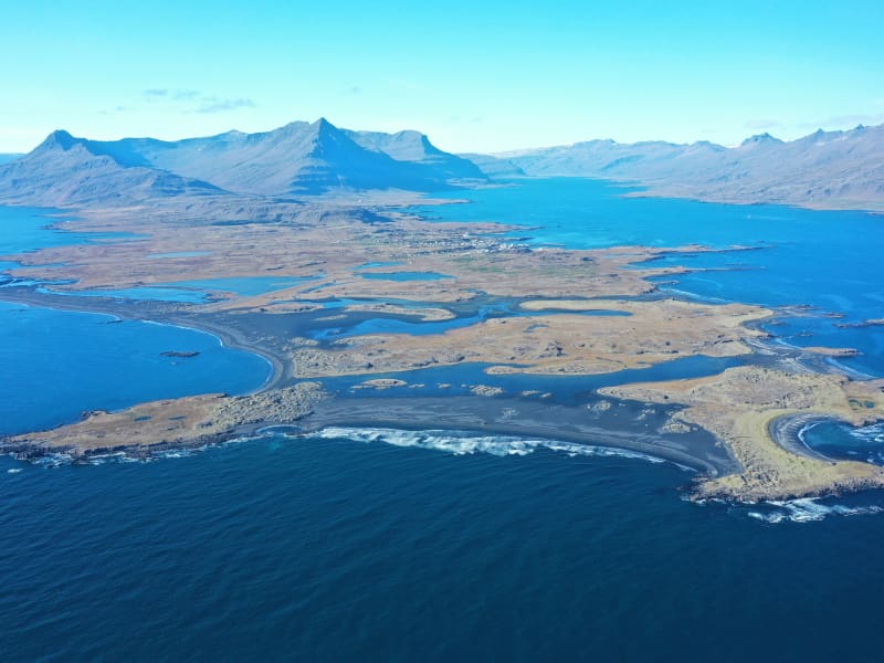
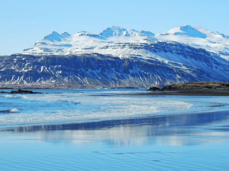
Just outside the airport in Djúpivogur are the Black Sands. It is a natural pearl complete with unique birdlife. The area offers a wide range of outdoor activities for the whole family and does especially well with bird enthusiasts.
Búlandstindur
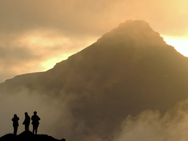
Búlandstindur is a 1069-meter-high basalt mountain in Djúpivogur district and is believed to be about 8 million years old. Búlandstindur is generally considered to be one of the most beautiful mountains in Iceland. At a height of about 700 m east of Búlandstindur runs a mountain ridge, Goðaborg, and it is said that people went up there with their deities immediately after the conversion to Christianity in order to throw them out of the mountain cliff. Other sources say that Goðaborg is a cliff high up in Búlandstindur, said to be wide and flat. It is steep and hard to get up there. Some say that there is water nearby, that was used to wash the bowels of animals that were sacrificed to the gods. Many people make their way to the summit every year. It is best to follow a road that runs along Búlandsá to the south and all the way to a dam that is in the heart of the valley. From there you walk straight up the grassy green slopes and landslides inside Stóruskriðugil in the direction of a pass inside Búlandstindur. After that, the route runs itself until the top peak is reached. You can view an aerial photo of a marked path up to the summit on Teigarhorn's website. The peak is a narrow and steep cliff and there is a great view. It is very important to be careful not to walk too far to the east if something is visually or if it is slippery, because the eastern slope of the mountain is steep and rocky. There is a good mobile connection on the summit.
Stapi in Stapavík
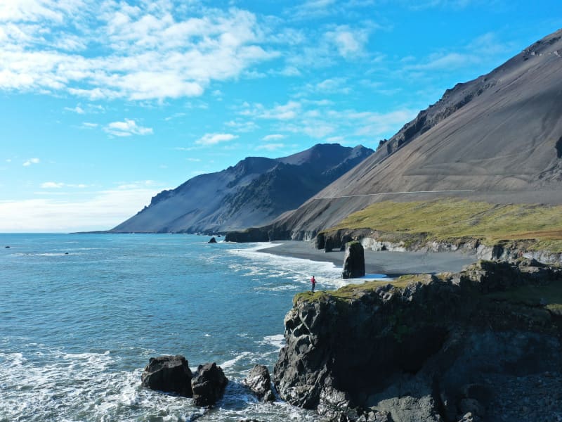
In Stapavík, south of Djúpivogur an close to Höfn, there is a majestic cliff rising about 20 meters out of the sea. It is landlocked and is a little way from the mainland cliff. Popular with locals and tourists alike, the cliff the beach south of Álftafjörður are considered unique natural gems and therefore essential stops when visiting the area.
Eggin í Gleðivík - The Eggs in Merry bay
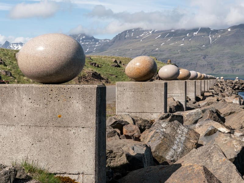
Eggin í Gleðivík (the eggs in Merry Bay) is an outdoor artwork by artist Sigurður Guðmundsson (b. 1942). The artwork has 34 replicas of eggs of nesting birds that nest in the vicinity of Djúpivogur and reflects the strong connection that Djúpivogur has with nature. The work is especially for the site. The eggs stand on concrete pillars that previously supported a landing pipe between the pier and the smelter. Eggin í Gleðivík are a popular tourist attraction and has become one of Djúpivogur´s landmarks.
Teigarhorn
Teigarhorn, close to Djúpivogur, is known for remarkable geological formations and interesting history of industry and culture. Teigarhorn is a nature reserve, and part of it is a natural monument. There is year-round ranger at Teigarhorn, and development work in the area is being done in harmony with nature. Teigarhorn is one of the most significant mining sites of zeolites in the world. Among the types of zeolite stones found at Teigarhorn are schoolite, stilbite, epistilbite, mordenite, laumontite and heulandite. There are also other minerals, such as seladonite, opal, chalcedony, rock crystal, calcite and Iceland spar. Zeolites from Teigarhorn have been used in various geological studies for more than 200 years. These include descriptions of crystal forms, chemical composition, internal structure of crystals and optics, some of which are among the first descriptions of the rocks in question. Samples from Teigarhorn were sold to museums around the world in the second half of the 18th century, but since 1976 the main mining places have been protected as natural monuments. Weywadthús, at Teigarhorn, was built by Níels P.E. Weywadt in the years 1880-1882. He was a store manager in the Örum and Wulff store in Djúpivogur. Weywadthús has been part of the National Museum of Iceland since 1992. Níels' daughter, Nicoline Weywadt, was the first Icelandic woman to study photography and operated a photography studio in Teigarhorn. Nicoline is also believed to have owned the first sewing machine in East Iceland.
Hálsaskógur
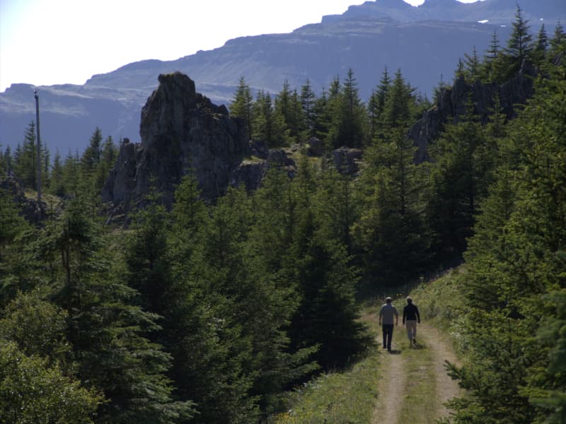
Hálsaskógur is in Búlandsnes, a short distance west of Djúpivogur. The forest area is very nice and there are signs providing information about the forest, such as the tree species, as well as tables and benches. There are footpaths going through the planted forest which makes it particularly suitable for those who prefer light walks.
Tankurinn
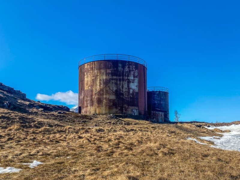
Tankurinn is an old fish oil tank reformed into an exhibition space for art and music. It is always open, and whether there is an installation there when you visit, you should at least go inside and enjoy the marvelous reverb. 
Æðarsteinsviti Lighthouse
Æðarsteinn lighthouse - a pretty structure, a little way inland from the Gleðivík Eggs. Walking distance from the Tankur. It´s a nice place worth visiting during the walk.
LIBERTY and Hans Jonathan
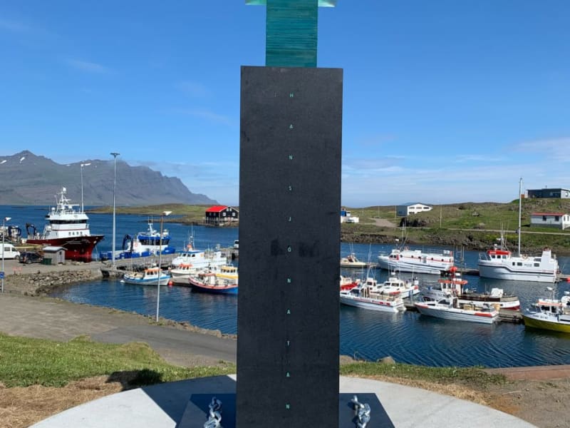
Hans Jonathan (1784-1827) was born into slavery on St. Croix in the Danish Virgin Islands in the Caribbean. His mother, Emilia Regina, was a house slave from West Africa; his father was white, probably a Dane. At age seven, Hans Jonathan was sent to Copenhagen to join the household of his owners, the Schimmelmann family. He played a heroic role in the Battle of Copenhagen in 1801, imagining he would become a free man. Widow Schimmelmann, however, took him to court and had his enslavement confirmed. Hans Jonathan then decided to take his freedom and escape to Iceland soon after the legal verdict. He settled at Djúpivogur where he worked as a trader at the Löngubúð store, later becoming a peasant. Icelanders embraced the newcomer, and nothing indicates that he would be shunned because of the color of his skin or his origin in slavery. He married a respected local girl, Katrín Antoníusdóttir. Their two children now have one thousand descendants. As far as we know, Hans Jonathan was the first black person to settle in Iceland. His biography, The Man Who Stole Himself: The Slave Odyssey of Hans Jonathan (authored by Gísli Pálsson), appeared in 2016 (also published in Icelandic, Danish, and French). A memorial sculpture, "Freedom," has been raised at Djúpivogur in his honor, echoing international protests against the use of skin color in refuting human rights. The memorial is the work of renowned Icelandic artist Sigurður Guðmundsson. The Government of Iceland, the inhabitants of Djúpivogur, Fiskeldi Austurlands, and numerous individuals generously financed its construction. Prime Minister Katrín Jakobsdóttir revealed the memorial at a ceremony in Djúpivogur on July 10th, 2021
Bóndavarðan - The farmers cairn
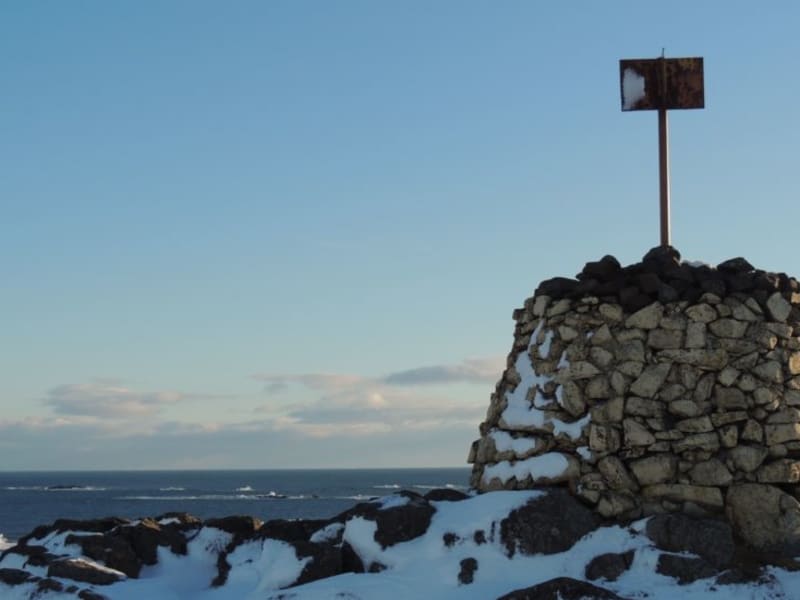
Bóndavarðan - The farmers ´cairn stands high on the ridge just seawards of the village. The view from Bóndavarðan cairn is great! it may have been first erected by farmers keeping watch towards the sea after a severe raid by North African pirates in 1627. There is a view indicator up the cairn.
Álftafjörður
Álftafjörður is a lagoon that Starmýrarfjörður, which is no wider than a large surf crosses them, separates the lagoon from the sea. The fjord is quite large, but relatively shallow and large areas of it dry up when the tides are low. There are several islands in Álftafjörður, Brimilsnes being the largest. To the south of the fjord rises Krossanesfjall, just over 700 m high straight up from the sea, but to the north are Mælifell and Sellönd. When this is released, we receive four valleys that rise from Álftafjörður, to the west. Their southernmost is Starmýrardalur. The mouth of the valley is narrow, but when it enters it opens slightly but high mountains, Flötufjöll and Miðfell to the south and Selfjall to the north, rise rapidly. Selá lies around the valley and has its source at the top of Starmýrardalur. At the mouth of the valley, the river flows through Sjónarhraun and from there in a bend to the northwest over Stekkjartún where it joins Starmýrará, which originates in Hæðir. From there, Selá falls into Krossavík south of Álftafjörður. North of Selfjall lies Flugustaðadalur, about 14 km. long. Like Starmýrardalur, it is narrow and the lowlands are small. To the east of the valley, the Suðurá / Flugustaðaá river, which originates in Bláskriðir at the bottom of the valley, falls under Tungutindar and Flugustaðatindir. Under Tungutindur by Tungusporð, the river Hofsá merges, which comes down from Hofsvötn east of Hofsjökull and together they flow east through Hofshólmur to the west of Álftafjörður. The mouth of Flugustaðadalur is to the south of the rivers and the mouth of Hofsdalur to the north, the division remains so until Tungutindur takes over and separates the valleys, so that Flugustaðadalur stretches further west and Hofsdalur bends to the northwest. Both valleys are fairly well-vegetated and there is considerable birch scrub. When you reach the valley, you face Jökulsgilsgrindur, Grísatungur and Hofsjökull (1280 m). At the northern side of Hofsdalur, steep mountain slopes take over and Selfjall (950 m) is the highest peak and beyond the mountain range is Geithelladalur, about 18 km long. High mountains are bends due to the valley all the way west of Þrándarjökull (1248 m) on the south side, but when you reach the bottom of the valley, land rises rapidly and the plateau northeast of Vatnajökull, so-called Hraun, is exposed. The valley is grassy and there is a lot of forest there. The Geithellaá river flows through the valley, which is a considerable waterfall and has its main source in large water into lava. It falls through Geithelladalur in waterfalls and gorges until it reaches the lowlands. From there it flows through gravel ears and falls into branches to the west of Álftafjörður. It is recommended to take a good time travelling through Álftafjörður and Hamarsfjörður to enjoy the natural beauty the area has to offer.
Hamarsfjörður
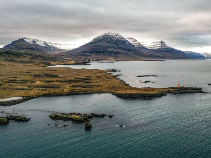
Hamarsfjörður, a sea reservoir that lies between Berufjörður and Álftafjörður, is a particularly beautiful area with many reasons for outdoor activities. Melrakkanes separates Álftafjörður and Hamarfjörður and out of that is Melrakkanesós which is a narrow channel between Stapaey in Starmýrarfjörður and Þvottáreyjar which are in the mouth of Hamarsfjörður, but the fjords fall into the sea through the estuary. Another narrow channel, Holusund, is on the east side of Þvottáreyjar and lies next to Búlandsnes. On the north side of Hamarfjörður is Hálsfjall, but up from the fjord to the west is Hamarsdalur and its top draft is at the foot of Þrándarjökull. Grassy places can be found in the valley. Hamarsá falls through the valley, which has its main source up on Hraun and Hamarsdalsdrögur. Glacial water from Þrándarjökull mixes with it and it can often be very watery. The river flows from many cliffs on its way down the valley and forms beautiful waterfalls. When you reach the bottom of the valley, the river flows through your ears, until it flows into the sea at the bottom of Hamarsfjörður. Off Hamarsfjörður and Búlandsnes on Papagrunn is the largest island in the Eastfjords, Papey, about 2 square kilometers in size. In Búlandsnes, south of Berufjörður, is the town of Djúpivogur. It is recommended to take a good time travelling through Hamarsfjörður and Álftafjörður to enjoy the natural beauty the area has to offer.
Sveinsstekksfoss
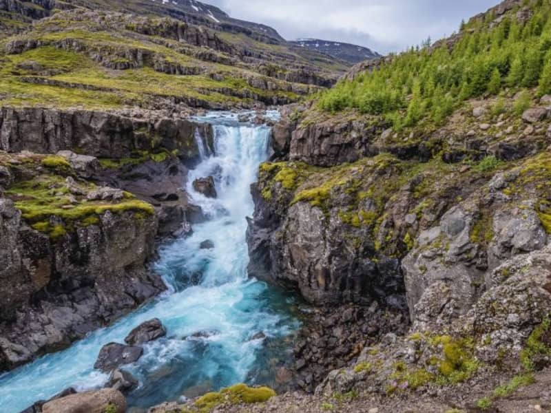
Sveinsstekksfoss, Fossárfoss eða Nykurhylsfoss Sveinsstekksfoss waterfall, also known as Fossárfoss waterfall, is a 50-foot waterfall on the Fossá River, the last fall before it empties into the Atlantic Ocean. It is located on Route 1, Northwest of Djúpivogur. You can climb above the waterfall to see more of the Fossá River cascades. Nykurhylsfoss waterfall is the lowermost waterfall in the Fossá River. The river plunges 15 m into a narrow gully, churning, and racing in pools and rapids until it reaches the 9 m deep Nykurhylur pool. The river Fossá has numerous waterfalls in its course. There used to be a magical water horse living in the lowest pool, just under the bottommost waterfall. All attempts to drive the water horse away remained unsuccessful, but it finally disappeared when baptismal water was poured into the river after the baptism of a child up the valley.
Blábjörg in Berufjörður
By the sea, on the north side of Berufjordur there is an interesting natural phenomenon. A short distance east of the farm Fagrihvammur, a peculiar cliff hammer rises and it is unlike any other rock in the area, both in colour and texture. The rock hammer is called Blábjörg (Blue Cliffs), and it's got a blue tinge. This rock is made of ignimbrite, approximately 9 million years old. The rock hammer is a testament to a spectacular event in Iceland's geological history; iignimbrite is formed by a spike in heavy explosive eruptions. When the eruption becomes heavier than the atmosphere, it collapses, so there will be a spike in volcanic eruptions, as the fiery spike whips at an alarming rate down the slopes of volcanoes. Is the speed such that there is no man's chance to get away from such a thing.
Djáknadys
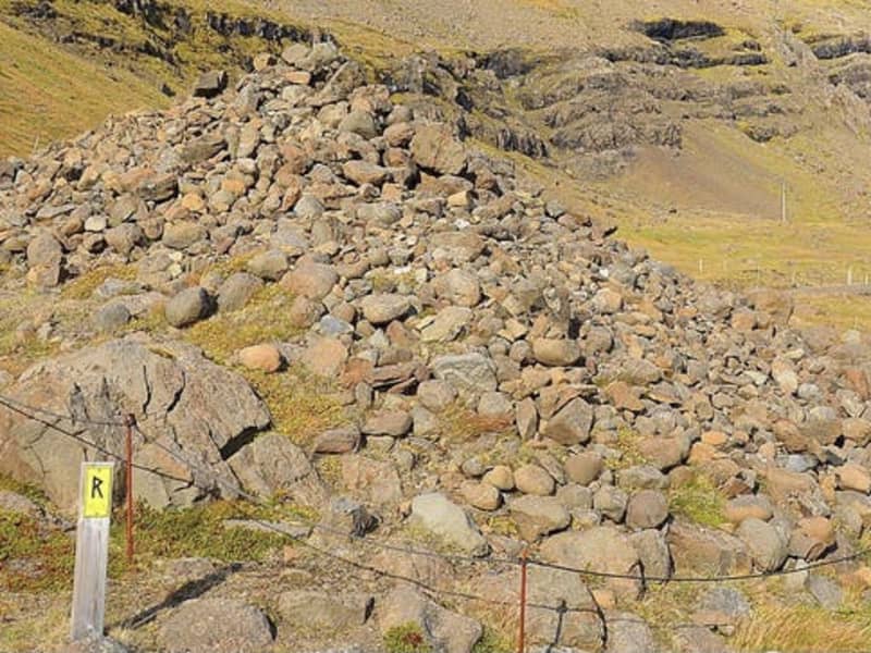
According to legend the mound marks the spot where the pastor of Háls and the deacon of Hamar fought to the death. Both were buried at the site, and that is the origin of the name Djáknadys (Deacon’s Burial Mound). Tradition requires every traveller, on first passing by Djáknadys, must throw a pebble or stone onto the mound: one for him/herself, and one for every horse or dog accompanying them. If they fail to do so they will lose their way. Another version of the tradition is that travellers must place three stones on the mound. An old verse on the subject says: To quickly dismount and fling a stone over the aged deacon brings good fortune along the road. Please treat this protected heritage site with respect and care. Do not remove stones from the mound and do not dispose of refuse under stones. 
Þvottaá
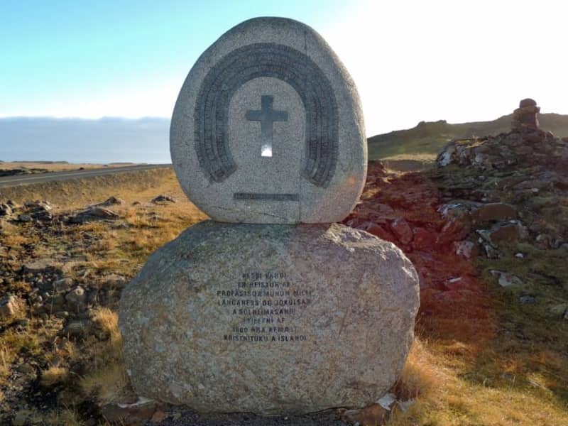
The farm Þvottá is the southernmost farm in Álftafjörður. Around the year 1000 the renowned Saga personality Hallur Þorsteinsson, or Síðu-Hallur, lived there. He received the priest and missionary Þangbrandur, who spent the winter with him. Síðu-Hallur and his whole household were baptized in the river by the farm and since then it was named River Þvottá (The Wash River). The farm gets its freshwater supplies from the so-called Þangbrandur Well, where the missionary probably held services at St. Michael’s Mass with the people of Þvottá attending the day before they were baptized. A ruin by the well was declared inviolate. Þvottá was a church site until 1754 and a parsonage for a long time. The old cemetery is still visible. Mt Mælifell (487m) is closer to the sea and north of it are Sellönd (Summer Pastures). The whole area is rather colourful because of the rhyolite intrusions and quite a few basaltic dykes decorate the landscape. These formations were created by the ancient and extinct central volcano, which has now mostly disappeared under the Álftafjörður Bay. Traces of several minerals were discovered in the area, gold, platinum etc. By Þvottaá, there is a monument to the adoption of Christianity and the area is vell suited for outdoor activities.