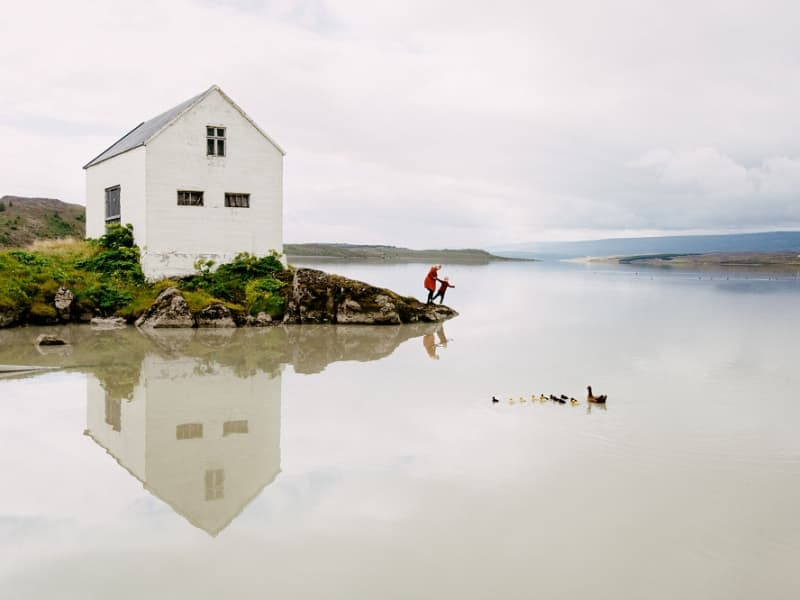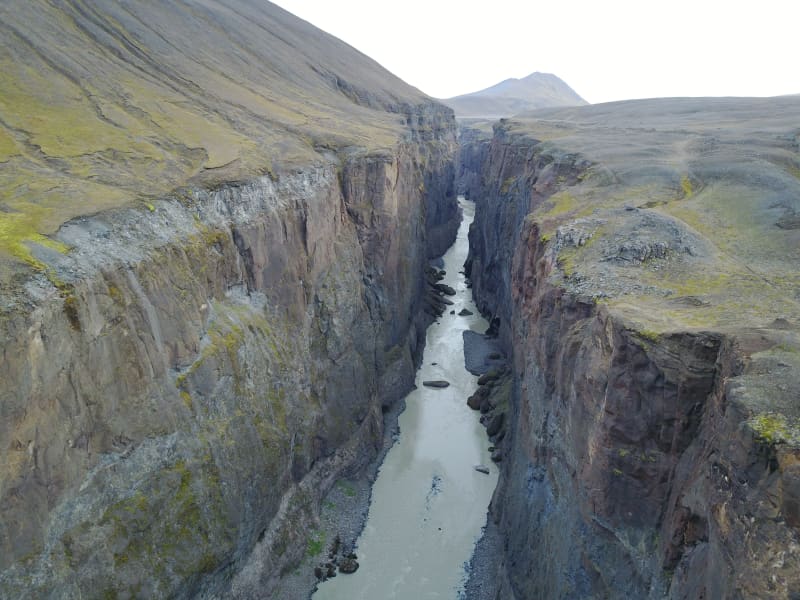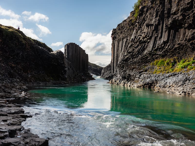
Stuðlagil
Stuðlagil is a unique basalt canyon located in Efri-Jökuldalur in Fljótsdalshérað, which in recent years has established itself as one of the most exciting destinations in East Iceland.
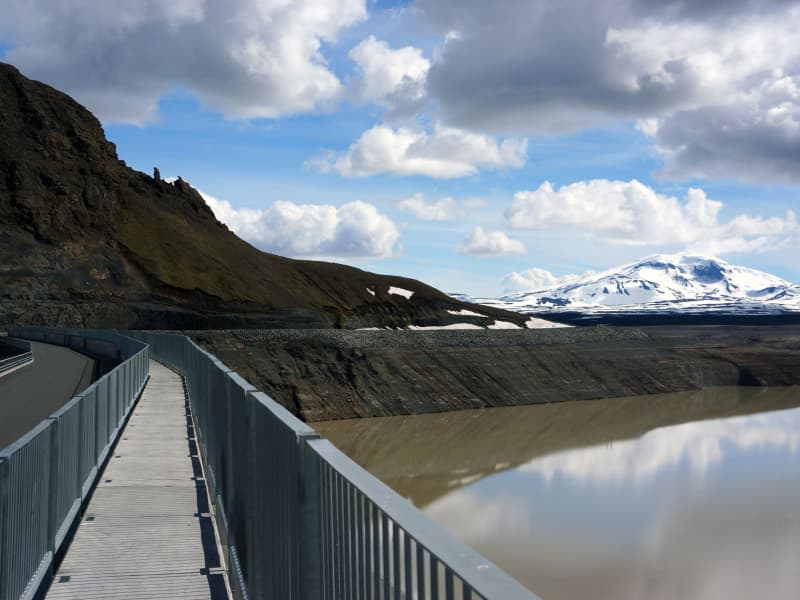
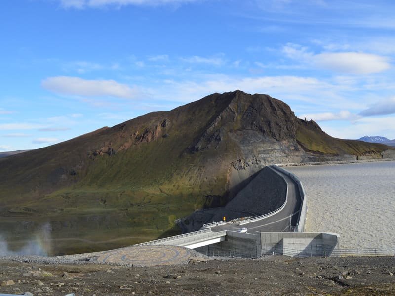
For the longest time, Stuðlagil canyon was mostly hidden by a powerful glacial river called Jökulsá á Dal (referred to as Jökla by locals). It wasn’t properly discovered until after the Káranhjúkar hydro-dam was put in use and the Hálslón reservoir started to fill, making Jökla’s water levels drop and revealing the stunning basalt columns of Stuðlagil canyon. Jökla is one of the longest glacial rivers in Iceland, spanning a total of 150 kms from Vatnajökull glacier to Héraðssandar beach. Entering Jökla, or other glacial rivers, is extremely dangerous and forbidden as they are very powerful, and their currents are not always visible on the surface.
Stuðlagil canyon boasts one of the country’s largest and most beautiful basalt formations and is exceptionally graphic, especially when Jökla’s glacial water is clear. The bluish-green colour of the water, which contrasts beautifully with the colourful basalt columns, really is a sight to behold. As is with glacial rivers, its colour and water flow change depending on the season. Come spring and snow start to thaw, and the Hálslón reservoir is overflowing, the river takes on a grey-brown colour. Overflow is most common from the beginning of August until October – but can occur at other times too. You can monitor the water level of the reservoir at any time. Stuðlagil canyon is a fantastic destination no matter the season, and no one should leave Austurland without visiting, even if only for a short time!
Stuðlagil canyon is located roughly 52 kilometres (about an hour’s drive) from Egilsstaðir. If you’re visiting from the North, it will take around an hour and a half to drive from lake Mývatn. When leaving Route one (the Ringroad) towards Stuðlagil canyon, you’ll be driving on a gravel road (923). Although gravel, the road is accessible to all cars and is open all year round. Keep in mind if visiting during wintertime that, weather and road conditions can change in a matter of minutes. You can access Stuðlagil canyon via two routes:
Stuðlagil observation platforms
Driving north on Highway 1 from Egilsstaðir, leading you through Jökuldalur, take the exit down route 923, just beyond Skjöldólfsstaðir. From there, it is about a 19 km drive on a gravel road to the farm Grund which stands on the northern side of Stuðlagil canyon.
Upon arrival, you'll find convenient parking and restroom facilities. From there, you’ll have safe and well-marked access to a series of observation platforms thoughtfully positioned throughout the area. These platforms offer breathtaking views from the canyon rim as well as from various points along the trails that wind down to the canyon floor. Whether you choose to take in the sweeping panoramas from above or explore the scenic paths that descend through the rock formations, you'll be treated to a variety of unique perspectives that highlight the natural beauty and dramatic scale of the canyon. With safety rails and maintained trails, it's an experience designed to be both awe-inspiring and accessible, just a short walk from the parking lot.
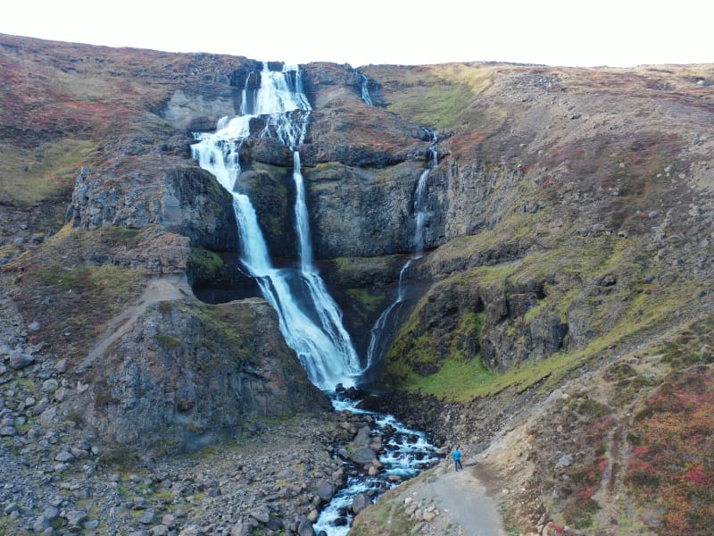
Stuðlagil hike
Driving north on Highway 1 from Egilsstaðir, leading you through Jökuldalur, take the exit down route 923, just beyond Skjöldólfsstaðir. Turn towards the Klaustursel farm after driving roughly 15 kms. By Klaustursel, you’ll find two parking lots, one by the bridge over Jökla (around 10 km hike to Stuðlagil canyon back and forth) and the other by Stuðlafoss waterfall (about 5 km hike to and from Stuðlagil canyon).
Stuðlafoss is a majestic waterfall surrounded by towering basalt columns. It truly is a sight, and you won’t find many like it in the world. Standing at the bottom of Stuðlagil canyon is another unique experience to check off your bucket list. Keep in mind when entering the canyon that the rocks might be wet and very slippery.
The nature surrounding Stuðlagil canyon is stunning but delicate. Visitors are encouraged to show respect for the area, wildlife and nature and leave it as they found it. From May 1st to June 10th, numerous pink-footed geese nest in the area and, therefore, crucial that guests stay within the marked trails so as not to upset the birds. The area surrounding Stuðlagil canyon is agricultural, so it’s common to see farmers bringing their sheep down from the highlands right before winter hits, which can be an enjoyable experience.
In summertime, you can continue your drive through route 923 into the East Iceland Highlands (F-roads are generally only open from around mid-June for a few months, see more here). T here you can get on to The Highland Circle travel route, which will lead you to exciting places such as Kárahnjúkar dam, Laugarfell and down into Fljótsdalur. Note that parts of the way are only accessible for well-prepared 4x4 vehicles.
For further information, visit the official Stuðlagil website.
View