Austurland is a hikers' paradise. Hiking trails and marked routes of different difficulty levels can be found all over the region. Here are some ideas for hikers who want to experience Icelandic nature and surroundings but stay off the beaten track.
See our: Top 10 Hikes to Explore in Austurland in the Summer of 2026
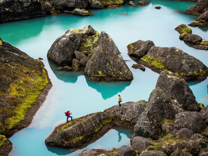
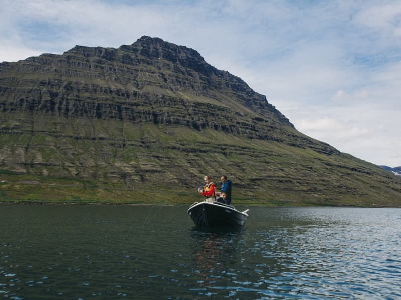
Stórurð
Stórurð boulders is one of Icelands most spectacular sights and has gained more popularity amongst hikers in recent years. The expansive surroundings offer plenty to see and experience; blue-green ponds contrast with flat, vegetated meadows surrounded by sheer-sloped and jagged tuff Dyrfjöll mountain peaks. As the name suggests, the area is strewn with many enormous boulders, likely abandoned by retreating glaciers.
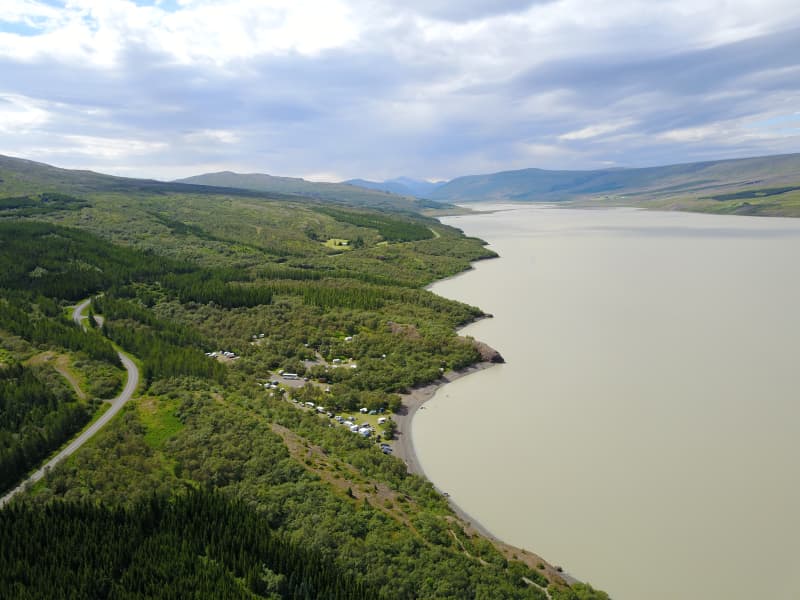
Five marked trails lead to and from Stórurð. Two from Vatnsskarð pass, one from Njarðvík and two from Borgarfjörður Eystri. Since Stórurð is located over 400 m above sea level, snow often lingers far into summer so best time for exploring this magnificent area is from mid-July to first appreciable snows of autumn. The hike back and forth takes about 4-5 hours so consider this a day tour.
View
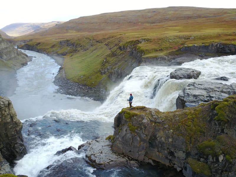
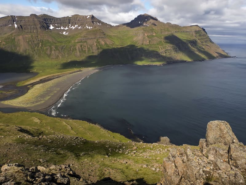
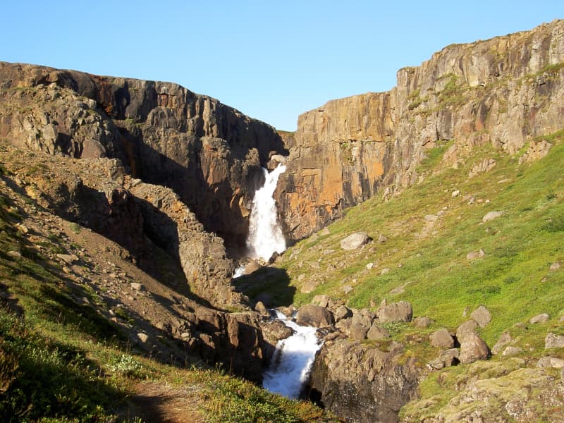
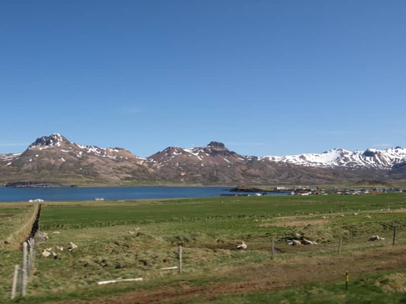
The Waterfall Circle
The Waterfall Circle is an 8 kilometers long hiking circle that starts and ends in Laugarfell. The trail takes you through a rugged and varied highland landscape and features five waterfalls, along with breathtaking views of Snæfell mountain and a dramatic canyon.
This beautiful hike is getting more and more popular among hikers and takes around 2–3 hours to complete, depending on conditions and pace. While it’s not overly difficult, there are a few steep and rocky sections, so sturdy footwear is recommended.
After the hike, you can soak your tired legs in Laugarfell’s natural hot spring. This trail is typically accessible from mid-June once snow has melted in the highlands.
GPX file of the track
Powered by Wikiloc
View
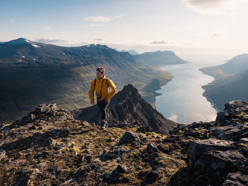
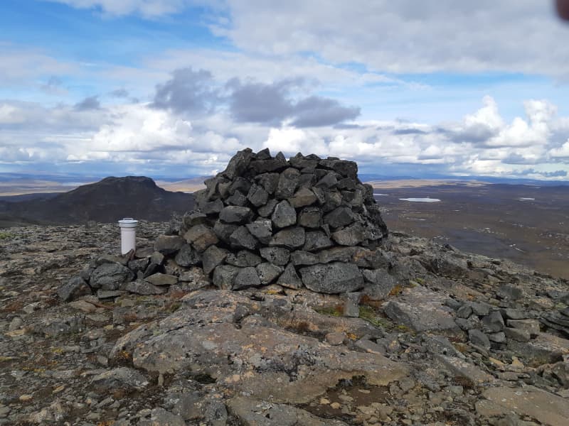
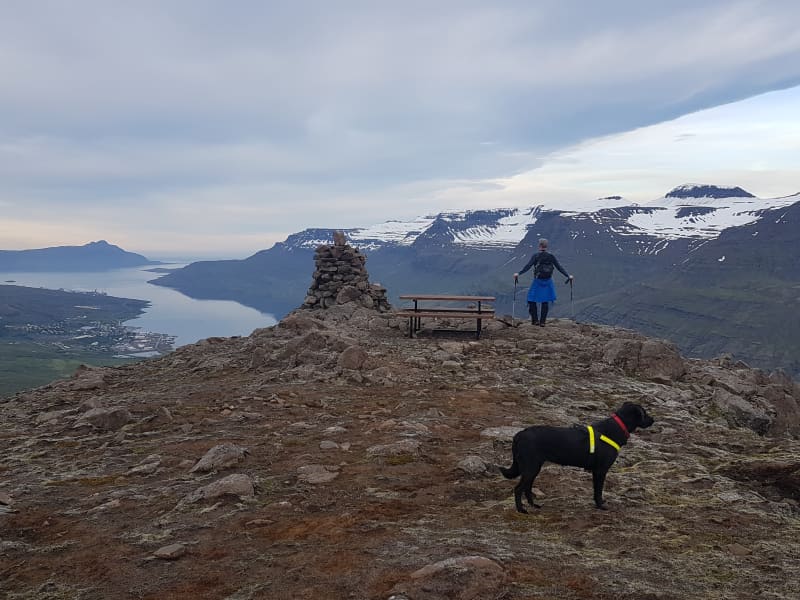
Bjólfur
Towering 1,085 meters over Seyðisfjörður, Mount Bjólfur offers one of the most rewarding panoramic views in Austurland. This 5.8 km one-way hike begins at the Stafdalur ski lodge and follows an old mountain track originally laid for fiber-optic cable installation. The route crosses the Stafdalsá river, passes a striking waterfall, and continues steadily up the ridge. The summit features a rock cairn and guestbook, but if you descend slightly beyond the top, you’ll reach a dramatic viewpoint directly above the fjord and the town below. This is a moderate out-and-back hike with around 645 meters of elevation gain, taking about 3 to 4 hours round trip. Snow can linger on the upper slopes, so it’s best done from late June onward.
Wikiloc | Bjólfur Trail
View
Víknaslóðir
Víknaslóðir trails, sometimes also referred to as Trails of the Inlets is a vast net of well-marked and versatile hiking routes reaching from the village in Borgarfjörður Eystri to Loðmundarfjörður. Locals have through the years marked out and maintained numerous trails, making the area a rightfully called hiker's Paradise. They also publish a high-quality hiking map and operate comfortable hiking lodges with facilities in Breiðavík, Húsavík and Loðmundarfjörður, deserted inlets and fjord, south of Borgarfjörður Eystri.
The mountains come in all shapes and sizes and the variety of colors is stunning; everything from the black sand beaches to the pinkish orange hues of the mountain ridges. The trails wind themselves between isolated coves and fjords over colorful hills and through green valleys all the way down to the coast. Abandoned houses and ruins of ancient farms leave their mark on the surroundings.
Travellers can easily spend a few days in the area exploring and taking in the breathtaking views. Tourism companies in Borgarfjörður Eystri offer hikers all kinds of services related to their journey, whether it be tour planning, guidance or transport.
View

Stapavík by Héraðsflói
Stapavík is an inlet that lies in a magnificent setting of steep cliffs and the open sea. From 1930-1945 Stapavík was a used as an unloading port for ships and is closely related to the commercial history of Borgarfjörður Eystri and Hérað. Remains of the facilities are very picturesque and the view from the inlet is beautiful on a sunny day.
A marked trail leads from the farmstead Unaós, following Selfljót river downstream to the rivermouth. Héraðssandur black sand beach opens to the North of the river with a view over Hellisheiði Eystri rhyolite mountain ridge. This is a about a two hour long (back and forth) family friendly hike. Travellers could also challenge themselves to a longer hike by crossing Gönguskarð mountain pass over to Njarðvík which adds a about two hours to the hike.
Powered by Wikiloc
View
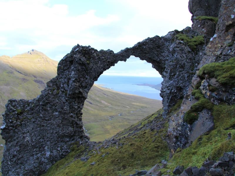
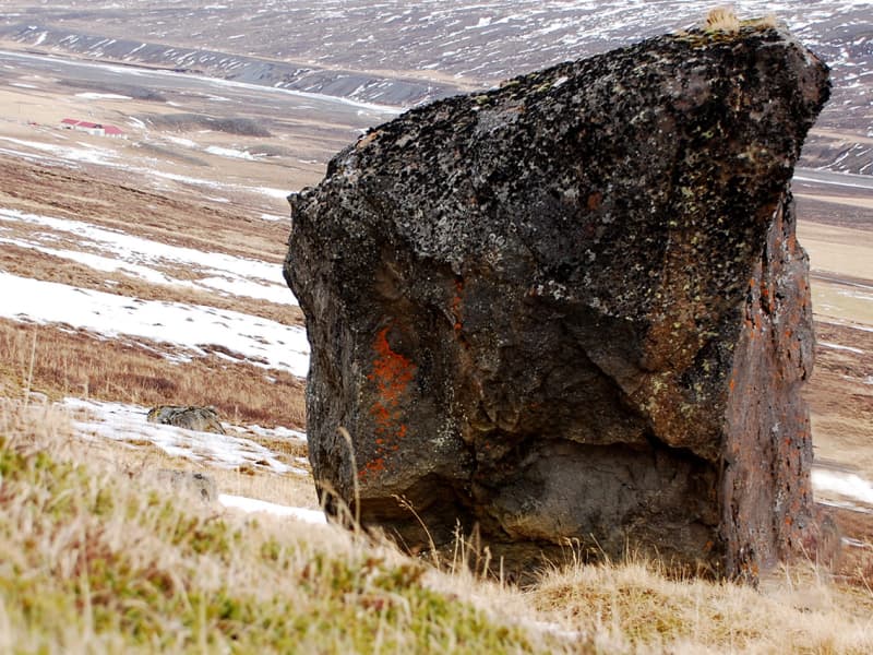
The Stone Arch in Jafnadalur
Tucked into the slopes of Mount Álftafell above the Jafnadalur valley, this natural stone arch is a hidden gem for hikers seeking a short but rewarding outing. Formed by centuries of erosion, the arch is a striking example of Iceland’s raw geological beauty. The trail begins in the village of Stöðvarfjörður and leads through the peaceful Jafnadalur valley. Along the way, you'll pass Einbúi, “The Hermit”, a solitary rock formation that rises dramatically from the valley floor. The path continues gently uphill toward the arch, offering views of the surrounding mountains and fjord. This hike is suitable for most walkers and typically takes around 2 to 3 hours round trip. The route is best enjoyed from late spring through early autumn, when the trail is clear and conditions are favourable.
View
Vöðlavík Hiking Trails
Vöðlavík, which is sometimes called Vaðlavík, is a deserted cove south of Gerpir, where there used to be several farms. A road leads to Vöðlavík from Eskifjörður, which is only open in the summer for four-wheel drive cars.
There are two marked hiking trails to Vöðlavík from Eskifjörður / Reyðarfjörður, one over Karlsskálastaður and on the other by Krossanes. From Vöðlavík there is a hiking trail to Sandvík. It is about a five-hour walk around Gerpisskarð, peaking at about 700 m.y.s.
From the cove and the heath, Vöðlavíkurheiði, two mountain peaks are the most prominent: Snæfugl and Hestshaus.
Disastrous maritime accidents have occurred at Vöðlavík in the past. For example, the ship Bergvík SU ran aground in Vöðlavík in December 1993. Many people still remember that in an attempt to get the ship afloat, the rescue ship Goðinn ran aground in the bay on January 10, 1994. One died at the wreck, but the Defense Forces' helicopter squadron at Keflavík Airport rescued other crew members. These events are discussed in the documentary Háski in Vöðlvík.
View
Fuglabjarganes
Fuglabjarganes is on the north side of Vopnafjörður’s coastline.
It is on Iceland’s nature conservatory list for its beautiful and diverse coast and abundant birdlife, making it a haven for nature enthusiasts and birdwatchers.
The hike begins near Road 913 and follows a 6 km circular footpath that takes you along the beach to the headland, where high buffs descend into the sea. Along the way, you'll see rock pillars rising from the ocean and enjoy panoramic views across the open sea. The terrain includes narrow sheep paths, grassy areas and small river crossings, which may be a little wet after rain.
This trail is best enjoyed from April to October when conditions are most favourable. Please exercise caution near the cliff and do not go too close the cliff edge.
View
Þerribjörg
Drive the main road up Hellisheiði mountain and when you’ve reached where you are about the highest part, take an off-road trail to the right from there until you’ve reached Kattárdalsdrög. The trail leads to Kattárdal valley. There is a sign where you can park your car and start walking. The trail is staked to the edge of the cliffs above Múlahöfn harbor. From there (65°45.144 - W14°21.964) lies a trail below the edge, down a rocky slope down to Múlahöfn, one of the natures’ masterpieces surrounded by cliffs and huge pillars of rock on two sides.
This harbor was declared an official trading harbor in 1890 but was only used once as such because of the complications when bringing the shipment further on land. From the harbor, walk north to the outer point. From there one can see Þerribjarg cliffs and Langisandur shore. The cylinder with the visitors’ log and a stamp is by the trail leading down to the beach. Hikers are encouraged to go down and walk along the sand under Þerribjarg before turning back.
Part of Hiking Treasures in Egilsstaðir Region
Powered by Wikiloc
View
Neskaupstaður Nature Reserve
Iceland´s first nature reserve.
The reserve, stretching from Stórilækur toward the ocean, became formally protected on November 29th, 1972, making Neskaupstaður Nature Reserve the first of its sort in Iceland. In fact, only a few towns in Iceland have access to such an ideal area for preservation at their very doorstep.
The scenery and view are magnificent, while flora, fauna, and geology are varied, creating a haven for recreation, observation, and instruction in the Icelandic countryside.
East of the peak Nípukollur (819m), the ridge slopes NE down to 609m. Lying along the entire eastern slope of Nípa, the protected area includes the shore and shallows into the sea. By the steep slope at the coastline, caves or hollows have been carved out by the ocean waves, of which Páskahellir cae is the largest one.
Plant diversity is abundant, with characteristic plants of East Iceland blooming along with rarer species. The cliffs are inhabited by Raven and Thrush, and in the coastal cliffs various sea birds nest, including Fulmars and Puffins. Eider Ducks live at the shore. And puddles left on the rocky coastline, as well as the wave-beaten seaside cliffs, are ideal for inspecting small marine creatures, such as crustaceans, snails and barnacles.
Statutory protection has two main aims. Firstly, to preserve the land and bio diversity as uninfluenced by man as possible, and secondly, to grant the public access to the rich and unspoiled Icelandic nature. To achieve these aims, visitors are kindly asked not to disturb in any way the vegetation or animal life of preserve.
More information about the Neskaupstaður Nature Reserve
View
Vestdalur
A walk to Vestdalur Nature Reserve, Vestdalur lake and the Mountain Lady cave.
The route was used to transport mail and trade in the old days between Seyðisfjörður and other towns in East Iceland. In 1880 – 1910 this was one of East Iceland’s most frequently used trails and still presents several pretty, piled-rock constructions, including cairns.
After several tiers of glorious waterfalls, you will arrive at a small lake, Vestdalsvatn, which remains frozen most of the year. There you will see Mt Bjólfur to your left. To the right you’ll find the tiny cave where the remains of the Mountain Lady were found in 2004. Around the Mountain Lady cave a group of workers found bones of a 30 year old lady, more than 400 pearls and brooches from the Viking era which have been identified as remains from the year 940.
View
Landsendi
Walk from the sign by the road no 917 towards Ker (before crossing the mountain road Hellisheiði) (N65°42.52- W14°24.41), and from there to Landsendahorn cliff. There one can enjoy a magnificent view of Móvíkur. Above them are 200–300 meters high cliffs and hanging rocky slopes called Móvíkurflug. The rock consists mostly of rhyolite of many colors but mostly yellowish, light brown or greenish grey. The cylinder with the visitors’ log and a stamp is on the banks above Ker.
Part of Hiking Treasures in Egilsstaðir Region
GPS : N65° 43.352-W14°23.300
Powered by Wikiloc
View
Fossastígur Hiking Trail
An easy and pleasant walk from the center of Seyðisfjörður town, by a walkway partly gravel, partly grassy through a forested area towards the vale Fjarðarsel where beautiful waterfalls and varied green growth await the wanderer. A visit to the oldest operational power plant in Iceland at Fjarðarsel (1913) is optional, provided that it is arranged beforehand. The plant marked a turning point in the history of Icelandic electrification. For the avid waterfall lover an added walk along the south side of Fjarðará river up to Neðri Stafur rock stratum, (300 m. alt.) is a must. Out of a total of 25 waterfalls, in river Fjarðará some of the most spectacular ones can be seen along the way. At Neðri Stafur rock stratum, the wanderer is presented with an exquisite view over Seyðisfjörður fjord and town, along with a fine selection of berries in late August. The scenic mountains, waterfalls, vegetation, and the history of the town is a wonderful blend that makes this walk unforgettable.
Fjarðará River & Fjarðarsel MuseumDuration: 2,5 and 4 hours / 2- 4 km.
Period: June - September
View
Bjargselsbotnar
Hiking trail starts by a sign near Hallormsstaðarskóli schoolhouse in Hallormsstaður woodland following a light green marked trail that passes through an area where half the mountain slid forward some 10.000 years ago. You’ll ascend up to Bjargselsbotnar, onwards to Bjarg and Þverbjarg to Illaskriða landslide. From there you follow the trail to the Leirtjarnarhryggur ridge.
Part of Hiking Treasures in Egilsstaðir Region
GPS : N65°05.465-W14°43.031
GPX file of the track
Powered by Wikiloc
View
Fardagafoss Hiking Trail
Fardagafoss waterfall is located near Egilsstaðir, at the base of Fjarðarheiði. It is one of three waterfalls on the Miðhúsaá; the others are called Gufufoss and Folaldafoss.
A marked hiking trail leads to the waterfall. The walk is generally easy, except for the final section, which can be a bit challenging to cross. The trail begins at a parking area along Road 93, near the rock known as Áningarsteinn.
Behind the waterfall there is a cave. According to local legend, a fearsome giantess once lived there. It is said that a tunnel runs beneath Fjarðarheiði to Gufufoss in the Fjarðará in Seyðisfjörður.
The giantess of Fardagafoss was said to possess a cauldron filled with gold. When she grew so old that she knew her death was near, she slid the cauldron down into a deep pothole in the middle of Gufufoss, further downstream along the Miðhúsaá River. Legend says that when the water level in the river is low, the handle of the cauldron can sometimes still be seen.
Powered by Wikiloc
View
Asknes Hiking Trail
Asknes in fjord Mjóifjörður houses the remains of a old whaling-station, which the Norwegians erected around year 1900. The factory was the largest of its kind in the world at that time. In its hayday there were 200 employees but today there are only around 40 people living in the entire Mjóifjörður region.
No road lies to Asknes, but it is accessible by foot from the road innermost in the fjord.
View
Eiríksstaðahneflar - hike
Hike starts by að sign on the bank of river Þverá south of Eiríksstaðir farm and continues on to Fremri Hnefill – mountain top (947 m). From there one can cross over to the top of Ytri Hnefill (922m) and down to Eiríksstaðir farm again. Travellers could challenge themselves to a longer hike by walking over to the ruins of the abandoned Hneflasel farm and then traverse back between the two mountains to Jökuldalur valley.
Part of Hiking Treasures in Egilsstaðir Region
GPS : N65°08.617-W15°28.195
View
Hólmatindur Hiking Trail
Hólmatindur, 985 meters high, is the pride of the people of Eskfjörður, and the beautiful peak stands on the east side of the fjord, facing the village. A challenging hiking trail leads to the mountain top, but hikers can sign a guest book at the top. Hólmatindur is one of the "Five Mountains in Fjarðabyggð " which is a project that school children invented and Ferðafélag Fjarðamanna implemented.
.
Powered by Wikiloc
View
Álfkonusteinn Hiking Trail
Above the farm Bustarfell in Vopnafjörður stands a large rock called Álfkonusteinn (Elf Stone). It is relatively easy to walk from Bustarfell to the rock, and an interesting legend related to the stone. It claims that a district magistrate’s wife at Bustarfell was once led in her dreams by an elf into the stone. There she came to the aid of an elf-woman in childbirth, who paid for the assistance with a beautiful gold-plated cloth. The cloth is neatly made, exotic and unique in this country, and is now owned by the National Museum of Iceland.
View

Hafrahvammagljufur
Hafrahvammagljúfur in Austurland is one of the largest and most magnificent gorges in Iceland. The gorge is about 200 meters from the bottom to the edge (where it is highest), and the canyon is about 8 kilometers long. There is a marked hiking trail along the gorge and down to Magnahellir. You need a four-wheel-drive car to drive to the trail's starting point, but you can see part of the gorge from Kárahjúkar dam, and you can get there by an average car.
View
Grænafell
The haven of Mt. Grænafell by Reyðarfjörður has served as the prime location for local outdoor activities for a number of years. At the top of the mountain, a beautiful lake awaits the visitor and a spectacular gorge carves the landscape beside the fell. A paradise of fine bushes at the foot of the mount completes the icing on the cake. The tiny forest is adorned by planted trees, brooklets and extensive rocks fragments from the cliff, reminiscent of dwellings from the land of fairy tales. The area has been made easily accessible by marked hiking trails.
View
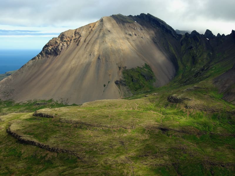
Sandfell
Sandfell is a distinctive 743m. high rhyolite mountain between Stöðvarfjörður and Fáskrúðsfjörður. The best approach is from the south side of Fáskrúðsfjörður. The trail leaves the coastal road between Víkurgerði and Vík farms and proceeds along the Víkurgerðisá River before cutting west for the peak. The scenery is excellent en route, with views of Fáskrúðsfjörður, Andey and Skrúður islands.
Powered by Wikiloc
View
Urðarhólar
A delightful short walk from Afrétt in the innermost part of Borgarfjörður Eystri takes the wanderer to Urðarhólar; idyllic scenery with hilly terrain and small ponds, rich birdlife, and colorful view of the mountaintops. The marked trail is 3 km. But should you wish to extend it, there is much to see!
View

Brúnavík
Brúnavík is a deserted inlet just south of Borgarfjörður Eystri, renowned for its serene surroundings. A hike back and forth from the parking lot at Hafnarhólmi marina across Brúnavíkurskarð pass (360 m) down to the ruins of the farm is approx. 12 km. Crossing at the mouth of the river is an absolute must to appreciate the colorful beach. The way back crosses the Brotagil ravine across the bridge to pass Hofstrandarskarð (320 m). The hike takes about 5-6 hours on a marked trail.
View