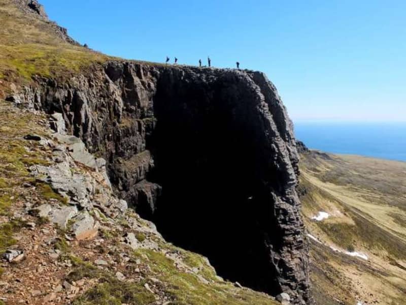
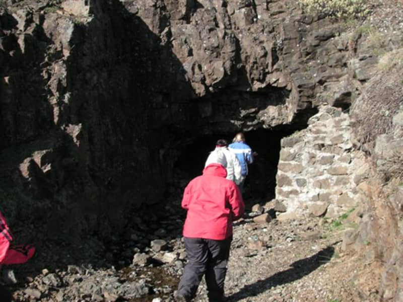
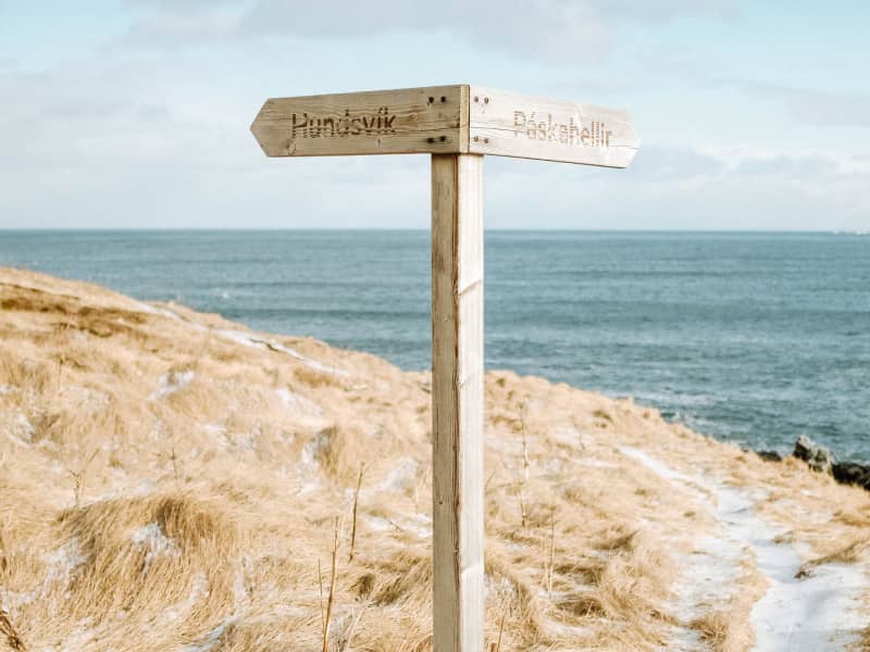
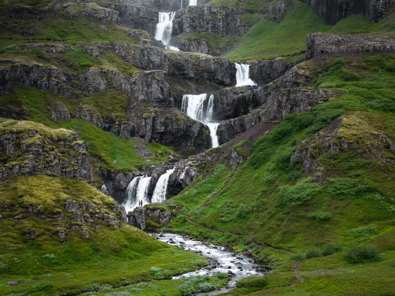
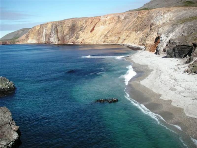
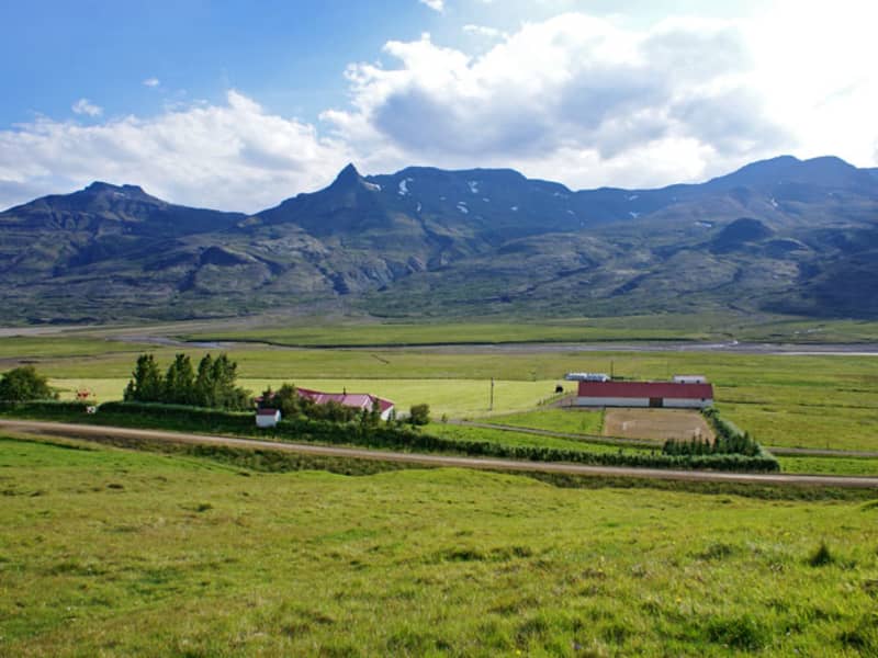
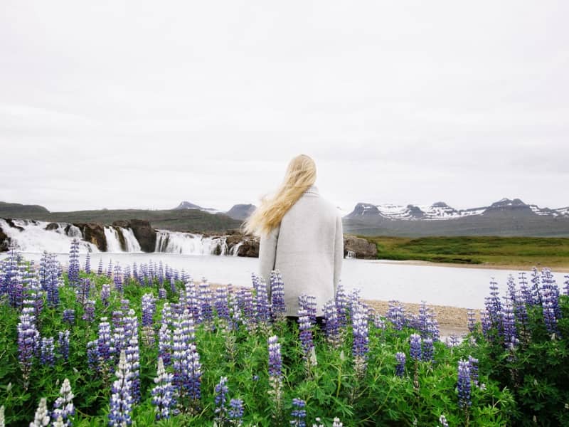
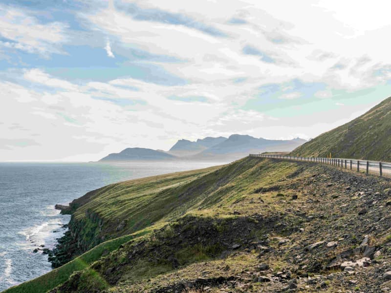
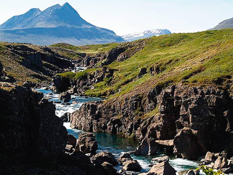
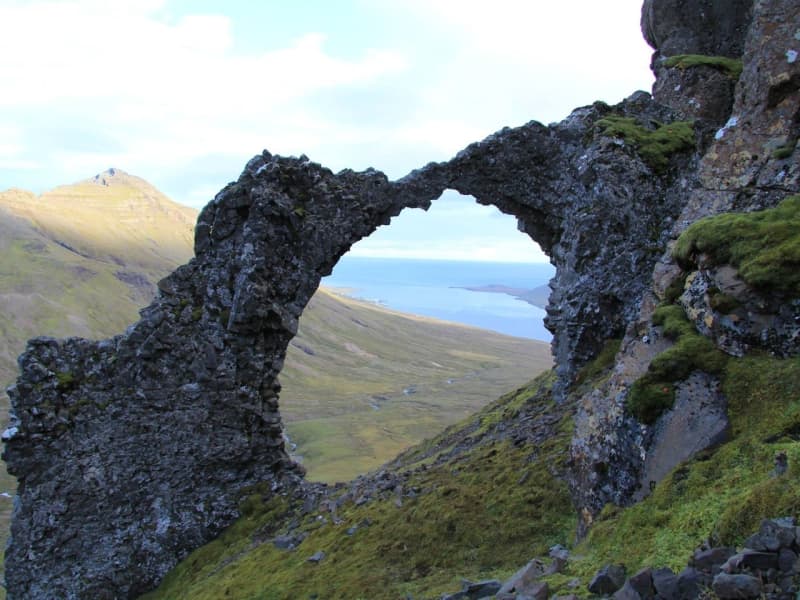
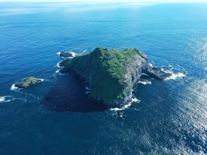
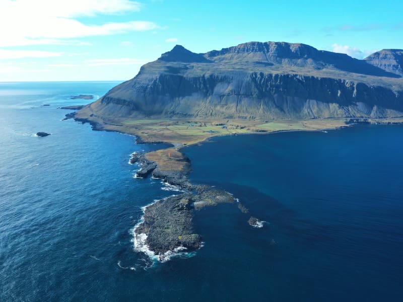
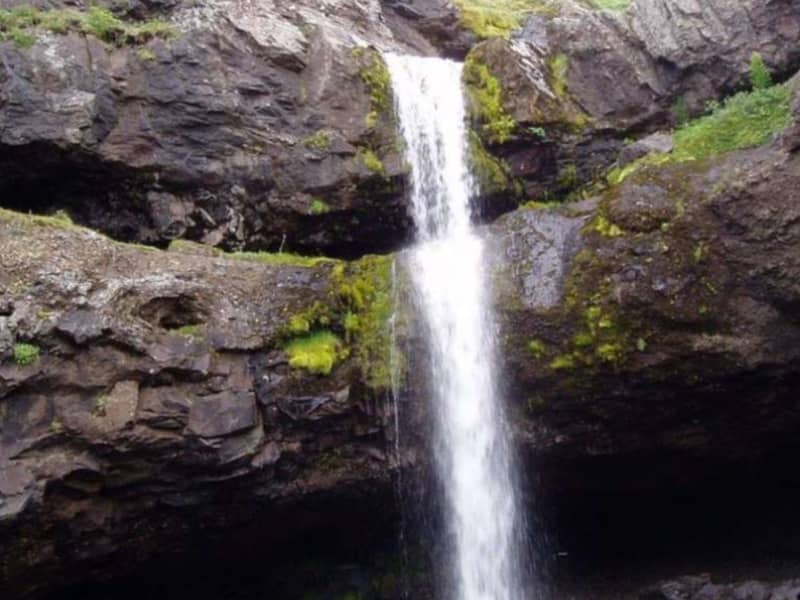
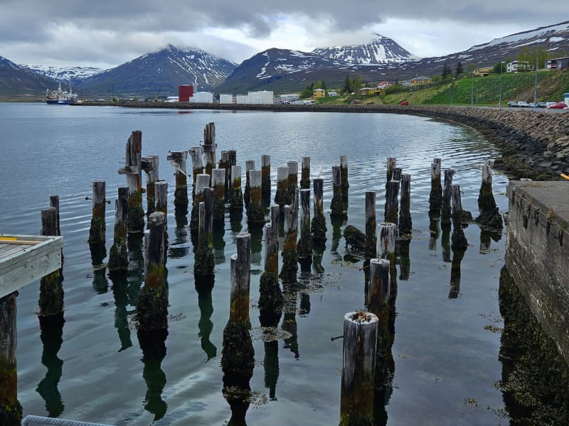
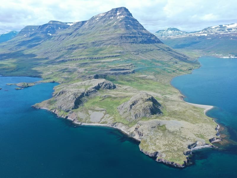
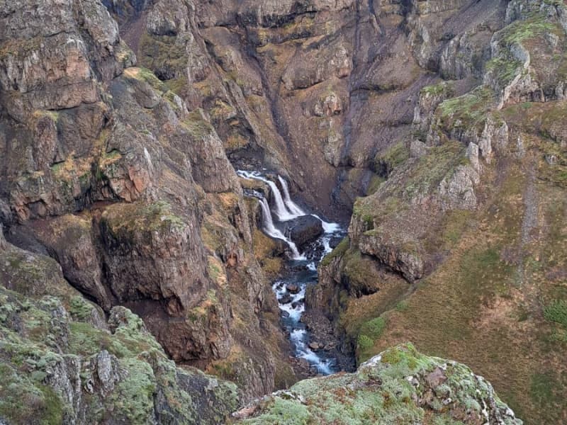
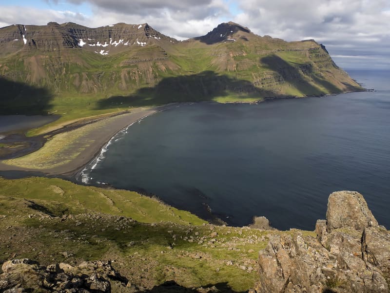
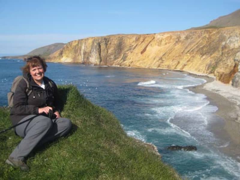
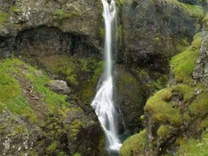
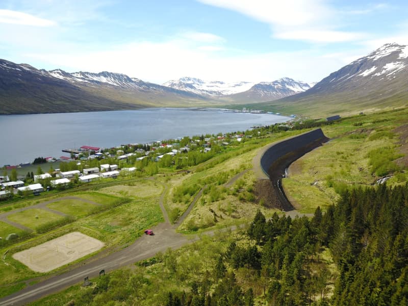
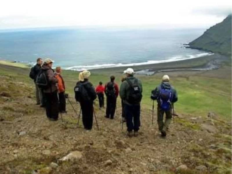
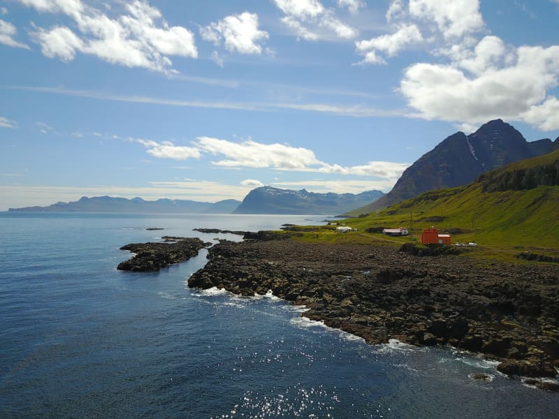
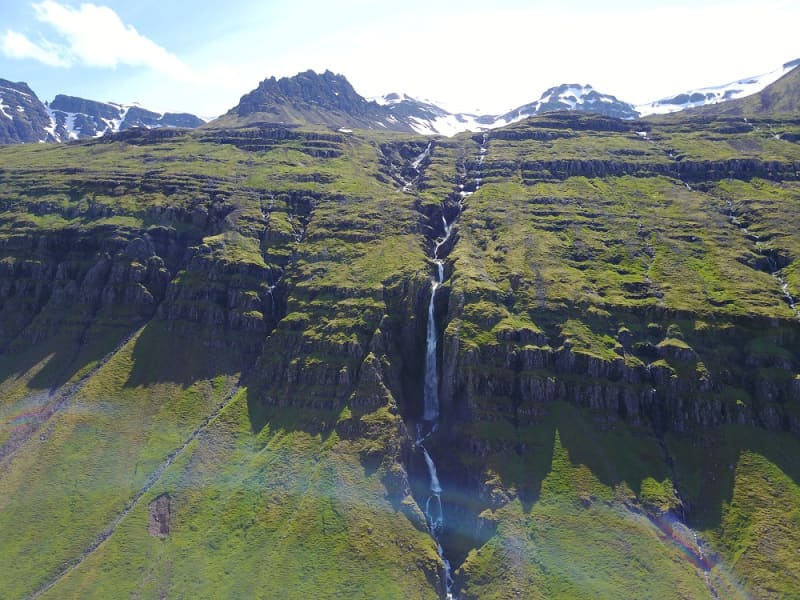
Skip to content

Or try searching by Category and/or Location

Destinations

Klifbrekkufossar
Klifbrekkufossar is a magnificent tier of waterfalls in Mjóifjörður. While descending the main road from Egilsstaðir the waterfalls can be spotted on the right-hand side.
Mjóeyri
Mjóeyri is a beautiful place outside the village in Eskifjörður. There is a lighthouse and a beach where it is fun to play.  Mjóeyri was the last execution site in Austurland, and there is an information board on the grave of the last man who was executed at Mjóeyri.  Today, Mjóeyri is a thriving tourism place where, among other things, you can get guidance around the area.
Flögufoss
Flögufoss is the highest waterfall in Breiðdalur valley, around 60 meters high. The waterfall is in the river Flöguá that runs through the Flöguskarð mountain pass. Just above Flögufoss is another small waterfall that falls to a ledge, from where the river runs under a small rock arch.  The hiking path leading to the waterfall is easy and short.
Búðará Canyon and Waterfall
A beautiful walking path from the center of Reyðarfjörður. Búðarárfoss can be found above Reyðarfjörður. The waterfall is full of water and falls down Búðarklettar. The river flows down through the center of the urban area of Reyðarfjörður. A pleasant footpath up the Búðarárgil, from the city center up the Búðará river. The route leads i.a. past the Icelandic Wartime Museum. The camp cliffs are very majestic as they are maintained, rock pigeons (Colombia livia) have their abode there, there is also a common raven (Corvus corax) and down in the moor there are quite a lot of stilts (Oenanathe oenanthe), mouse shrike (Troglodytes troglodytes) and snow tit (Plectrophenaxnivalis). Soon after, you come to Búarðarfoss and above it is the Reyðarfjörður Electricity Dam.  The Electricity supply was established with the joint effort of the towns people in 1930. Even higher is Svínadalur.
Gerpir
Gerpir is the easternmost cape of Iceland, steep and rugged, 661 meters high. It is believed that the oldest cliffs in Iceland, about 12 million years old, are found in Gerpir.  Gerpissvæðið is a true paradise for hikers. Ferðafélag Fjarðamanna has issued a hiking map of the area, which is available in information centers and shops in Fjarðabyggð.  Anyone interested in outdoor activities should visit the Gerpir area.  Powered by Wikiloc
Saxa
Just off the coast of farm Lönd in Stöðvarfjörður, there´s a singular rock formation called Saxa ("The Grinder). This is an impressive perforated cliff, penetrated ceaselessly by the swelling waves of the Atlantic, resulting in spectacular eruptive splashes which fling seaweed and algae, minced by the force of the ocean, high into the air.
Höskuldsstaðir
Höskuldsstaðir is a farmstead of distinction, located in the south branch of valley Breiðdalur, close to highway no. one. A post office up to 1947 and a relay for the postmen on their way across Berufjöður pass. Höskuldsstaðir was the birthplace of the venerated scholar Dr. Stefán Einarsson, former professor at the John Hopkins University of Baltimore. Einarsson is remembered for his literary achievements as well as for his research in the sphere of the Icelandic language.
Beljandi
In Breiðdalsá, close to the farm Brekkuborg in Breiðdalur valley, is the Beljandi waterfall. In fact, there are two waterfalls; Ytri Beljandi and Innri Beljandi, and eponymous pools. The waterfalls are not very high, but they are beutiful and well worth the short hike from the road through Breiðdalsvík. The whole area is extremely beautiful and suitable for outdoor activities.
Aldamótaskógur at Tinna
In the summer 2000, a project was started in Iceland to celebrate the turn of the century and the 70th anniversary of Iceland Forestry Society. Five Millennium Forests (Aldamótaskógur) were planted in Iceland; one tree for each living Icelander.  The plants, representing the inhabitants of Austurland, where planted by Tinnudalsá river (Tinna), at Eydalir. A few decades before, some trees had been planted in that same area turning it into a great outdoor recreational area. A beautiful marked hiking trail runs through the forest, along Tinna. 
Heydalir (Eydalir)
There has been a vicarage at Heydalir since early Christianity in Iceland and several renowned vicars have served there through the ages. Among them was the vicar and hymn poet Einar Sigurðsson (17th century) whose poetry is still venerated among the nation. A pillar stone has been erected in his memory at Heydalir. The church that now stands in Heydalir was hallowed July 13th in 1975 and the old church was unchurched that same day. The old church was built in 1856 but it burned to the ground on June 17th, 1982. The name of the place is somewhat erratic; some people talk say Haydalir and Heydalir is mentioned in some of Iceland’s old Sagas. Others talk about Eydalir, especially older locals, and the vicar Einar Sigurðsson is associated with Eydalir. In the church´s record book, which has been in use since 1909, both names are used equally. Today the official name of this place is Heydalir. 
Kambanes
Between Breiðdalur valley and Stöðvarfjörður there are three steep lines emanating from the mountain Súlur. Peninsula Kambanes is an ideal area for outdoor activities of any kind.
Breiðdalseldstöð
Breiðdalur central volcano is an ancient volanic area above Breiðdalur valley and Berufjörður. It was the object of extensive research carried out by the English geologist George D.L. Walker who made East-Iceland teritary volocanologic phenomenons the main object of his professional work. The Breiðdalur area of volcanism is set with rhyolithic-inserts producing the mainstay of majestic mountain range searating Breiðdalur and Berufjörður, e.g. Mt. Flögutindur, Mt. Smátindar, Mt. Röndólfur, Mt. Slöttur and Mt. Stöng. The southern side of the volanic formation is highly colorful and the instrusions assume an irregular aspect, set with tephra-layers. The site of the central volcano extends between Mt. Fossárfjall, south of Berufjörður to Mt. Bæjartindur, which towers above farm Þorgrímsstaðir in Breiðdalur. The western slope runs along Mt. Ófærunafir towards the west, whereas the eastern side - although highly eroded - extends east of Mt. Kerlingartindur, S-Breiðdalur. The southern region of Breiðdalur - the very centre of area - forms a basin where the excruciating heat has transformed the rock to such an extent that the basalt and the andestite have turned pale-green, making it problematic to tell them apart from the rhyolite. This can be clearly detected at river Innri-Ljósá Blágil ravine. The beforementioned chain of mountains was formed at a later date as the rhyolite wielded its way to the surface through the basalt layers, forming insertions on top of the massive tephra layers along the edges of the crater. Their remnants are visible in rhyolithic-rocks throughout the Breiðdalur region. This central volcano is considered to be of later date than its Álfta- and Reyðarfjörður counterparts. The Reyðarfjörður ignimbrite, a pyroclastic flow made as a burning hot mixture of about 430 km2 with a diameter of about 6 m. thickness. This layer is linked the Mt. Skessa south of Reyðarfjörður, best known as the Skessulag. The immense volcanism of the area has resulted in a great variety of rare minerals and semi-precious stones on display at Petra´s wonderful stone collection in Stöðvarfjörður and the Breiðdalur miniral museum in Breiðdalsvík.
Jórvíkurskógur
Jórvíkurskógur is an attractive Icelandic woodland. It has all that the local people disire: Green growth and plants with berries and mushrooms. The trees are tall enough to form a wind-shelter, there ar enice hiking trails and lovely brooklets with pure water flowing briskly, old farmhouse, and green lawns. This is an ideal spot for resting peacefully and enjoy life.
Meleyri
Meleyri is a charming shoreline near Breiðdalsvík. This is an outdoor area, a colorful birdlife arena and popular among locals and tourists alike. The locals use this area a lot, especially during winter because snow des not stick to the sand. 
Streitishvarf
Streitishvarf is a great outdoor area, suitable for the whole family. A beautiful, short hiking trail offers a brilliant insight to the geological history of Austurland, especially the dikes that are characteristic for the area. Although the hiking trail is short, it is a great place to stop for a few hours; to play and enjoy the nature. A lighthouse was first built at Streitishvarf in 1922 and it operated until 1958, when it was removed due to the building of a new lighthouse in Breiðdalsvík. the Streitisviti lighthouse operating today was built in 1984.
Streitisviti
A lighthouse was first built at Streitishvarf in 1922 and it operated until 1958, when it was removed due to the building of a new lighthouse in Breiðdalsvík. The Streitisviti lighthouse operating today was built in 1984.  Streitishvarf is a great outdoor area, suitable for the whole family. A beautiful, short hiking trail offers a brilliant insight to the geological history of Austurland, especially the dikes that are characteristic for the area. Although the hiking trail is short, it is a great place to stop for a few hours; to play and enjoy the nature. 
The Stone Arch in Jafnadalur
Naturally carved into the stone  In the slope of mt. Álfafell, there is an exceptionally beautiful rock arch. A real charmer for any walker. Taking the walk from Stöðvarfjörður town, Einbúi, the hermit rock formation is on the way to the arch.  Álftafell is at the end of Jafnadalur valley.   
Einbúi
Jafnadalur is a valley in Stöðvarfjördur facing northward. At the core of the vale, there is Einbúinn - "The Hermit"- , a voluminous and solitary rock in otherwise flat surroundings. The Jafnadalur also boasts a 6 m. stonearch, located to the east of Mt. Álftafell. A walking trail connects Jafnadalur and fjord Fáskrúðsfjörður. These are agreeable surroundings and well-suited for short or extensive hikes.   Powered by Wikiloc
Stórakerald and Tyrkjaurð
Historical mountain sites. Steðji is the name of the mountain that stands tall behind Stöðvarfjörður town. On the side of this characteristic mountain is Stórakerald, which is an unusually large ravine. Besides being an old route landmark, there are old tales of the residents in Stöðvarfjörður seeking refuge in Stórakerald and defending themselves by throwing stones at Turkish pirates, who made a foray in Iceland in the early 1700s. This tactic paid off, running the Turks out of Stöðvarfjörður and giving the rocky area in front of the ravine the symbolic name of Tyrkjaurð, or the Turkish scree.
The French Graveyard - le cimetiere francais
Just outside the Fáskrúðsfjörður town is a monument with the names of 49 French and Belgian sailors who died in Iceland. In 2009, representatives from the Association of Fishermen of Gravelines arrived at the French Days town festival and delivered new crosses for the graves of the French fishermen. Gravelines is an old fishing town on the north coast of France and the sister town of Fáskrúðsfjörður. During the French Days town festival, two wreaths of flowers are laid at the monument in the French graveyard in memory of the Icelandic and French sailors who have died at sea.
Hafnarnesviti
Hafnarnesviti lighthouse is not the biggest one but is well worth the hike to get there. There was a small settlement on Hafranes. At some point, 100 people lived there, but most moved away early 20th century, and by 1970, it was completely abandoned. In 1939, the French Hospital was exported to Hafnarnes, and it stood there for about 70 years. The extensive building now forms the core of the French house cluster in Fáskrúðsfjörður.
Kolfreyjustaður
The vicarage Kolfreyjustaður in Fáskrúðsfjörður dates back to the year 1878 many old and beautiful artifacts are there to be seen. The place swarms with stories and legends.  The troll Kolfreyja lends her name to the site and her fellow troll lived on the island of Skrúður.  
Sandfell
Sandfell is a distinctive 743m. high rhyolite mountain between Stöðvarfjörður and Fáskrúðsfjörður. The best approach is from the south side of Fáskrúðsfjörður. The trail leaves the coastal road between Víkurgerði and Vík farms and proceeds along the Víkurgerðisá River before cutting west for the peak. The scenery is excellent en route, with views of Fáskrúðsfjörður, Andey and Skrúður islands. Powered by Wikiloc
Skrúður
Skrúður is an island in Fáskrúðsfjörður. It is surrounded by high cliffs and is accessible only to the bold and brave. There is a sizable cave on the island, which sailors occasionally used as a shelter when making their way southwards. Legends say three giant brothers were living in Austurland. One made his home in Skrúður, the second in Streitishvarf, and the third on Papey. The Skrúður dweller abducted his wife from the on-shore vicarage of Kolfreyjustaður; she was the local priest´s young daughter. Legends relating to their insular existence lived among the sailors who visited the island.  
Vattarnes
The Vattarnes peninsula is part of a beautiful coastline between Reyðarfjörður and Fáskrúðsfjörður. Vattarnesviti lighthouse is located on Vattarnes. It used to be part of the official way between those two towns, which are now connected by a tunnel. On a good day, choosing the longer way is well worth it.
Vattarnesviti
Vattarnesiviti lighthouse is located on Vattarnes. There has been a lighthouse at Vattarnes since 1912 but the one standing today was built in 1957.  The Vattarnes peninsula is part of a beautiful coastline between Reyðarfjörður and Fáskrúðsfjörður. 
Gilsárfoss
A pleasant hiking trail leads from Vattarnesvegur, on the east side of the urban area on Fáskrúðsfjörður, up along Gilsá. There are numerous beautiful waterfalls on the way and you can walk behind one of them. That waterfall is called Gilsárfoss.  It takes about 15 minutes to walk to the waterfall from the road. Powered by Wikiloc
Barkurinn - The Barque
At around 30 km in length, Reyðarfjörður is the longest of the East Icelandic fjords, and is almost 6 km wide. From it´s mouth, the fjord initially lies towards the northwest, then turnes west so as to shelter it´s inner areas from ocean swells. In many places below the shore there are aalso sharp drop-offs which make harbour conditions especially favourable. The area where the barque (barkurinn) is located is named Bakkagerðiseyri (eyri = gravel flats deposited by the stream running from the slopes above). The group of houses first built here gradually grew into the village of Búðareyri, through nowadays this village is usually just named after the fjord. Two Norwegian brothers, Otto and Fredrik Wathne, moved to Iceland near the end of the 19th century and built up trading and fishing operations which contributed to the growth of the village. The sunken Barque In 1884, the Wathne brothers had part of a barque sunk below Bakkagerðiseyri so that a wharf could be fastened to it which has ever since been known as Barkurinn. The Wathne´s soon added a warehouse, salting shed and even a store and residence on the low gravelly area, continuing business here until nearly 1905. However, nothing remains of all this apart from Barkurinn, and even it has been restored. The original barque can still be seen below the wharf when the sea is calm at low tide. By 1907, a road was opened over Fagridalur pass, and Barkurinn became one of the main shipping points for imports and exports from Fljótsdalshérað and Reyðarfjörður. For many years, a regional cooperative operated a considerable business at Reyðarfjörður, including at Bakkagerðiseyri. Activities were increased by the foreign occupation during World War II, with the military forces attempting to blast away the sunken barque, but giving up and rebuilding Barkurinn under the same name. Restoration of Barkurinn The condition Barkurinn was in before restoration began in 2010 - a once impressie structure that had seen better times. In 2010, the Fjarðabyggð Harbour Fund restored Barkurinn, re-building it partly above the barque, which can still be viewed on the sea floor below. The new wharf is solely meant for peasure - a site where residents and visitors can fish, read about the warf´s history and enjoy the scenery. What is a Barque? The large sailing ships called barques normally had three masts, which from the rear were the mizzenmast, mainmast and foremast. Historically, barques transported goods to and from Iceland, and once old and dilapidated were often considered handy as a base support for harbour structures. This involved sinking the barque to the bottom and fastening a wharf to it for the fishing industry and various other vessels.
Búðará
Búðará flows right through Reyðarfjörður town. In the center of the town, you will find the start of a beautiful hiking trail that runs along the river through the forested riverbank of Búðará. When you come to the War Museum, you can choose whether to walk along with a wooded lookout point along the ridge east of the War Museum or up to Búðarárfoss waterfall.
Grænafell
The haven of Mt. Grænafell by Reyðarfjörður has served as the prime location for local outdoor activities for a number of years. At the top of the mountain, a beautiful lake awaits the visitor and a spectacular gorge carves the landscape beside the fell. A paradise of fine bushes at the foot of the mount completes the icing on the cake. The tiny forest is adorned by planted trees,  brooklets and extensive rocks fragments from the cliff, reminiscent of dwellings from the land of fairy tales. The area has been made easily accessible by marked hiking trails.
Hólmanes
Between Reyðarfjörður and Eskifjörður you can visit the Nature reserve Hólmanes. This is an ideal place to enjoy a good walk either down to the sea or up the hills. Birds and remarkable rock formations can be enjoyed in Hólmanes. With luck, you could stumble upon a herd of reindeers. Powered by Wikiloc
Geithúsaárgil ravine
Geithúsárgil is a ravine that runs down from the mouth of Sléttudalur under the roots of Grænafell in Reyðarfjörður. The river that flows down the gorge is called Geithúsaá and joins Norðurá when it comes down to the fjord. The gorge is magnificent and spectacular with criss-crossing hammer walls on each side and has been shaped by the Geithúsaá river over the centuries. The river has thus shaped the gorge and still is, but gorges are said to be the characteristics of "young waterfalls".  
Helgustaðanáma Hiking Trail
The Iceland spar mine in Helgustaðaland can be found on the way from Eskifjörður to Vöðlavík, and a footpath leads to it. Helgustaðanáma is an old Iceland spar mine in the land of Helgustaðir in Eskifjörður, which was protected as a natural monument in 1975. Helgustaðanáma is one of the most famous spar mines in the world, where spar was excavated from the ground from the 17th century until the first half of the 20th century. Most of the Iceland spar in museums around the world comes from the mine at Helgustaðir, but some of the largest and purest specimens of spar in the world were found in Helgustaðanáma. Iceland spar is a particularly clear crystal of the rock calcite, but the rock played a vital role in developing various studies on the properties of light. Today the Iceland spar is protected, and it is strictly forbidden to remove it from Helgustaðanáma.
Hólmatindur Hiking Trail
Hólmatindur, 985 meters high, is the pride of the people of Eskfjörður, and the beautiful peak stands on the east side of the fjord, facing the village. A challenging hiking trail leads to the mountain top, but hikers can sign a guest book at the top. Hólmatindur is one of the "Five Mountains in Fjarðabyggð " which is a project that school children invented and Ferðafélag Fjarðamanna implemented.    . Powered by Wikiloc
Oddsskarð
It was not until 1949 that Norðfjörður first came into road contact with the neighboring settlements. The route was through Oddsskarð, one of the highest mountain roads in the country, which was usually difficult to navigate due to heavy snow. A tunnel was built under Oddsskarð in the years 1974-1977. The tunnel is 626 m long at 632 m above sea level. Close to the pass, you´ll find one of the best ski resorts in Iceland. In the wintertime, these delightful and versatile hills call out to skiers to come and enjoy. There are hills to fit the needs of all ages and different capacities. Here can you find more info: Oddsskarð 
Vöðlavík Hiking Trails
Vöðlavík, which is sometimes called Vaðlavík, is a deserted cove south of Gerpir, where there used to be several farms. A road leads to Vöðlavík from Eskifjörður, which is only open in the summer for four-wheel drive cars. There are two marked hiking trails to Vöðlavík from Eskifjörður / Reyðarfjörður, one over Karlsskálastaður and on the other by Krossanes. From Vöðlavík there is a hiking trail to Sandvík. It is about a five-hour walk around Gerpisskarð, peaking at about 700 m.y.s. From the cove and the heath, Vöðlavíkurheiði, two mountain peaks are the most prominent: Snæfugl and Hestshaus. Disastrous maritime accidents have occurred at Vöðlavík in the past. For example, the ship Bergvík SU ran aground in Vöðlavík in December 1993. Many people still remember that in an attempt to get the ship afloat, the rescue ship Goðinn ran aground in the bay on January 10, 1994. One died at the wreck, but the Defense Forces' helicopter squadron at Keflavík Airport rescued other crew members. These events are discussed in the documentary Háski in Vöðlvík.
Völvuleiði
At the top of Hólmaháls, just above the road, is the grave mound of a Völva (prophetess) that has protected Reyðarfjörður and Eskifjörður from attacks from sea for centuries. Legend has it that Völva lived in Sómastaðir in the 17th century, and before she died, she asked to be buried where the best view of Reyðarfjörður was. She said that the fjords, Eskifjörður and Reyðarfjörður, would never be attacked from sea as long as her bones remained intact. Later, when the Turks came to the East Fjords, they intended to sail into Reyðarfjörður and plunder, but when they sailed to the mouth of the fjord, such a thick fog came towards them that they had to turn away.  The legend also says that as long as stones are regularly added to the grave, nothing terrible will happen in the fjords. 
Bleiksárfoss waterfall
Bleiksá and its waterfalls are the first thing that catches your eye when you turn off the main road into Eskifjörður. The highest waterfall in the series of Bleiksár waterfalls is called Bleiksárfoss. Floodlights have been directed up to Bleiksárfoss, and it is quite a spectacle to see it on dark winter evenings, whether it slides down the slope or is covered in ice.
Hólmanes
Between Reyðarfjörður and Eskifjörður you can visit the Nature reserve Hólmanes. This is an ideal place to enjoy a good walk either down to the sea or up the hills. Birds and remarkable rock formations can be enjoyed in Hólmanes. With luck, you could stumble upon a herd of reindeers. Powered by Wikiloc
Páskahellir Cave
Páskahellir is a small cave by the seaside of Neskaupstaður Nature Reserve, with pillow lava and rock tunnels. You can also find holes that were probably formed by prehistoric trees. A forest that used to grow here was most likely destroyed by lava around 12 million years ago. After that, erosion by the sea formed the cave itself. Legend has it that by visiting Páskahellir on Easter morning, you can see the sun dancing over the ocean waves when rising. The name Páskahellir can easily be seen as a result of this folklore. The walk from the entrance of the Nature Reserve to the site is about 10 to 15 min. Wooden stairs lead down from the walking path down to the cave, but please note that climbing down can be tricky and must be done with caution.
Rauðubjörg
These brightly colorful rhyolite cliffs rise over the seashore of Barðsnes peninsula, across the bay from Neskaupstaður. Residents of the fjord have long said that if the sun shines on them in the evening, there will be good weather the next day.
Hengifoss í Seldal
Norðfjörður's highest waterfall Hengifoss, is in the river Hengifossá, which flows from Oddsdalur valley into the valley Seldalur. The canyon is exceptionally pretty and lush.  
Viðfjörður
The beutiful wilderness at bay Norðfjarðarflói. Of the three fjords or main arms in Norðfjarðarflói bay, Viðfjörður is the most southern. The remaining two are Norðfjörður, the home to Neskaupstaður town, and Hellisfjörður. The Viðfjörður area is widely known for a beutiful walking trails, one lying along the shore from Viðfjörður to Stuðlar and Barðsnes (app. 3hrs walk). This path follows, for the most part, an old track. A bridge lies over the river Viðfjarðará. Viðfjörður was known in the 19th century as a ghostly place. Strange incidents were reported to happen, enkindling eerie stories on the viðfjörður phenomenons. A popular 20th-century Icelandic author, Þórbergur Þórðarson, described some of the ghostly goings-on at Viðfjörður decades ago in one of his books.
Neskaupstaður Nature Reserve
Iceland´s first nature reserve. The reserve, stretching from Stórilækur toward the ocean, became formally protected on November 29th, 1972, making Neskaupstaður Nature Reserve the first of its sort in Iceland. In fact, only a few towns in Iceland have access to such an ideal area for preservation at their very doorstep. The scenery and view are magnificent, while flora, fauna, and geology are varied, creating a haven for recreation, observation, and instruction in the Icelandic countryside. East of the peak Nípukollur (819m), the ridge slopes NE down to 609m. Lying along the entire eastern slope of Nípa, the protected area includes the shore and shallows into the sea. By the steep slope at the coastline, caves or hollows have been carved out by the ocean waves, of which Páskahellir cae is the largest one. Plant diversity is abundant, with characteristic plants of East Iceland blooming along with rarer species. The cliffs are inhabited by Raven and Thrush, and in the coastal cliffs various sea birds nest, including Fulmars and Puffins. Eider Ducks live at the shore. And puddles left on the rocky coastline, as well as the wave-beaten seaside cliffs, are ideal for inspecting small marine creatures, such as crustaceans, snails and barnacles. Statutory protection has two main aims. Firstly, to preserve the land and bio diversity as uninfluenced by man as possible, and secondly, to grant the public access to the rich and unspoiled Icelandic nature. To achieve these aims, visitors are kindly asked not to disturb in any way the vegetation or animal life of preserve. More information about the Neskaupstaður Nature Reserve 
Hellisfjörður
A charming, richly vegetated fjord, deserted and hidden behind the mountainous peninsula across the bay from Neskaupstaður. The ruins of a whaling station that operated early in the 20th century can still be seen here. Powered by Wikiloc
Avalance Defence Structures
A part of the great outdoors in Norðfjörður. Over the last several years, impressive structures have been built above the town of Neskaupstaður, in order to protect it from snow on the towering mountain slopes. Footpaths allow you to view these structures and you can even get on top of them to enjoy a stupendous panorama of the fjord. Currently two identical defence structures have been built, but in all there´ll be four structures along the mountain side. The remaining two sets are in early preperation stage.
Sandvík Bay
Once the easternmost settlement in Iceland. Though this inlet of the Gerpir cliffs is now abandoned, it once sheltered Iceland´s easternmost settlement, and is still home to the famous ghost Glæsir. He used to precede people who were from here wherever the went, and greeted everybody by taking off his head in a friendly manner. A marked path goes from Stuðlar til Sandvík Bay, through the Sandvíkursakð mountain pass. It´s an app. three hrs. route, going 500m above sea level. The view from the mountain pass is nothing less than stunning.
Asknes Hiking Trail
Asknes in fjord Mjóifjörður houses the remains of a old whaling-station, which the Norwegians erected around year 1900. The factory was the largest of its kind in the world at that time. In its hayday there were 200 employees but today there are only around 40 people living in the entire Mjóifjörður region. No road lies to Asknes, but it is accessible by foot from the road innermost in the fjord.
Dalatangaviti
At Dalatangi, there are two lighthouses. The older one was built by the fishing operator Ottó Wathne in 1895. He paid for the lighthouse construction, which is made of basalt with stone glue in between. The Danish Lighthouse Institute then provided lighting fixtures, a kerosene lamp, and a mirror to amplify the light. Following the construction, the National Treasury took over the operation of the lighthouse. The younger lighthouse was built in 1908 and is still in use. The road to Dalatangi lies from Mjóifjörður town. It is not possible to drive further east in Iceland. At Dalatangi, there is an excellent view to the north, to Glettingur and into Loðmundarfjörður and Seyðisfjörður. Dalatangi has a weather station, and a regular observations have been made there since 1938.
Dalatangi
The way out to Dalatangi lies along a narrow road that winds out of Mjóifjörður. Drive along with landslides and cliffs, past waterfalls and gorges. When Dalatangi appears, it is as if you are on an island inland. It is not possible to drive further east in Iceland. At Dalatangaviti, there is an excellent view to the north, all the way to Glettingur and into Loðmundarfjörður and Seyðisfjörður. The two lighthouses on Dalatangi have a remarkable history. The older one was built on the initiative of the Norwegian fishing operator and entrepreneur Otto Wathne in 1895. It is made of basalt stone with stone glue in between. The younger lighthouse, which is now in use, was built in 1908. At Dalatangi, there is a beautiful farm. By the farm, there is an ornamental garden and a greenhouse.
Prestagil
Prestagil is a small gorge innermost in Mjóifjörður, on the south side. A small but beautiful waterfall flows through the gorge, which derives its name from a legend about a giantess that lured two priests into the canyon. This is a gorgeous outdoor area.