Skip to content

Or try searching by Category and/or Location

Top destinations

Þverárgil canyon
A hiking path running along Þverá river in Þverá canyon in Vopnafjörður. The canyon is exceptionally beautiful as one can see colorful rock formations from an old volcano, contrasting the otherwise dark rocks of the Smjörfjöll mountains. There is rich birdlife in this area, especially Icelandic moorland birds. The views are magnificent over the Hofsá valley and out to sea. The hiking path is of medium difficulty, about two hours long and is a little bit upward.  The starting point of the walk is above the Þverá river on rd. 919.
Skjólfjörur black sand beach
Be sure to visit Skjólfjörur beach when driving through Vopnafjörður! The beach is only a short walk from the road and offers a magnificent view of the open Atlantic sea. If you’re lucky, you might even spot a whale. The beach has a rocky shore with colorful stones that capture the eye. Driftwood brought to land by the waves is a testament to the incredible force the sea possesses. Please respect the fact that it is forbidden to remove stones from the beach.  One characteristic of Vopnafjörður is the incredible rock pillars and cliffs that take on various forms, often resembling different creatures. Ljósastapi rock pillar stands out in the sea just off Skjólfjörur. It is often called Fíllinn or the Elephant by locals, as its form resembles an elephant. To the right of Ljósastapi, the mountain Búrið stands out from the mountain range. Búrið is a part of the Fagradalur mountains, an ancient volcanic area. In the Fagradalur mountains, you can see colorful rhyolite rocks that certainly make their mark on the surrounding environment. A marked walking path takes you down to Múlahöfn harbour and to Þerribjörg cliffs, east of Hellisheiði eystri, where the rhyoli te is at its most beautiful.
Kolbeinstangi Lighthouse
Kolbeinstangaviti Lighthouse is just under 20 meters tall and stands in a magnificent location in Leiðarhöfn, Vopnafjörður. The lighthouse was built in 1942 but was not put into use until two years later when the lighting equipment finally arrived from England. The lighthouse is coated with light quartz, and the dark surfaces are covered with obsidian gravel. Kolbeinstangaviti is the only lighthouse that has retained this appearance, meaning it has not been brushed with any sealant. There is a beautiful and easy walking path from the village along the gravel road to Leiðarhöfn and the lighthouse. The path offers a lovely view over the village and the fjord. An old mining road branching off the main road to Leiðarhöfn also makes for an enjoyable walk out to Kolbeinstangi.  The peninsula's tip offers stunning scenery ideal for outdoor activities and very popular among locals.
Sandvík in Vopnafjörður
Sandvík is a long, black sandy beach at the innermost part of the fjord. This is a family paradise created by nature. Visitors may find seashells, take a walk, watch the birds, build a sand castle - or follow their own imagination. Along this coast a supply ship ran aground on 2nd October 1981. All the crew were rescued. At low tide one can still see a glimpse of the wreckage. Access to Sandvík is by a track down to the bay from near the golf course.  Visitors are reminded to be careful along the beach. The river Hofsá may overrun its banks in the spring, and as a result quicksand can form along the beach.
Gljúfursárfoss
The Gljúfursárfoss waterfall, situated on the southern side of Vopnafjörður, runs down a colorful ravine just below the parking lot. The waterfall is about 45 meters high and very beautiful.   The river Gljúfursá used to be a major obstacle to travellers heading east over the mountain pass Hellisheiði eystri. Many accidents occurred when people tried to cross the river by foot or on horseback.   You can also walk along the river to the old bridge over Gljúfursá, built around 1900 and was a great improvement at the time. The story goes that construction began on the bridge after a man on horseback died while attempting to cross the river during winter.    A marked hiking path leads from the parking lot along the river Gljúfursá, and around Drangsnes.   
Bustarfell Museum
In Hofsárdalur in Vopnafjörður you will find the old family farm Bustarfell, a quaint, centuries old Icelandic turf house with red gables and a grass-grown roof which is now a museum. Bustarfell is one of the oldest and best preserved turf houses in Iceland. In 1532, the farm was bought by Árni Brandsson and his wife Úlfheiður and has been owned by their descendants ever since.  A visit to the museum at Bustarfell is a journey through the history of farming in Iceland and changes in lifestyle from the beginning of the 18th century to the mid-20th century. When walking through the museum, you feel as if the inhabitants have only just left the house. Three kitchens from different eras are showcased, as well as other artifacts from around the farm which show how technology has developed.    Hjáleigan Café is located next to the museum, and a hiking path leads to the rock Álfkonusteinn, source of a local folktale.  Opening hours: 10-17 every day from June 1st to August 31st.
Smjörfjöll
The mountain range between Vopnafjörður and Fljótsdalshérað is called Smjörfjöll (litterally stands for "Butter Mountains"), consisting of high and steep mountains, the highest ones around 1.250 meters high. North of Smjörfjöll is Hellisheiði eystri, where the old road from Vopnafjörður to Hérað lies. The road is amongst the highest mountain roads in Iceland, reaching 655 meters at its highest point.  Due to the elevation it has not been possible to keep the road open once snow firmly settled and now it is only open during the summer. The road may be steep and windy but it offers magnificent views over Vopnafjörður to the north and Héraðsflói to the East.
Álfkonusteinn Hiking Trail
Above the farm Bustarfell in Vopnafjörður stands a large rock called Álfkonusteinn (Elf Stone). It is relatively easy to walk from Bustarfell to the rock, and an interesting legend related to the stone. It claims that a district magistrate’s wife at Bustarfell was once led in her dreams by an elf into the stone. There she came to the aid of an elf-woman in childbirth, who paid for the assistance with a beautiful gold-plated cloth. The cloth is neatly made, exotic and unique in this country, and is now owned by the National Museum of Iceland.
Drangsnes
A hiking trail leads from the parking lot by Gljúfursárfoss through Drangsnes, to Krummsholt. At Krummsholt you can see ancient ruins dating back to Viking age. In fact, a Viking named Þorsteinn Uxafótur is said to have lived there. Looking at such ancient habitats leaves one wondering about the lives lived here centuries ago, wishing the earth could talk and tell us the stories of our ancestors. Walking along the precipitous cliffs is a great experience and leaves few visitors unmoved.  
Fuglabjarganes
Fuglabjarganes is on the north side of Vopnafjörður’s coastline.  It is on Iceland’s nature conservatory list for its beautiful and diverse coast and abundant birdlife, making it a haven for nature enthusiasts and birdwatchers.  The hike begins near Road 913 and follows a 6 km circular footpath that takes you along the beach to the headland, where high buffs descend into the sea. Along the way, you'll see rock pillars rising from the ocean and enjoy panoramic views across the open sea. The terrain includes narrow sheep paths, grassy areas and small river crossings, which may be a little wet after rain.  This trail is best enjoyed from April to October when conditions are most favourable. Please exercise caution near the cliff and do not go too close the cliff edge. 
Hofskirkja
The Hof vicarage has always been a major factor in the history of Vopnafjörður. It was home to some of the major characters of Vopnfirðinga Saga and they controlled one of two chieftainships in Vopnafjörður in the 10th century. The only ordained priest also serving as chief, ruled from Hof in the 12th century. A monument to the Vopnfirðinga Saga stands by the driveway to Hof.  It is believed that the first church at Hof was built shortly after the adoption of Christianity. The church currently in use was built in 1901, taking over from a turf church from medieval times. The church stands in Hofskirkjugarður cemetery, a beautiful garden offering pleasant views of Hofsárdalur valley. 
Hraunlína
An observation area offering nice views over the lagoons - Skógarlón and Nýpslón near Vopnafjörður. Lón is a nature reserve because of the great variety of animal and bird life. The lagoons are inhabited by over 40 microorganisms in addition to fish species and birds. The walk walk along the beaches of the Lón is beautiful, enjoying the the bird life in all its variety. At the observation point, just off Búðaröxl road, is an information sign for Vopnafjörður.
Ljósastapi
Be sure to visit Skjólfjörur beach when driving through Vopnafjordur! The beach is only a short walk from the road and offers a magnificent view of the open Atlantic sea. If you’re lucky you might even see a whale. The beach has a rocky shore, with colorful stones that capture the eye. Driftwood which the waves have brought to land is a testament to the incredible force the sea possesses. Please respect that it is forbidden to remove stones from the beach.  One characteristics of Vopnafjordur is the incredible rock pillars and cliffs that take on various forms, often resembling different creatures. Ljósastapi rock pillar stands out in the sea just off Skjólfjörur. It is often called “Fíllinn” (the Elephant by locals), as its form resembles an elephant. It is a vera photogenic place! To the right of Ljósastapi, the mountain Búrið stands out from the mountain range. Búrið is a part of the Fagradalur mountains, an ancient volcanic area. In the Fagradalur mountains, you can see colorful rhyolite rocks that certainly make their mark on the surrounding environment. A marked walking path takes you down to Múlahöfn harbour and to Þerribjarg cliffs, east of Hellisheiði Eystri, where the rhyolite is at its most beautiful.
Vopnfirðingasaga Monument
An archeological dig in 2006 revealed ruins from the time of Vopnfirðingasaga, not far from the present church at Hof. The saga is believed to have been written in the 13th century, taking place in 960-990. One of the main characters in Vopnfirðingasaga is Helgi Þorgilsson, whose nickname was Brodd-Helgi. He was raised at Hof and later became farmer and chieftain at Hof. As a young boy, Helgi fastened a piece of iron to a bull's head so it would win a struggle with another bull, and that is the source of Helgi's nickname. When still a teenager, Brodd-Helgi stepped in on the fight between the farmers Svartur and Skíði and judged Svartur guilty. Svartur fled up on Smjörvatnsheiði and Brodd-Helgi followed him and attacked him armed with shield and a flat stone which he had fastened in his breeches below the shield. He killed Svartur and was famous for this deed. Brodd-Helgi and Geitir from Krossavík were great friends since childhood. Brodd-Helgi married Geitir's sister, Halla, and their son Bjarni Brodd-Helgason was fostered at Krossavík. Their involvement in the fate and property of Hrafn Austmann, who spent the winter at Krossavík and disappeared at the winter games at Hagi, led to the cooling of their friendship. Brodd-Helgi divorced Halla, Geitir's sister, and married Þorgerður "silver" from Fljótsdalur. The disagreements of these former friends ended in full-blown enmity. The representatives of Geitir and Brodd-Helgi also disagreed and all worked toward the end of their friendship. Brodd-Helgi's unpopularity increased and was finally more than the farmers could bear. Geitir is said to have killed Brodd-Helgi at Sunnudalur. At the instigation of Þorgerður, Bjarni killed his foster-father and uncle, Geitir. But the saga was not over. Þorkell, Geitir's son, took his father's chieftainship and Bjarni Brodd-Helgason was chieftain at Hof. They had grown up together at Krossavík and were first cousins. Bjarni tried to make peace with Þorkell but failed, and Þorkell failed three times to avenge his father's death. The final battle was on a field at Eyvindarstaðir. Bjarni was victorious, later made peace with Þorkell and invited him to live at Hof as long as he lived. Thirty years of vengeance was over.
Tangasporður
Vopnafjörður town is located on Kolbeinstangi peninsula. The outmost part of Kolbeinstangi is called Tangasporður and is not inhabited. The landscape is characterised by unusual rock formations and white sand beaches. There are three small mountains on Tangasporður: Fagrafjall, Miðfell and Tafla. Enjoy a walk to Tangasporður, preferably by following a track that starts by the crossroads (rd. 85 and 917) above the town. This leads through a small grove and out to the tip of the peninsula. The birdlife is rich in this area, especially on the east side. Seals relaxing in the tidemark are a common sight on the beach at the tip of Tangasporður. It is also possible to start the walk by turning left off the road to the lighthouse on Kolbeinstangi. 
Virkisvík
Virkisvík cove is a beautiful place with colourful sediments, basalt formations and a waterfall that cascades over precipitous cliffs into the sea.  The oldest known rock formations, above the sea, in Iceland are in Austurland and Westfjords. They are about 15-16 million years old, from the Miocene Tertiary era.  The layers from that epoch are formed of lava flows with occasional sediment layers in between. Such layers, in thicker form, have long been research subjects, since they often include plant or animal remains which hold information about the climate when the layers formed. Two thick sediment layers can be found in Vopnafjörður. One in Virkisvík and the other at Bustarfell mountain. 
Vopnafjarðarkirkja
Vopnfjarðarkirkja church was built in 1903 and is now a historic building. Until that year, there was no church in the village, but there were churches at Refstaður and Hof (both in Hofsárdalur valley).  The altarpiece in Vopnafjarðarkirkja was painted by Jóhannes Kjarval and is called „Savior talks to the people.“ When bishop Jón Helgason visited the church he is supposed to have said that the people in the painting look like demons in hell. However, he supposedly added that they seemed to be listening closely to Christ nevertheless. 
Hellisheiði eystri
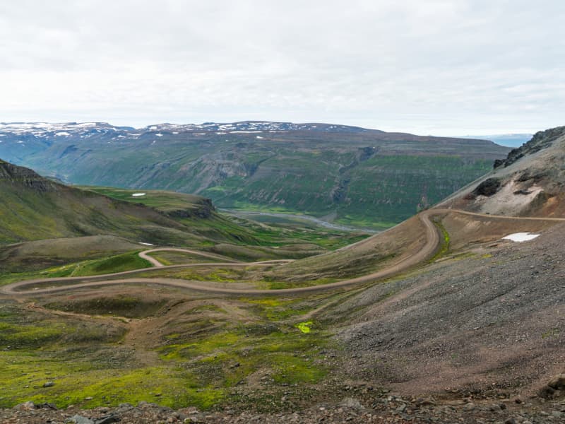
Hellisheiði eystri lies between Vopnafjörður and Fljótsdalshérað. When coming from Vopnafjörður, the route follows Hlíðarvegur (Road No. 917) around the bottom of the fjord and then along the southern coast of Vopnafjörður into Böðvarsdalur, a journey of about 20 km. From there, the road climbs steep slopes up to Hellisheiði, which spans about 14 km. When approaching from Fljótsdalshérað, you take a turn from Route 1 just north of the bridge over Jökulsá á Dal onto Road No. 917 and continue for about 33 km along Jökulsárhlíð until you reach Héraðsflói. Theroad then ascends the heath following Hellisá, forming part of the route On the Edge.   Crossing Hellisheiði is an adventure; the road is one of the steepest and highest mountain roads in Iceland, reaching up to about 665 meters. It is accessible to all vehicles in summer but is closed and not maintained during winter. Due to its high elevation, winter sets in early in autumn and spring arrives late. The vegetation on the heath reflects this, with plants like glacier buttercup and other alpine species, and the spring flowers often appear well into summer. Traffic on the heath is generally light, allowing travellers to enjoy the peace, natural beauty, and views at their leisure. On the Vopnafjörður side, just before reaching the Fagridalur slope, there is a hill called Fönn, where the snow rarely melts completely in summer. It is said that if the snow does fully melt, it predicts a very harsh winter.    
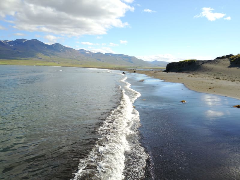
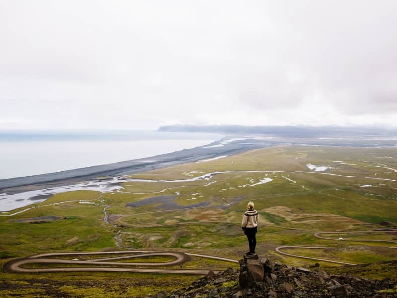
On a clear day, the view from the eastern edge of the heath is spectacular, stretching from the vast ocean to the extensive lowlands and mountains of Fljótsdalshérað. By the coast is Héraðssandur, a black sand beach often lined with surf between the mountains. Inland from there is a wide, flat, and lush lowland. Beyond the flatlands, a majestic mountain range separates Hérað from the fjords, with the impressive Dyrfjöll mountains particularly notable. Further inland, you can see the valleys of Fljótsdalshérað and the highlands. The rivers Jökulsá á Dal and Lagarfljót have shaped the flatlands with glacial deposits and sands, constantly changing their courses and creating islands, as reflected in the many place names.    
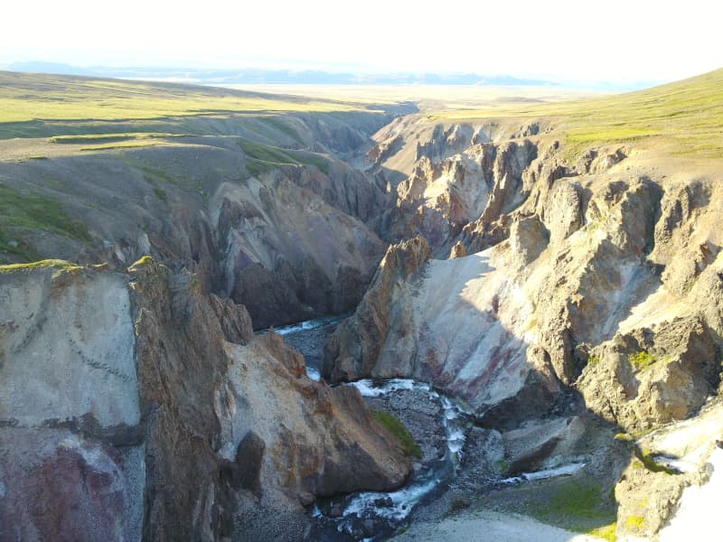
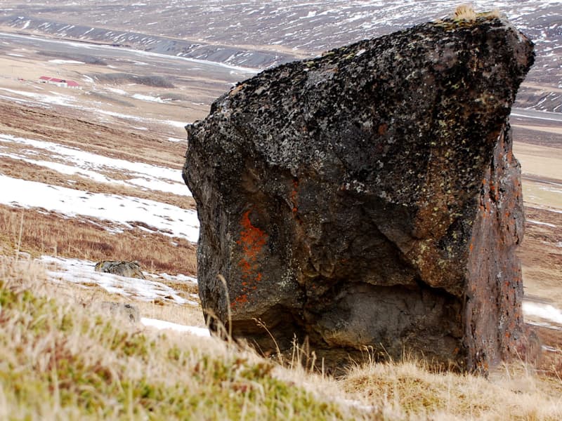
Kattárdalur and Fagridalur are significant valleys extending into the northern part of the cape between Vopnafjörður and Héraðsflói. Between them lies Dýjafjall, a bright green mountain covered in moss, easily visible from the road across the heath. Towards the tip of the cape is the centre of an ancient central volcano known as Fagradalseldstöð, which was active around 14.5 million years ago and is the oldest known central volcano in East Iceland. Only part of the volcano is visible above sea level, with the rest having been eroded and shaped by glaciers. The volcanic products are seen in various rock formations in the surrounding area, such as colourful rocks like light-coloured rhyolite. The road across Hellisheiði lies within the influence zone of this volcano, although the signs are more evident further out on the cape.    
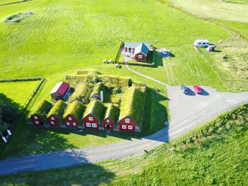
Fagridalur was long inhabited and considered a good resourceful farm with seals, driftwood, eider duck nesting, and fishing opportunities.A school also operated there. Fagridalur was abandoned in 1964.   Before motor roads, Hellisheiði was one of the routes between Fljótsdalshérað and Vopnafjörður. It was the trading route for residents of Jökulsárhlíð, who went to Vopnafjörður for commerce. There was also a postal route over Hellisheiði. In 1959, a trail was cleared over the heath. The route via Hellisheiði is about 40 km shorter than traveling via the main road through the Ring road (route 1) and route 85.   
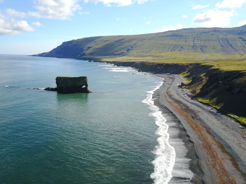
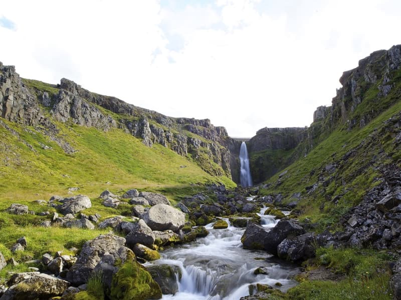
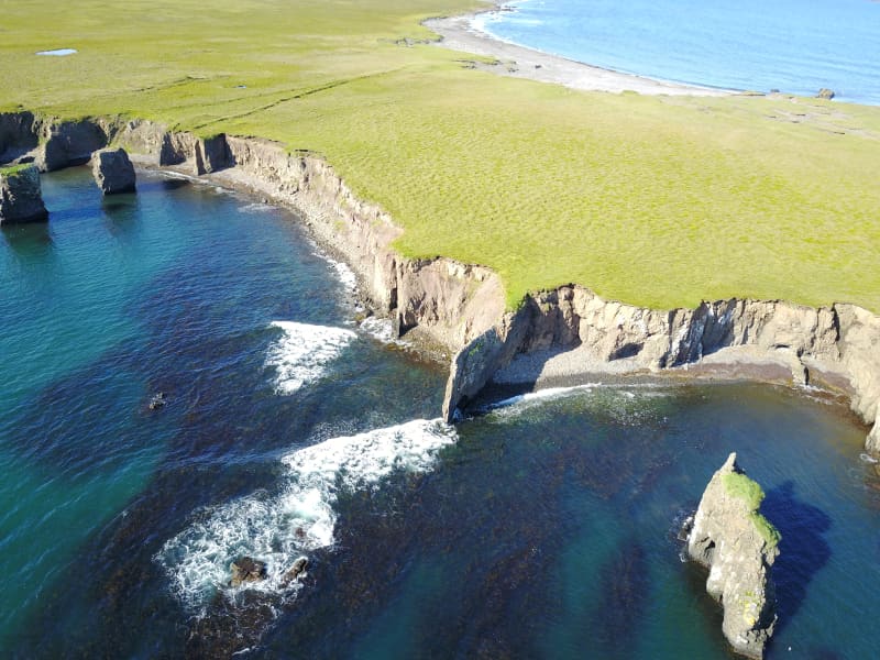
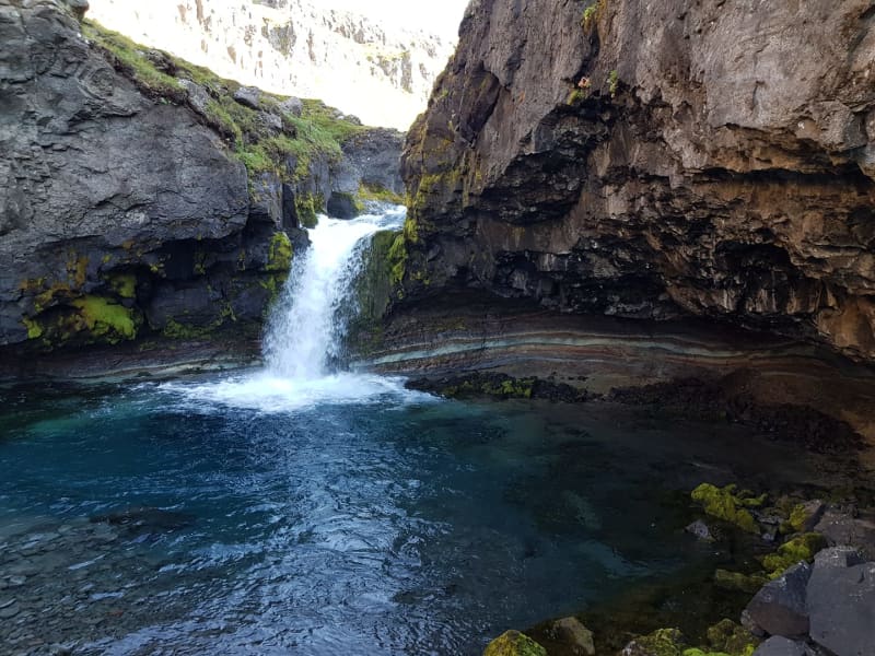
From Hellisheiði, there is a route to Þerribjarg and Múlahöfn. From the road over Hellisheiði a track leads northeast over Dýjafjall to Kattárdalur. This track is followed until a parking area and information sign in the Kattárdalur area. The hiking trail to Múlahöfn and Þerribjarg begins here. The trail is steep and quite challenging and should ideally only be attempted in good visibility. The trail is marked from the sign to the edge above Múlahöfn. From there, a sheep trail descends over a scree ridge to Múlahöfn. The harbor is a natural formation, surrounded by cliffs and stacks on two sides. Múlahöfn is a natural harbor, but it was difficult to transport goods from there to the settlements. From Múlahöfn, the trail continues along the shore northward to the outer point, where Þerribjarg is visible. Þerribjarg and its surroundings are a masterpiece of natural formations in the heart of the ancient Fagradalur volcano. Yellow, yellow-pink, and black cliffs with diverse formations, peaks, stacks, and scree extend from the heath's edge down to the shore above the green-blue sea. The view over Héraðsflói and out to the open sea is magnificent.   There are many interesting stopping points accessible right off Road No. 917 on either side of Hellisheiði, which are worth taking the time to explore. On the eastern side, there is a hiking trail leading to Landsendi (Lands End) just before the road turns up to Hellisheiði. On the Vopnafjörður side, there are Skjólfjörur and Ljósastapi just inside Böðvarsdalur, and further inland are Virkisvík, Gljúfursárfoss, and Drangsnes.