Skip to content

Or try searching by Category and/or Location

Stapavík by Héraðsflói
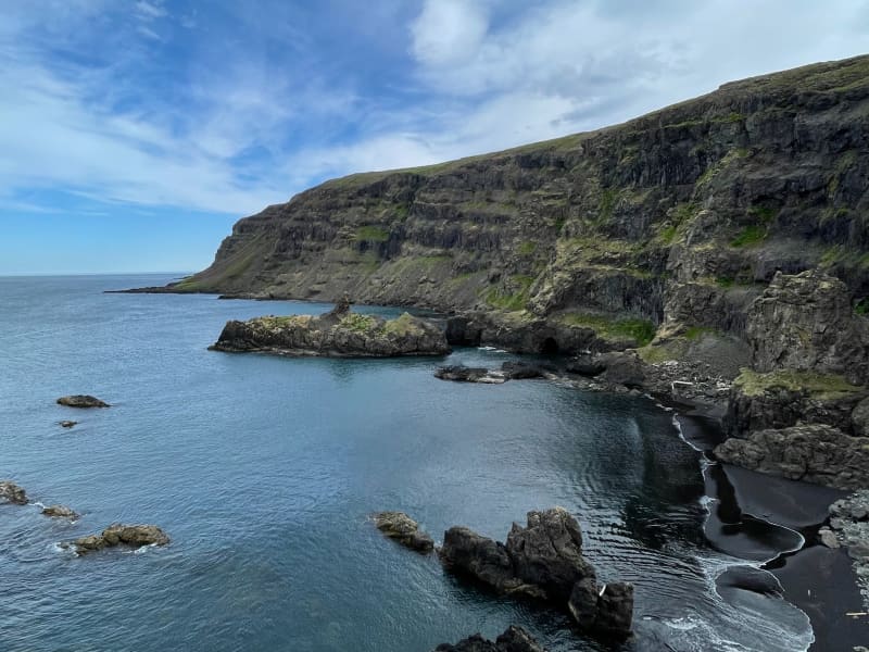
Stapavík is an inlet that lies in a magnificent setting of steep cliffs and the open sea. From 1930-1945 Stapavík was a used as an unloading port for ships and is closely related to the commercial history of Borgarfjörður Eystri and Hérað. Remains of the facilities are very picturesque and the view from the inlet is beautiful on a sunny day.  A marked trail leads from the farmstead Unaós, following Selfljót river downstream to the rivermouth. Héraðssandur black sand beach opens to the North of the river with a view over Hellisheiði Eystri rhyolite mountain ridge. This is a about a two hour long (back and forth) family friendly hike. Travellers could also challenge themselves to a longer hike by crossing Gönguskarð mountain pass over to Njarðvík which adds a about two hours to the hike. Powered by Wikiloc
Páskahellir Cave
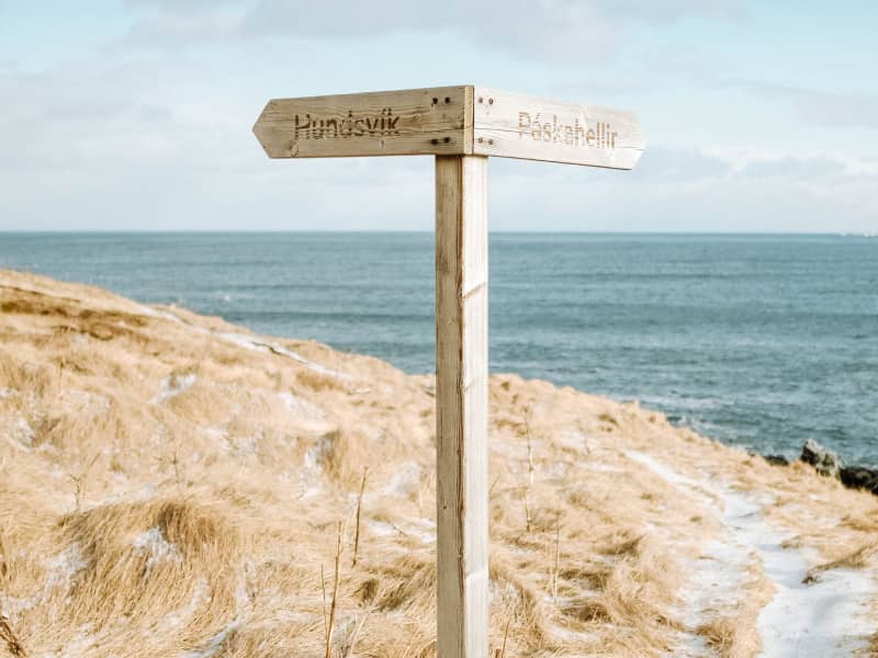
Páskahellir is a small cave by the seaside of Neskaupstaður Nature Reserve, with pillow lava and rock tunnels. You can also find holes that were probably formed by prehistoric trees. A forest that used to grow here was most likely destroyed by lava around 12 million years ago. After that, erosion by the sea formed the cave itself. Legend has it that by visiting Páskahellir on Easter morning, you can see the sun dancing over the ocean waves when rising. The name Páskahellir can easily be seen as a result of this folklore. The walk from the entrance of the Nature Reserve to the site is about 10 to 15 min. Wooden stairs lead down from the walking path down to the cave, but please note that climbing down can be tricky and must be done with caution.
Einbúi
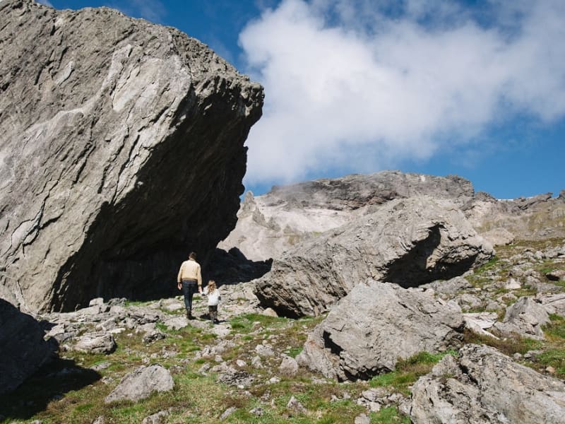
Jafnadalur is a valley in Stöðvarfjördur facing northward. At the core of the vale, there is Einbúinn - "The Hermit"- , a voluminous and solitary rock in otherwise flat surroundings. The Jafnadalur also boasts a 6 m. stonearch, located to the east of Mt. Álftafell. A walking trail connects Jafnadalur and fjord Fáskrúðsfjörður. These are agreeable surroundings and well-suited for short or extensive hikes.   Powered by Wikiloc
Arboretum in Hallormsstaðar Forest
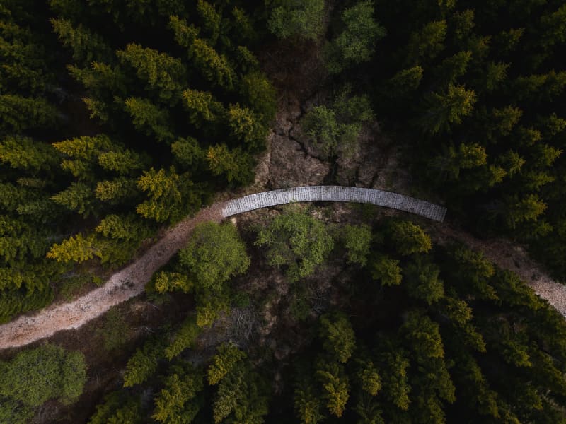
The Hallormsstaður Arboretum is unique in Iceland, comprising a collection of around 80 tree species originating from various parts of the world. In addition to trees, there are also various species of shrubs. Begin your walk through the arboretum from the car park by the main road and follow the paths. Allow yourself plenty of time, about 2-3 hours, to explore the arboretum, enjoy the surroundings, and breathe in the fresh air. Walk down to Lake Lagarfljót, enjoy a picnic, and listen to the birds singing.Forestry in Hallormsstaður began in 1903 by fencing off 12 hectares for a tree nursery called Mörk. Half a hectare was prepared as nursery beds, marking the beginning of the nursery. In 1905, 50 Engelmann spruces were planted on the upper half of Mörk. Now, only five of these trees remain, and they are the oldest spruces in the forest, standing close to the parking lot.Over the years, single trees and groups of various species have been planted in Mörk. This arboretum is already the most impressive in the country, offering visitors a good opportunity to see both common and rare species. 
Hallormsstaður National Forest
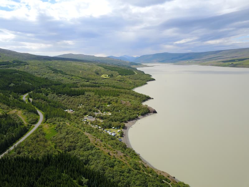
The birchwood remnants at Hallormsstaður farm were protected in 1905, making it Iceland’s first national forest. Today, birch forest and woodland cover about 350 hectares within the original fenced area, and a variety of tree species have been planted on another 200 hectares. Large areas to the north and south have been annexed to the forest more recently and either planted with trees or allowed to naturally regenerate with birch. A total of 85 tree species from over 600 locations worldwide can be found in the forest, covering around 740 hectares.Lands managed by the Land and Forest Service are designated as National Forests. These areas are open to everyone year-round and are located throughout Iceland. Many, like Hallormsstaður Forest, are easily accessible and offer a variety of facilities for outdoor recreation. Others require a 4WD vehicle or hiking up steep hillsides to enjoy.Hallormsstaður Forest is ideal for hiking, strolling, or biking. There are well-marked trails, in different colors, throughout much of the surrounding woodland. These trails are shown on a clear map published by the Forestry Service, which you can find in boxes at the entrance of many trails and nearby services. The maps can also be downloaded here.There are two camping sites in the forest: one in Atlavík and the other in Höfðavík. Both sites have small and large flat areas among the trees and are close to Lake Lagarfljót. Foresters will collect the payment for camping. More information can be found on our Facebook page.Rest places and picnic areas are scattered throughout the forest. For example, in Stekkjarvík, there is a barbecue area and a playground. The arboretum in Hallormsstaður is unique in the Arctic region. 
Selskógur
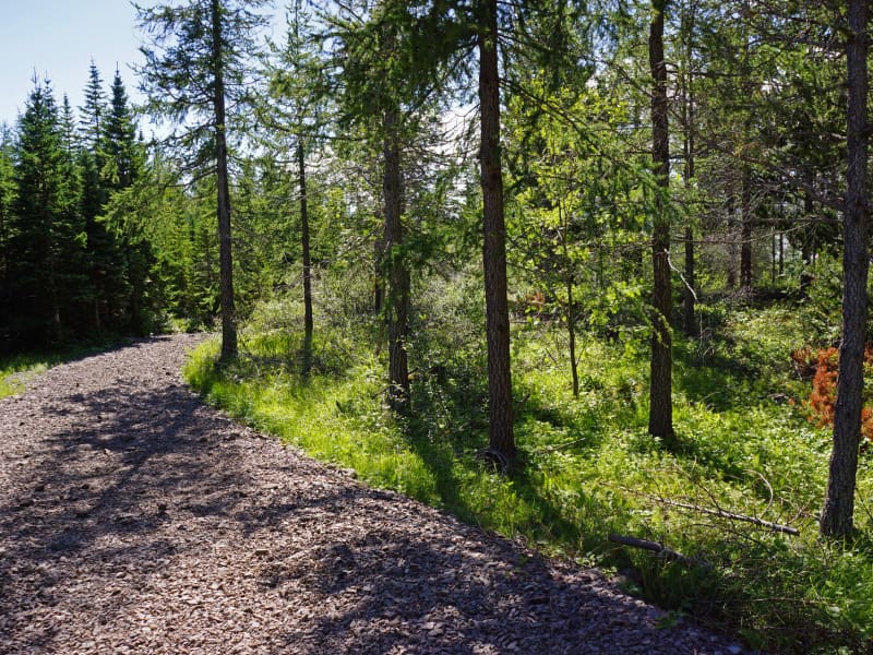
Selskógur the small forest on the eastern outskirts of Egilsstaðir, mainly consists of birch but also numerous rowans. Inviting woodchip trails of various lengths lure the wanderer to stroll through the peaceful surroundings.  A football field and a playground are among other recreational options in the area.
Fardagafoss Hiking Trail
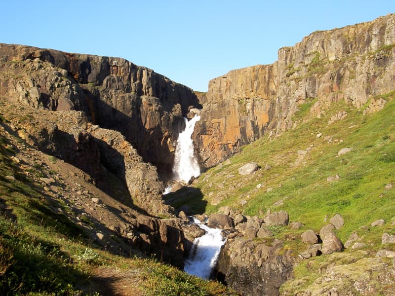
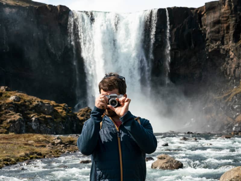
Fardagafoss waterfall is close to Egilsstaðir, at the roots of Fjarðarheiði. It is one of three waterfalls in the Miðhúsaá river; the others are called Gufufoss and Folaldafoss. There is a marked hiking trail to the waterfall, and it is easy except for the last part, which is a bit difficult to cross. The hiking trail starts at a car park by road 93, close to Áningarsteinn rock.  Behind the waterfall is a cave. The story goes that an awful giantess one lived in the cave. It is believed that a tunnel runs through Fjarðarheiði to Gufufoss in Fjarðará in Seyðisfjörður. The giantess in Fardagafoss was famous for having a cauldron full of gold. When the giantess had become so old that she knew her death was imminent, she slid the kettle with the gold down into a deep pothole in the middle of Gufufoss, further down the Miðhúsaá river. The handle of the cauldron is said to be visable when there is little water in the river. Powered by Wikiloc
Bjargselsbotnar - hike
Hiking trail starts by a sign near Hallormsstaðarskóli schoolhouse in Hallormsstaður woodland following a light green marked trail that passes through an area where half the mountain slid forward some 10.000 years ago. You’ll ascend up to Bjargselsbotnar, onwards to Bjarg and Þverbjarg to Illaskriða landslide. From there you follow the trail to the Leirtjarnarhryggur ridge.  Part of Hiking Treasures in Egilsstaðir Region GPS : N65°05.465-W14°43.031  
Brimnesviti
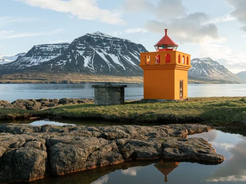
Brimnesviti lighthouse is loated on Brimnes peninsula, which is situated on the north side of Seyðisfjörður´s coastline. A 10 km. drive from the town centre brings guests to Selsstaðir farm. A hiking trail leads from the farm to Brimnes. For centuries, this was one of the bigges fishing centres in Iceland. Traces of old buildings are still visible. 
Skjólfjörur black sand beach
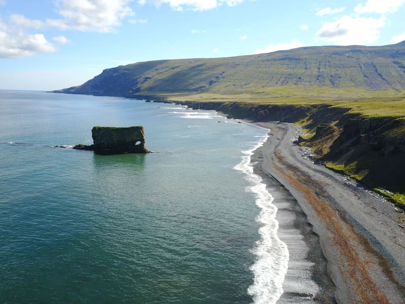
Be sure to visit Skjólfjörur beach when driving through Vopnafjörður! The beach is only a short walk from the road and offers a magnificent view of the open Atlantic sea. If you’re lucky, you might even spot a whale. The beach has a rocky shore with colorful stones that capture the eye. Driftwood brought to land by the waves is a testament to the incredible force the sea possesses. Please respect the fact that it is forbidden to remove stones from the beach.  One characteristic of Vopnafjörður is the incredible rock pillars and cliffs that take on various forms, often resembling different creatures. Ljósastapi rock pillar stands out in the sea just off Skjólfjörur. It is often called Fíllinn or the Elephant by locals, as its form resembles an elephant. To the right of Ljósastapi, the mountain Búrið stands out from the mountain range. Búrið is a part of the Fagradalur mountains, an ancient volcanic area. In the Fagradalur mountains, you can see colorful rhyolite rocks that certainly make their mark on the surrounding environment. A marked walking path takes you down to Múlahöfn harbour and to Þerribjörg cliffs, east of Hellisheiði eystri, where the rhyoli te is at its most beautiful.
Gufufoss
Gufufoss waterfall is a beautiful waterfall in Seyðisfjörður. The name is due to the steam emitted by the waterfall and envelops it in a certain mystery. The road over Fjarðaheiði lies next to the waterfall, and the access to it is very good.
Fossastígur Hiking Trail
An easy and pleasant walk from the center of Seyðisfjörður town, by a walkway partly gravel, partly grassy through a forested area towards the vale Fjarðarsel where beautiful waterfalls and varied green growth await the wanderer. A visit to the oldest operational power plant in Iceland at Fjarðarsel (1913) is optional, provided that it is arranged beforehand. The plant marked a turning point in the history of Icelandic electrification. For the avid waterfall lover an added walk along the south side of Fjarðará river up to Neðri Stafur rock stratum, (300 m. alt.) is a must. Out of a total of 25 waterfalls, in river Fjarðará some of the most spectacular ones can be seen along the way. At Neðri Stafur rock stratum, the wanderer is presented with an exquisite view over Seyðisfjörður fjord and town, along with a fine selection of berries in late August. The scenic mountains, waterfalls, vegetation, and the history of the town is a wonderful blend that makes this walk unforgettable. Fjarðará River & Fjarðarsel MuseumDuration: 2,5 and 4 hours / 2- 4 km. Period: June - September 
Vestdalur
A walk to Vestdalur Nature Reserve, Vestdalur lake and the Mountain Lady cave. The route was used to transport mail and trade in the old days between Seyðisfjörður and other towns in East Iceland. In 1880 – 1910 this was one of East Iceland’s most frequently used trails and still presents several pretty, piled-rock constructions, including cairns. After several tiers of glorious waterfalls, you will arrive at a small lake, Vestdalsvatn, which remains frozen most of the year. There you will see Mt Bjólfur to your left. To the right you’ll find the tiny cave where the remains of the Mountain Lady were found in 2004. Around the Mountain Lady cave a group of workers found bones of a 30 year old lady, more than 400 pearls and brooches from the Viking era which have been identified as remains from the year 940.
Tvísöngur Sound Sculpure
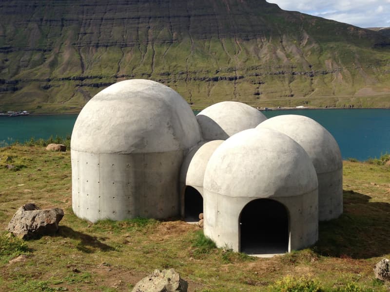
Tvísöngur sculpture, by artist Lukas Kühne, mixes concrete, nature, and sound to create an interactive tribute to Iceland’s unique tradition of five-tone harmony.  The installation piece looks like a grouping of interconnected cement bubbles from afar. Up close the five segments are quite large, ranging from roughly 6 to 12 feet tall and can be entered via rounded arches built into the walls. Once inside the stark industrial domes, visitors will find that they have each been designed to resonate at different harmonies as the wind blowing in off the cliff rushes through the openings. The collective effect is almost as though the wind itself is playing a giant instrument. The five chambers of the piece are meant to recall the Icelandic musical tradition of quintal harmony, with each dome reflecting a tone in the tradition. Juxtaposed with the serene and stark surroundings, it seems as though Iceland itself is creating the music. Tvísöngur is a permanent work and is meant to keep the country’s musical traditions alive, which is not an easy thing to do simply with concrete.
Grænafell
The haven of Mt. Grænafell by Reyðarfjörður has served as the prime location for local outdoor activities for a number of years. At the top of the mountain, a beautiful lake awaits the visitor and a spectacular gorge carves the landscape beside the fell. A paradise of fine bushes at the foot of the mount completes the icing on the cake. The tiny forest is adorned by planted trees,  brooklets and extensive rocks fragments from the cliff, reminiscent of dwellings from the land of fairy tales. The area has been made easily accessible by marked hiking trails.